Country:

 City:


The walk starts from the banks of the Bidassoa at a place called Endarlatsa, near where the two bridges cross the river (altitude 8m).
(S/E) Walk past the memorial stone marking the site of the old bridge (1698); it is here that the Rio Endara, a small tributary of the Bidassoa, forms the border between the provinces of Guipúzcoa and Navarre. Very close by, downstream on the other side, is Border Marker No. 1 between France and Spain (see the ‘Places to visit’ section) . At the starting point, the ‘Aiako Haria’ sign informs visitors that they are entering the nature park of the same name. The red-and-white-marked path begins with a flight of steps; the slope is steep and slippery at the start, follows the ridge and quickly rises above the valley. This section of the route (up to the summit of Erlaitz) passes over the remains of the defensive line dating from the Carlist Wars of the 19th century, with its ruined towers and redoubts (the Endarlatsa tower is on the right-hand side of the path, shortly after the starting point). Further up, you’ll pass the Pika tower (Torreon). Entry inside is now prohibited.
(1) The route takes us to the castle (or at least what remains of it...) of Pagogaña. Further on, cross the small road (GI3454) which climbs from Irun towards the Elurretxe Pass.
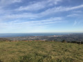
(2) Ascent of Erlaitz (496m). On this hilltop stands a bunker belonging to ‘La línea P’, a water-filled ditch and barracks (dating from the Franco era), with a beautiful panoramic view over the Basque Coast. Head back down to rejoin the small tarmac road, follow it for a while, then take the long track on the left leading to the dam and its lake (San Antón or Endara in Basque). Further on, stop to visit the hermitage.
(3) Leave the road just below the restaurant and take the path that runs alongside a field just beneath the high-voltage power line. You’ll need to go through an inconspicuous gate, then take a narrow track below the road which follows the Tellerigurutzetako Erreka stream through the woods.
(4) This takes you to the San Antón Pass, where you rejoin the road.
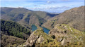
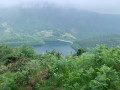
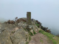
Climb Kopako Harria via a well-marked path, returning the same way. At the summit (596m), there is a stunning panoramic view overlooking the lake.
(6) Further on, turn off due north onto a narrow track suitable for vehicles. Follow a series of tracks which lead back to the starting point after passing the Endarlatza Hermitage. (S/E)
 Local authority
 Moderate

 Association / Club / Walk leader
 Easy
 Visorando Member