Agiña Endara

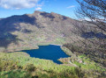
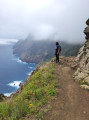
A lovely circular route passing via the summit of Agiña, which overlooks Lake Endara.

Unfortunately, the descent through the forest down to the lake has been ruined to make way for a mountain bike track, which means the route loses much of its charm.

Details

n°3150789
Creation:
Last update:
Last review:
  • Walking
    Activity: Walking
  • ↔
    Distance: 3.20 mi
  • ◔
    Average duration: 2h 30 
  • ▲
    Difficulty: Moderate

  • ⚐
    Back to start: Yes
  • ↗
    Ascent: + 1,194 ft
  • ↘
    Descent: - 1,211 ft

  • ▲
    Highest point: 1,985 ft
  • ▼
    Lowest point: 846 ft

Photos

Description of the walk

To reach the start, cross the border at Béhobie and take the N-121A towards Pamplona (Iruña in Basque). After 12 km, exit at Lesaka and turn right onto the NA-4000 towards Lesaka and Oiartzun. Pass through Lesaka and continue on the NA-4000 for 7.5 km. At a hairpin bend to the left between km 13 and km 14, take the small road branching off to the right towards the starting point, which is situated in the woods on the edge of the paths leading off on either side of this small tarmac road.

(S/E) Head west along thePR®-NA-17 Lesaka Agiña trail (PR® stands for Pequeño Recorrido, meaning ‘short walk’, and NA for Navarra, the province of Navarre).

(1) Ignore the turn-off to the right onto thePR®-NA-11 and continue alongthe PR®-NA-17.

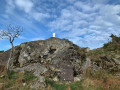
(2) Turn right, begin the ascent by following the ridge line that runs alongside the woodland and reach the summit of Agiña (618 m).

(3) Continue westwards and descend along the ridge, first through a meadow and then through the wooded area.

(4) Follow the contour line to the right, then head due north to descend towards the lake via a series of steep hairpin bends.
When you reach the road, take the first right at the end of the bend towards the Ola Berri restaurant.

(5) Take thePR®-NA-11 path, marked in red and white, which branches off to the right at the bend. The path joins theGR®11, which is tarmac-surfaced.

(6) At the junction, turn right onto the tarmac road which leads back to the car park (S/E).
Waypoints

  1. S/E : mi 0 - alt. 1,512 ft - Car park in the woodland at the start of the PR-NA-17
  2. 1 : mi 0.42 - alt. 1,650 ft - Continue on the PR-NA-17
  3. 2 : mi 0.73 - alt. 1,808 ft - Junction on the ridge line
  4. 3 : mi 1.01 - alt. 1,985 ft - Summit - Agiña
  5. 4 : mi 1.39 - alt. 1,424 ft - Edge of the woodland
  6. 5 : mi 1.87 - alt. 850 ft - Start of the PR-NA-11
  7. 6 : mi 2.87 - alt. 1,345 ft - Crossroads
  8. S/E : mi 3.2 - alt. 1,512 ft - Return to the car park

Notes

There are no water points along the route; make sure you bring enough water as it can get hot.

Worth a visit

You can have lunch at the Ola Berri restaurant.

Always be cautious and plan ahead when you're outdoors. Visorando and the author of this route cannot be held responsible for any accidents occurring on this route.

The GR® and PR® markings are the intellectual property of the Fédération Française de Randonnée Pédestre.

Reviews and comments

5 / 5
Based on 1 review

Reliability of the description
5 / 5
Ease of following the route
5 / 5
Route interest
5 / 5
Marion_arotz
Marion_arotz

Overall rating : 5 / 5

Date of your route : Apr 01, 2024
Reliability of the description : ★★★★★ Very good
Ease of following the route : ★★★★★ Very good
Route interest : ★★★★★ Very good
Very busy route : No

An easy circular walk offering superb views of La Rhune, the ‘Three Crowns’ and a 360-degree panorama of both the coast and the countryside.
The descent towards the lake is quite steep (you’d have to be a bit of a risk-taker to tackle it on a mountain bike!!) but is very easy on foot.
It took us just under two hours, including photo breaks and a coffee stop at Ola Berri. We didn’t come across anyone else on the trail itself.

As for the starting point, I’d say the tarmac track is actually somewhere between kilometre 9 and kilometre 10 when heading up from Lesaka (not km 13 and 14 as indicated).

Machine-translated

Other walks in the area

For more walks, use our search engine .

The GPS track and description are the property of this route's author. Please do not copy them without permission.