The Customs Officers’ Path from Biriatou

The border winds peacefully along the waters of the River Bidasoa, then rises abruptly up the ridge of the Pyrenees, towards the Col d’Ibardin and on to the Rhune massif. Numbered boundary markers were erected in the mountains to demarcate this administrative line, and patrols of vigilant customs officers had to be deployed to curb the night-time smuggling and trafficking of goods in days gone by. This walk partly follows in the footsteps of these border guards; you will notice that the job required a certain level of physical fitness at the time, as the climb to border marker No. 3 is quite challenging, though fortunately shaded by a beautiful oak grove. In these forgotten corners of the Basque mountains, provided you are not put off by steep slopes, the circular route becomes a splendid ascent towards the first Pyrenean peaks.

Details

66961490
Creation:
Last update:
Last review:
  • Walking
    Activity: Walking
  • ↔
    Distance: 5.15 mi
  • ◔
    Average duration: 3h 50 
  • ▲
    Difficulty: Moderate

  • ⚐
    Back to start: Yes
  • ↗
    Ascent: + 1,686 ft
  • ↘
    Descent: - 1,660 ft

  • ▲
    Highest point: 1,539 ft
  • ▼
    Lowest point: 43 ft

Photos

Description of the walk

From Urrugne, head straight on towards Béhobie (D810). Once in this part of Urrugne, follow the signs for Biriatou. In the lower part of the village, turn right onto a road signposting the start of the trail 5 km ahead. Follow the Bidasoa river as you pass through several neighbourhoods. At Ihiztokia (2.5 km), the road continues opposite along the ‘Chemin de Liçarlan’ forest track, which is tarmacked on a smooth surface, leading to a car park at a right-hand bend.

(S/E) From the bend in the track (80 metres above sea level), start by climbing a stony path to the left, upstream of a stream (signposted ‘liaison GT2’). You’ll reach a junction of two paths (elevation 123), which you should note for the return journey.

(1) Follow the path to the right. This passes through a first copse, then descends towards the wide forest track, which you should follow straight ahead. At Lizarlan Farm, continue straight on along the grassy path downhill. Through the forest, reach the bed of the Lizarlan stream further down and continue descending along the right bank. A footbridge on the left allows you to cross the stream. On the other side, ignore the gate on the right used by the GRT2 near the ruins. Keep to the yellow-marked path straight ahead, which climbs steeply to the left and leads onto a wooded ridge, where a break under the magnificent oak trees will be most welcome.

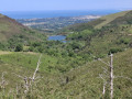
(2) Take the path up to the left. After a viewpoint overlooking the Bidassoa valley, the path crosses a rocky outcrop (at an altitude of around 275 m) and continues its challenging climb. As you pass near boundary marker no. 3, the slope finally levels off. Follow the grassy path opposite, which crosses the Azkope dome (alt. 375 m).

(3) Descend on the other side towards a pass.

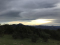
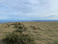
(4) At the pass marked by boundary marker no. 5 (alt. 360 m), ignore the wide path to the right and instead follow the steep border path straight ahead, which climbs along the edge of the trees.At the top of the slope (boundary marker no. 6), there is a beautiful view towards La Rhune and L’Ibanteli. The path passes to the right of the rocky outcrops, carved into the rock, then back to the left of the ridge to reach a grassy pass (alt. 465 m).

(5) As soon as you reach the first hawthorn bush, leave the ridge by turning left to find the start of a new path which runs for some time along the hillside until it reaches the Col des Joncs (elevation 421).

(6) Cross over to the opposite slope and follow the GR®10, marked in red and white, veering slightly to the left. Descend steadily above Lake Xoldokogaina to reach the Col de Pitare (316 m).

(7) At the Col de Pittare or Col des Poiriers, ignore the GR®10 markings and turn sharply left at the edge of the woodland, onto a path that immediately splits into two branches. Take the left-hand branch, which enters the forest, and follow the path as it descends through the woodland in two wide hairpin bends, then runs alongside a stream.

(8) Once you reach a dirt track (elevation 221), cross the stream and follow the track to the right to reach the Lantzetaerreka crossroads (alt. 200 m).

(9) Ignore the two tracks on the right and take the path leading down to the left to reach a remarkable oak tree.

(10) Turn left beneath the oak and head towards the bed of the Lantzeta stream. The path then follows its left bank and rejoins the first junction encountered on the way out (elevation 123).

(1) Follow the path down to the right to return to the car park (S/E).

Waypoints

  1. S/E : mi 0 - alt. 266 ft - Car park
  2. 1 : mi 0.11 - alt. 390 ft - Junction of three paths
  3. 2 : mi 1.12 - alt. 46 ft - First ascent to border marker no. 3 - Bidassoa (fleuve)
  4. 3 : mi 1.83 - alt. 1,178 ft - Grassy summit of the - Akozpe
  5. 4 : mi 2.11 - alt. 1,178 ft - Azkope Pass
  6. 5 : mi 2.56 - alt. 1,539 ft - Col
  7. 6 : mi 3.33 - alt. 1,348 ft - Col des Joncs (421m)
  8. 7 : mi 3.83 - alt. 1,037 ft - Pittare Pass - Pitare lepoa
  9. 8 : mi 4.36 - alt. 735 ft - Stream
  10. 9 : mi 4.64 - alt. 650 ft - Lantzetaerreka crossroads
  11. 10 : mi 4.77 - alt. 548 ft - Oak
  12. S/E : mi 5.15 - alt. 266 ft - Car park

Notes

Signposting: Yellow, White and Red.
Facilities and services: water point, toilets.

Worth a visit

(3) Igneous rocks
The summit of Azkope features several outcrops of very hard rock. This is granite, sometimes containing linear veins of quartz. A magmatic rock, formed over 300 Ma ago, it forms the bedrock of the Pyrenean mountain range and can also be found in the Cauterets and Néouvielle massifs.

(4) The boundary markers
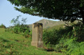
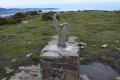
The definitive boundary between France and Spain was established under Napoleon III and Isabella II, Queen of Spain, by the three Treaties of Bayonne of 1852, 1862 and 1866. The boundary is marked in the mountains by boundary markers or crosses, numbering 602 from the Atlantic to the Mediterranean.

(5) Butterworts and sundews
The Plateau des Trois Fontaines is a wetland with particularly acidic waters. It is the ideal habitat for sphagnum mosses, ancient mosses with exceptional absorbency, whose lower, dead parts do not decompose, thus forming a thick, spongy layer. A constant trickle of water and a little humus provide the ideal living conditions for two unusual insectivorous plants: the common butterwort and the sundew. To meet their energy needs, they have sticky leaves with which they capture insects that venture a little too close.

Always be cautious and plan ahead when you're outdoors. Visorando and the author of this route cannot be held responsible for any accidents occurring on this route.

The GR® and PR® markings are the intellectual property of the Fédération Française de Randonnée Pédestre.

Reviews and comments

4.6 / 5
Based on 3 reviews

Reliability of the description
4.3 / 5
Ease of following the route
4.3 / 5
Route interest
5 / 5
User 27831465

Overall rating : 5 / 5

Date of your route : May 05, 2026
Reliability of the description : ★★★★★ Very good
Ease of following the route : ★★★★★ Very good
Route interest : ★★★★★ Very good
Very busy route : No

You have to go all the way to the end, but it’s well worth it. It’s quite a climb, but what a treat to be up there – the view is magnificent for nature lovers, and you feel almost alone in the world.
It gave me the chance to explore the Comète network up close!

Machine-translated

caroliina64
caroliina64
• Edited:

Overall rating : 3.7 / 5

Date of your route : Feb 18, 2026
Reliability of the description : ★★★☆☆ Average
Ease of following the route : ★★★☆☆ Average
Route interest : ★★★★★ Very good
Very busy route : No

I almost gave up on going to the starting point because there is a large warning sign: continue at your own risk about 2 or 3 km before the start of the hike, then take a road above the Bidassoa which is narrow and in poor condition, even unpaved.

The next difficulty is finding and taking a secondary path in front of a huge rock that you have to climb (between markers 2 and 3). Between 4 and 5, the path also stops in front of some rocks, and you have to go through the middle (this isn't clear in the description).

The customs officers must have been in great shape!

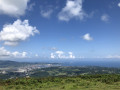
On the positive side, there are beautiful views of Spain, the 3 couronnes and the Rhune.

Machine-translated

Franck07FB
Franck07FB

Overall rating : 5 / 5

Date of your route : May 09, 2025
Reliability of the description : ★★★★★ Very good
Ease of following the route : ★★★★★ Very good
Route interest : ★★★★★ Very good
Very busy route : No

A varied route (climb through the forest), views of Spain. No difficulties with navigation or technical challenges

Machine-translated

Other walks in the area

For more walks, use our search engine .

The GPS track and description are the property of this route's author. Please do not copy them without permission.