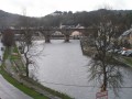
Following the canalised River Aulne

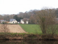
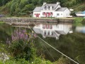
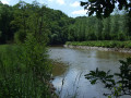
The route is largely a return walk, following a section of the channelled River Aulne. Peace and quiet, with the murmur of the water as you approach the two locks. You’ll regularly spot pairs of mallards and, occasionally, herons and great cormorants.

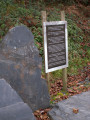
Along the route, you’ll pass a memorial stone commemorating a terrible shipwreck on this river in 1693 (in which 77 people, including many children, drowned).

Details

1732326
Creation:
Last update:
Last review:
  • Walking
    Activity: Walking
  • ↔
    Distance: 6.79 mi
  • ◔
    Average duration: 3h 15 
  • ▲
    Difficulty: Easy

  • ⚐
    Back to start: Yes
  • ↗
    Ascent: + 154 ft
  • ↘
    Descent: - 154 ft

  • ▲
    Highest point: 207 ft
  • ▼
    Lowest point: 49 ft
  • ⚐ Country: France
  • ⚐ City: Châteaulin (29150)
  • ⚑
    Start/End: N 48.215565° / W 4.033082°
  • ❏
    IGN map(s): Ref. 0517OT, 0618OT
  • Hour-by-hour weather

Photos

Description of the walk

Car park on the banks of the Aulne, at a place called Toull ar C’hefeleg (woodcock’s hole) (access via thesecond roundabout at the Pouillot junction.

(S/E) From the car park, take the towpath eastwards and continue along the canal until you reach the first lock, the Trésiguidi lock, after about 1.6 km.

(1) Go past the lock and continue along the canalised River Aulne, which forms a large meander.

(2) Look out for the Vieux Bourg and its chapel on the opposite bank, which was the administrative centre of the commune of Lothey until 1846. Carry on until you reach the Lothey Lock.

(3) Carry on along the towpath until you reach a fork in the path. On your left, note the memorial stone commemorating the shipwreck that occurred here in 1693 (77 victims).

(4) Ignore the path on the left – which will be your return route – and continue along the canal for about 750 metres until you reach a small ruined house, where you leave the canal.

(5) Turn left onto this path, which climbs quite steeply through woodland; pass an old ruined building and, at the top, come out onto a small road near Verouri Farm.

(6) Turn left to head down towards the former Tréziguidy manor house, now a farm known as Maner Coz. Note the entrance porch. Walk round the farm whilst continuing downhill. At the three-way junction, turn left to rejoin the canal bank (marker stone).

(4) Begin the return journey via the Lothey and Trésiguidi locks – a distance of approximately 4.5 km – to return to the car park where you started (S/E).

Waypoints

  1. S/E : mi 0 - alt. 52 ft - Place known as Toull ar C’hefeleg - Aulne (fleuve)
  2. 1 : mi 1.06 - alt. 56 ft - Trésiguidi Lock
  3. 2 : mi 2.3 - alt. 62 ft - View of the Vieux Bourg
  4. 3 : mi 2.5 - alt. 62 ft - Lothey lock
  5. 4 : mi 2.71 - alt. 62 ft - Memorial stone
  6. 5 : mi 3.16 - alt. 66 ft - Path leading uphill through the woods (ruins)
  7. 6 : mi 3.39 - alt. 200 ft - Road to the left near Verouri
  8. S/E : mi 6.79 - alt. 52 ft - Place known as Toull ar C’hefeleg

Notes

I have kept the difficulty rating at ‘Easy’ because, apart from a steep slope in the woods at (5), followed by an easy descent, the rest of the route along the towpath is completely flat.

There are picnic tables at the car park at the start.

Worth a visit

Reviews and comments

4.7 / 5
Based on 2 reviews

Reliability of the description
5 / 5
Ease of following the route
5 / 5
Route interest
4 / 5
FLOCH
FLOCH ★

Thank you for your feedback.
Personally, I tend to avoid round-trip routes.
In this case, I made an exception as I couldn’t find a circular route.
I can recommend the ‘https://www.visorando.com/randonnee-le-l…’ walk , starting from Pont Coblant. (Best done in spring – the route is full of flowers, especially along the towpath).
Kind regards.

Machine-translated

Cat29
Cat29

Overall rating : 4.5 / 5

Date of your route : Nov 06, 2022
Reliability of the description : Not used / Not applicable
Ease of following the route : ★★★★★ Very good
Route interest : ★★★★☆ Good
Very busy route : No

A lovely, easy walk – it’s a shame it’s almost a straight out-and-back along the canal, but it’s not always easy to find a circular route.

Machine-translated

FredoS
FredoS

Overall rating : 4.7 / 5

Date of your route : Mar 07, 2021
Reliability of the description : ★★★★★ Very good
Ease of following the route : ★★★★★ Very good
Route interest : ★★★★☆ Good
Very busy route : No

A peaceful route along a flat path. The 2 hours and 40 minutes of walking fly by. No difficulty. A pleasant route

Machine-translated

BRIGUIP
BRIGUIP

A lovely, easy walk in peaceful surroundings, completed in 2 hours and 35 minutes.

Machine-translated

Other walks in the area

For more walks, use our search engine .

The GPS track and description are the property of this route's author. Please do not copy them without permission.