


Refine your search for walks in Église Sainte-Marie-Madeleine (Pibrac)
Église Sainte-Marie-Madeleine (Pibrac) walks


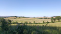
 From Pibrac to L’Isle Jourdain via the GR® 653
 Visorando Member
 15.01 mi
 +814 ft
 -833 ft
 7h 35
 Difficult
 Departure from Pibrac (Haute-Garonne)
A stage on the Way of St James via the Arles route between Pibrac and L’Isle-Jourdain, following theGR® 653, which is better signposted than the Camino.
The walk starts and finishes in front of a station so that you can return to the starting point by train.
Walks near Église Sainte-Marie-Madeleine (Pibrac)
The banks of the Touch from Plaisance to Saint-Martin du Touch
 6.71 mi
+43 ft
-72 ft
3h 05
 Moderate
Departure from Plaisance-du-Touch (Haute-Garonne)
This long walk along the Touch, between the river, lakes, woods and meadows, is very pleasant, varied, often shaded and well laid out. It can also be done by bike. And, of course, you can walk shorter sections.
The Saint-Cypriote Walk
4.41 mi
+16 ft
-10 ft
2h 00
 Easy
Departure from Toulouse (Haute-Garonne)
The Cypriote Walk, organised by the Rive Gauche en Transition collective of the Toulouse en Transition association.
A walk through the streets of Saint-Cypriotes to discover the neighbourhood’s green spaces.
Toulouse left bank: Jardins du Barry, Cartoucherie and Saint-Cyprien
 Association / Club / Walk leader3.41 mi
+36 ft
-46 ft
1h 35
Easy
Departure from Toulouse (Haute-Garonne)
Stroll along the left bank of Toulouse and discover the city's new developments on a former industrial site. Green spaces have been created to provide shade and coolness in summer. The route is safe and away from traffic. The walk continues towards the historic district and ends at Saint-Cyprien.
Les Sept Deniers
4.37 mi
+26 ft
-20 ft
2h 00
Easy
Departure from Toulouse (Haute-Garonne)
This walk starts at the Tisséo Canal du Midi station (line B, 15, 70) on Boulevard de la Marquette in front of the General Council, then heads towards the Sept Deniers district along the canal. The return route follows the Garonne embankment and the Canal de Brienne to reach Compans Cafarelli (line B, 45, L1, L14). Bike stations are available at the start and finish.
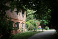
Through the parks and along the waterways of Toulouse
 6.89 mi
+72 ft
-39 ft
3h 15
Moderate
Departure from Toulouse (Haute-Garonne)
This is an easy walk, accessible to all, allowing you to discover Toulouse through its main parks while enjoying beautiful views along the banks of the Garonne.
In the footsteps of the Roman ramparts of Tolosa
 1.96 mi
+7 ft
-20 ft
0h 55
Easy
Departure from Toulouse (Haute-Garonne)
This very easy urban walk will take you to the 10 remains of the Roman ramparts of Toulouse fromthe 1st and 3rd centuries AD that are still visible today in public spaces. The duration of this walk will depend on how much time you spend observing the sites.
Île du Ramier via the footbridges from Empalot to Esquirol
3.92 mi
+39 ft
-20 ft
1h 50
Easy
Departure from Toulouse (Haute-Garonne)
This walk allows you to discover Île du Ramier, which is currently undergoing development work, via the two new footbridges. Starting from Empalot, the walk joins the Prairie des Filtres and ends at Esquirol, a pocket of wild nature hidden in the heart of the city. The Garonne River flows through it. Our best athletes come here to win medals...
From Borderouge to Launaguet Town Hall
3.89 mi
+30 ft
-30 ft
1h 50
Easy
Departure from Toulouse (Haute-Garonne)
Walk between the terminus of line B at Borderouge and Launaguet Town Hall. This route links a recent neighbourhood of Toulouse, built from 2010 onwards, with a 19th-century château that houses the municipal services of the town of Launaguet. After crossing the Rocade Nord, the route passes along paths running alongside the Hers river and residential areas. A bridge leads into Aucamville through a landscaped natural area. The path then takes us to Launaguet, where we can visit the town hall and its park, which offers a remarkable view.
From L’Isle-Jourdain to Gimont via the Way of St James
 15.10 mi
+810 ft
-830 ft
7h 40
Difficult
Departure from L'Isle-Jourdain (Gers)
A day on the Arles route of the Way of St James, mainly following theGR® 653, which is better signposted than the Camino. The walk starts and ends in front of a railway station, so you can return by train on the same day.
Short circular loop around Launac
4.44 mi
+138 ft
-125 ft
2h 10
Easy
Departure from Launac (Haute-Garonne)
In the 12th century, a castle and a fortified village were built by the Viscounts of Gimoes. The castle became the property of the Counts of L'Isle Jourdain. Launac was the site of the bloody Battle of Palot. After a period of calm, the seigneury passed into the hands of Toulouse parliamentarians, sparking a conflict over feudal rights. The inhabitants resisted and even emigrated for years. After the Revolution, the market hall and church were rebuilt, a school was created and the ramparts were demolished.