From Pibrac to L’Isle Jourdain via the GR® 653

A stage on the Way of St James via the Arles route between Pibrac and L’Isle-Jourdain, following theGR® 653, which is better signposted than the Camino.
The walk starts and finishes in front of a station so that you can return to the starting point by train.

Details

n°4346841
Creation:
Last update:
Last review:
  • Walking
    Activity: Walking
  • ↔
    Distance: 15.01 mi
  • ◔
    Average duration: 7h 35 
  • ▲
    Difficulty: Difficult

  • ⚐
    Back to start: No
  • ↗
    Ascent: + 814 ft
  • ↘
    Descent: - 833 ft

  • ▲
    Highest point: 951 ft
  • ▼
    Lowest point: 482 ft
  • ⚐ Country: France
  • ⚐ City: Pibrac (31820)
  • ⚑
    Start: N 43.6213° / E 1.28861°
  • ⚑
    End: N 43.617133° / E 1.089864°
  • ❏
    IGN map(s): Ref. 2043ET, 2043O
  • Hour-by-hour weather

Photos

Description of the walk

Car park at Pibrac station.

(S) Leave the Impasse de la Gare and turn left onto Rue de la Gare, then head up towards the Esplanade des Églises, staying on the pavement on the left-hand side of the road.

(1) After the castle, cross the road at the pedestrian crossing and head up towards the Esplanade des Églises. Walk behind the town hall and turn left onto the Ancien Chemin de Brax. The route is very well signposted with small signs showing a scallop shell on a blue background. Turn right onto Rue du Pas du Courbet and cross the railway line, taking care of oncoming trains. Follow the signs indicating to go straight on to pass by the Fontaine de Sainte-Geneviève.

(2) Continue to Chemin de la Fontaine.
On a short round trip, slightly to the right, you’ll find the fountain with a viewpoint overlooking the Parc des Tambourettes.
Continue along Chemin de la Fontaine, with your back to the fountain, then onto Chemin des Ânes. After a bend to the left, there is a T-junction.

(3) “The Chemin de Saint-Jacques goes straight ahead”, but you must turn right to follow the GR®.

(4) After about 400 m, carry straight onalong theGR® alternative route. As you come out of the woods, head straight ahead to take the footpath, which becomes a road. Continue to the next T-junction.

(5) Turn right onto the Chemin du Gayné and follow it to the end of the road.

(6) At the junction (with a disused farm opposite), turn left onto the Route de Sainte-Germaine. Follow this road until you enter the Forêt de Bouconne.

(7) In the forest, turn left, then left again, and follow the path, keeping to the red and whiteGR® markings.

(8) Cross the D24 with care and continue straight ahead. Follow this path to the edge of the riding club. The well-marked route follows a branch of the GR®.

(9) Turn right and head back up to the central track, walking alongside the railway line.
Turn left and cross the railway line at the old station, taking care to look both ways. Continue along the central track and take thefirst wide path on the left, then the next one on the right, and then carry on straight ahead until you reach thefourth wide path.
Then turn left, then immediately right onto the sandy path. The path goes uphill, then downhill, and comes out onto the Route de Léguevin (Avenue de Bouconne).

(10) Cross the road carefully and head straight ahead. Follow the path and, when it ends, turn right and head back up to the central track. This section forms part of theGR® and the Way of St James coming from Léguevin.

(11) Turn left and follow the central track. Pass the car park at the Maison Forestière de Saint-Louis and continue to the right, then slightly to the left. Do not take the historic path which joins the tarmac road. Follow this path until you reach the edge of the forest.

(12) At the junction with the Route de Mérenvielle (D531), carry on straight ahead onto the Chemin de Moufielle. Take care. The road descends continuously.

(13) At the start of the climb, after the house on the right, leave the road and take the path on the left. Follow this path, which climbs steeply before descending gently and ending at a road. Walk down the Chemin des Ninets to the roundabout on the Route de Ségoufielle.

(14) Turn left towards L’Isle-Jourdain, walking along the pavement. After 200 m, cross at the pedestrian crossing and enter the station car park; continue on to the station, the end of the walk (E).

Waypoints

  1. S : mi 0 - alt. 512 ft - Car park at the - Gare de Pibrac
  2. 1 : mi 0.3 - alt. 587 ft - Town centre - Église Sainte-Marie-Madeleine (Pibrac)
  3. 2 : mi 0.82 - alt. 531 ft - Sainte-Germaine fountain after the - Corbet (rivière)
  4. 3 : mi 1.84 - alt. 541 ft - GR – Camino split
  5. 4 : mi 2.12 - alt. 551 ft - Junction
  6. 5 : mi 2.71 - alt. 617 ft - The Gayne Trail
  7. 6 : mi 3.51 - alt. 617 ft - Gayné
  8. 7 : mi 4.3 - alt. 623 ft - Start of the Bouconne Forest
  9. 8 : mi 5.03 - alt. 673 ft - Crossing the D24
  10. 9 : mi 5.54 - alt. 686 ft - Climb back up to the central path
  11. 10 : mi 7.8 - alt. 689 ft - Crossing the Léguevin road
  12. 11 : mi 8.76 - alt. 791 ft - Main path
  13. 12 : mi 11.19 - alt. 951 ft - Crossing the Mérenvielle road (D531)
  14. 13 : mi 12.31 - alt. 617 ft - Moufielle Trail
  15. 14 : mi 14.67 - alt. 499 ft - Route de Ségoufielle
  16. E : mi 15.01 - alt. 489 ft - Car park at the - Gare de L'Isle-Jourdain (Gers)

Notes

The Sainte-Germaine Fountain in Pibrac provides drinking water.
Given the length of the walk, plan to take a packed lunch; you can stop at the car park of the Maison Forestière Saint-Louis in Pujaudran, where there are permanent tables and benches, visible from the central path.
Ideally, you should have someone driving to drop you off at Pibrac station and pick you up at L’Isle-Jourdain station. They can also bring you your packed lunch at midday.
Remember to stay well hydrated during the walk and take a 10-minute break every 2 hours.

Worth a visit

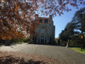
Pibrac Castle, and especially its gardens, are well worth a visit.
The Basilica of Sainte-Germaine has never been consecrated, so there are very few services held there and it is usually closed, but you can visit it by asking for the keys at the presbytery; the interior is very light and airy.
The Sainte-Germaine Fountain offers a lovely view of the Tambourrettes Garden.
Don’t miss the community gardens just past the fountain.
By taking a variant ofthe GR® route, you can walk past the house where Sainte-Germaine lived.
In the Forest of Bouconne, if you stay on the central path, you’ll pass the Forain-François-Verdier memorial.

Always be cautious and plan ahead when you're outdoors. Visorando and the author of this route cannot be held responsible for any accidents occurring on this route.

The GR® and PR® markings are the intellectual property of the Fédération Française de Randonnée Pédestre.

Reviews and comments

5 / 5
Based on 1 review

Reliability of the description
5 / 5
Ease of following the route
5 / 5
Route interest
5 / 5
sylvie31
sylvie31

Overall rating : 5 / 5

Date of your route : Apr 02, 2021
Reliability of the description : ★★★★★ Very good
Ease of following the route : ★★★★★ Very good
Route interest : ★★★★★ Very good
Very busy route : No

A section of the Way of St James as a ‘trial run’ for a planned multi-day trek. No complaints about the route, which is really reassuring; the path is well signposted and very pleasant (mainly through woodland and along country lanes). We set off from Pibrac at 8.15 am and arrived at L’Isle-Jourdain at 2.15 pm, having taken a break of about 20 minutes. There were no particular difficulties – it’s flat all the way (with just one climb at the end of the route). Thank you for this route; we’ll soon be trying out the others on the Way of St James.

Machine-translated

Other walks in the area

For more walks, use our search engine .

The GPS track and description are the property of this route's author. Please do not copy them without permission.