


Refine your search for walks in Église Saint-Jean-Baptiste de Wattwiller
Église Saint-Jean-Baptiste de Wattwiller walks


 From Uffholtz to Wattwiller via the Coteaux du Vieil-Armand
 Visorando Member
 3.75 mi
 +390 ft
 -381 ft
 2h 05
 Easy
 Departure from Uffholtz (Haut-Rhin)
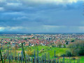
Starting from the village of Uffholtz, you will walk to Wattwiller, passing through the vineyards on the hill overlooking the two villages.
Hartmannswillerkopf - Molkenrain - Freundstein circular from Wattwiller
 11.92 mi
+4,180 ft
-4,173 ft
9h 05
 Difficult
Departure from Wattwiller (Haut-Rhin)
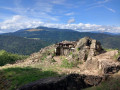
A beautiful hike from Wattwiller to Hartmannswillerkopf, then Molkenrain, Freundstein with the remains of the castle, and back through the bunkers and trenches of the First World War.
There are many places to eat along the hike.
Just under 7 hours of walking, not counting long breaks.
Route de découverte de Wattwiller
 2.24 mi
+135 ft
-121 ft
1h 10
Easy
Departure from Wattwiller (Haut-Rhin)
Located in the south of the Haut-Rhin, Wattwiller has long been known for its thermal springs. Today, its water is still used in our bottles. This route allows you to discover much of its heritage, notably its four fountains, the Church of Saint John the Baptist and the François Schneider Foundation museum. This route includes a short detour that gives you an overview of the village. To round off the route, we recommend combining it with a visit to neighbouring villages such as Uffolthz or Berrwiller.
From Soultz-Haut-Rhin to Cernay
17.04 mi
+643 ft
-633 ft
8h 25
 Very difficult
Departure from Soultz-Haut-Rhin (Haut-Rhin)
A long hike, almost flat, but covering a significant number of kilometres. This route will take you through villages and towns such as Hartmannswiller and Cernay. When conditions allow, the view stretches as far as the Alps. Apart from the theme of religion, which is very prominent with the various small churches and the Thierenbach Basilica, the theme of the First World War is also present on the way back. Most of the hike is in open country. Only a quarter of the hike is covered between Wattwiller and the basilica of Thierenbach.
Walks near Église Saint-Jean-Baptiste de Wattwiller
Le Col du Grand Ballon depuis Soultz
8.15 mi
+3,596 ft
-89 ft
6h 55
Difficult
Departure from Soultz-Haut-Rhin (Haut-Rhin)
Randonnée presque quasiment en montée qui permet de relier Soultz, sympathique village culturel, au Col du Grand Ballon où vous pourrez passer la nuit avant d'aller le lendemain matin au sommet. Bien que cette étape soit courte en kilomètres, elle comporte un important dénivelé à ne pas négliger. Mais que de beautés en revanche entre les forêts et points de vues remarquables dans la dernière partie du parcours.
Guebwiller – Grand Ballon
 Tourist office8.25 mi
+3,622 ft
-174 ft
6h 55
Difficult
Departure from Guebwiller (Haut-Rhin)
Get straight to the heart of the matter with the ascent of the Grand Ballon, which will delight the fittest walkers!
Starting from Guebwiller, the first day of this multi-day hike will take you to the Grand Ballon, the highest peak in the Vosges mountains, which rises to an altitude of 1,424 metres. The climb to this pass is therefore quite challenging and requires a good level of fitness. Along the way, you’ll be able to enjoy the varied landscapes and the flora and fauna of the Vosges, and on arrival, the exceptional panoramic views across the whole of the Alsace plain, the Black Forest and even the Bernese Alps if the sky is clear.
3-day tour of the Grand Ballon: from Guebwiller to the Grand Ballon
8.23 mi
+3,622 ft
-174 ft
6h 55
Difficult
Departure from Guebwiller (Haut-Rhin)
First day of the 3-day Grand Ballon circuit. Starting from Guebwiller, the first day of this multi-day hike will take you to the Grand Ballon, the highest peak in the Vosges mountains, which rises to an altitude of 1,424 metres. The ascent is quite challenging and requires a good level of fitness. Along the way, you can enjoy the varied landscapes and the flora and fauna of the Vosges, and on arrival, the exceptional panoramic views across the whole of the Alsace plain, the Black Forest and, on a clear day, even the Bernese Alps.
A day trip to Lac du Ballon
8.50 mi
+1,467 ft
-2,031 ft
5h 10
 Moderate
Departure from Murbach (Haut-Rhin)
Enjoy a relaxing break at Lac du Ballon before setting off again along the Route des Crêtes.
The route for this second day, starting from the Grand Ballon, includes a short detour to Lac du Ballon, so you can take in the scenery and the tranquillity of this little paradise. The walk continues along the Route des Crêtes to Markstein, with views of the Grand Ballon and the Thur Valley, and, if you wish, you can enjoy the leisure and outdoor activities on offer at the Markstein resort.
On the ridges: Grand Ballon – Markstein – Petit Ballon
 13.44 mi
+2,110 ft
-3,022 ft
8h 00
Difficult
Departure from Murbach (Haut-Rhin)
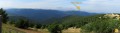
An easy route, gently undulating across the highest peaks of the Vosges, through stubble fields and forests. Magnificent views over the surrounding valleys.
Gsang towards the Hundsruck Pass
4.44 mi
+499 ft
-1,444 ft
2h 30
Easy
Departure from Moosch (Haut-Rhin)
Return to the Hundrunck Pass via the summit of the Vogelstein.
Ascent to the Grand Ballon from Sengern (Guebwiller) via the lake
 5.78 mi
+2,910 ft
-39 ft
5h 10
Difficult
Departure from Lautenbachzell (Haut-Rhin)
A challenging climb to the Grand Ballon from Sengern (past Guebwiller). The route passes by the beautiful Lac du Ballon and the Gustiberg farmhouse inn, both of which offer very pleasant places to stop for a break.
Linthal – Grand Ballon – Markstein
12.20 mi
+3,553 ft
-1,319 ft
8h 40
Difficult
Departure from Linthal (Haut-Rhin)
A very physically demanding first day with a wide variety of landscapes.
Starting from Linthal, the most mountainous village in the Guebwiller region, the first day of this multi-day hike will take you to the Auberge du Steinlebach, via the Grand Ballon – the highest peak in the Vosges mountains, rising to an altitude of 1,424 metres – and the Markstein resort. The ascent is quite challenging and requires a good level of fitness. Along the way, you’ll pass the Gustiberg farmhouse inn, Lake Ballon and the Haag farmhouse inn…
Auberge du Belacker – Grand Ballon
10.07 mi
+3,353 ft
-2,126 ft
7h 35
Difficult
Departure from Moosch (Haut-Rhin)
For this lovely new stage, which will take you from Belacker to the Grand Ballon, the highest peak in the Vosges, follow the Club Vosgien route, marked with Yellow Rectangles. These markings indicate theGR®532, an iconic walking route across the Vosges linking Woerth in the Bas-Rhin to Belfort.
Although the distance is shorter, this stage is by no means easy. After a descent towards Saint Amarin, with a 560m drop in altitude, don’t forget to save your energy, as a 1,000m climb then awaits you to reach the “roof of the Vosges”.
From the ridges towards the Petit Ballon
8.32 mi
+866 ft
-784 ft
4h 35
Moderate
Departure from Ranspach (Haut-Rhin)
The Munster Valley, Hohrodberg, Haut-Koenigsbourg Castle – just how far will the Col d’Oberlauchen take your view?
Setting off from Markstein, before crossing the resort’s ski slopes, you can stop off to visit the Notre-Dame-des-Neiges Chapel for a brief cultural break. Heading towards the Petit Ballon, this route crosses numerous passes and peaks, such as the Klintzkopf and the Hilsenfirst, not to mention the Col d’Oberlauchen, from which you’ll be able to spot many of the area’s distinctive features… Keep your eyes peeled!