From Lake Maggiore to Lake Como

A magnificent route through the Swiss canton of Ticino and the Italian province of Lombardy. Over the course of eight days, you will discover three lakes and three different atmospheres. You will climb several peaks overlooking these lakes. The ridges you will walk along often form the geographical border between Switzerland and Italy.

Details

3196520
Creation:
Last update:
Last review:
  • Walking
    Activity: Walking
  • ↔
    Distance: 62.64 mi
  • ◔
    Average duration: 8 days 
  • ▲
    Difficulty: Difficult

  • ⚐
    Back to start: No
  • ↗
    Ascent: + 20,725 ft
  • ↘
    Descent: - 20,751 ft

  • ▲
    Highest point: 6,890 ft
  • ▼
    Lowest point: 653 ft

Photos

Stages of the route

This route needs several days, find the details below:

  1. S
  2. 2
  3. 3
  4. 4
  5. 5
  6. 6
  7. 7
  8. E

Notes

The main challenge in planning this route is the issue of ‘transport’.
Personally, I opted for public transport from Locarno (very convenient in Switzerland, slightly less so in Italy).

Day one:

  • Locarno to Cadenazzo: Train
  • Cadenazzo to Riva Gambarogno: Bus 329.

Last day:

  • Cernobbio – Menaggio: Bus C10
  • Menaggio – Lugano: Bus C12
  • Lugano – Locarno: Train.

Accommodation for the various stages:

  • In Cernobbio: several hotels and other accommodation options are available.

For stage6, the walking route begins on the opposite shore of the lake at Claino-Osteno. The journey from San Mamète to Claino via Porlezza can be made by bus:

  • San Mamete – Porlezza, Line C12
  • Porlezza – Claino, Route C22

Worth a visit

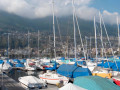
  • Lake Maggiore.
  • Locarno.
  • Ascona.
  • Vira.
  • Monte Gambarogno.
  • Alpe di Neggia
  • Indemini.
  • Alpe Neggia.
  • Mount Tamaro.
  • Lake Lugano.
  • Rivera
  • Gola di Lago
  • Motto della Crocce.
  • Mount Bar.
  • Monte Bar Hut.
  • Pozzaiolo Pass
  • Monte Gazzirola.
  • Church of San Lucio.
  • Bocchetta di San Bernardo.
  • Pairolo.
  • Sasso Grande.
  • Denti della Vecchia.
  • Mount Boglia.
  • Monte Bré.
  • Lugano.
  • Castello and the church of San Martino.
  • San Mamete.
  • Porlezza.
  • Mount San Salvator.
  • Claino - Osteno.
  • Lanzo d’Intelvi.
  • Campione d’Italia.
  • Trench Trail.
  • Monte Generoso.
  • Orimento.
  • Erbonne.
  • Colma Crocetta.
  • Monte San Bernardo.
  • Murelli Mountain Hut.
  • Bugone Mountain Hut.
  • Monte Bisbino.
  • Santuario della Beata Vergine on Monte Bisbino.
  • Cernobbio.
  • Lake Como.
  • Como.
  • Menaggio.
  • Bellagio.

Always be cautious and plan ahead when you're outdoors. Visorando and the author of this route cannot be held responsible for any accidents occurring on this route.

Reviews and comments

Other walks in the area

For more walks, use our search engine .

The GPS track and description are the property of this route's author. Please do not copy them without permission.