Capanna Pairolo - San Mamete

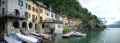
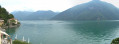
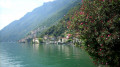
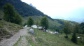
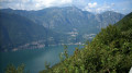
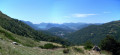
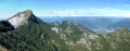
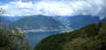
This fifth stage will take you to the shores of Lake Lugano in Italy, to the small village of San Mamete. You can even swim in the lake at the Albergo Stella del Italia. This route offers several panoramic viewpoints, particularly from the "Denti della Vecchia" massif, where the lake plays hide and seek with the teeth. In Castello, from the Oratory of San Martino, you can enjoy a splendid view of the lake.

This walk is part of a multi-day hike: From Lake Maggiore to Lake Como

Details

3210325
Creation:
Last update:
Last review:
  • Walking
    Activity: Walking
  • ↔
    Distance: 6.19 mi
  • ◔
    Average duration: 3h 40 
  • ▲
    Difficulty: Moderate

  • ⚐
    Back to start: No
  • ↗
    Ascent: + 942 ft
  • ↘
    Descent: - 4,416 ft

  • ▲
    Highest point: 4,678 ft
  • ▼
    Lowest point: 909 ft

Photos

Description of the walk

Note: From the start to point 4 at Capanna Pairolo to Pian di Scagn, follow path No. 52, the “Sentiero Lago di Lugano”, marked by this green symbol.

(S) From Capanna Pairolo, take trail No. 52 (also known as the Scenic Trail) towards the Denti della Vecchia.

(1) Leave the Scenic Trail and continue along Trail No. 52 until you reach another junction.

(2) Join the Scenic Trail again, which merges with Trail No. 52, and arrive at the foot of Sasso Grande.

(3) Follow this magnificent path which runs alongside the Denti della Vecchia massif.

(4) Carry on to the left along this border path to Pian di Scagn.

(5) Leave Switzerland by turning eastwards and descend gradually towards Alpe de Bolgia (1,121 m).

(6) At Alpe de Bolgia, keep heading east along path No. 10 until you reach a forest track (No. 7).

(7) Cross the forest track, staying on path No. 10, to rejoin the Via Alla Derta.

(8) Follow this small road to quickly reach the little village of Castello, which overlooks Lake Lugano.

(9) Walk round Castello and rejoin path No. 10, which descends to the lake. On the Strada Statale 340, heading east, make your way to your accommodation for the night: the “Stella del Italia” Hotel (E).

Waypoints

  1. S : mi 0 - alt. 4,409 ft - Capanna Pairolo
  2. 1 : mi 0.28 - alt. 4,639 ft - Leave the Scenic Trail.
  3. 2 : mi 1.48 - alt. 4,610 ft - Return to the Scenic Trail.
  4. 3 : mi 1.59 - alt. 4,583 ft - Denti della Vecchia
  5. 4 : mi 2.89 - alt. 3,875 ft - Pian di Scagn
  6. 5 : mi 3.3 - alt. 3,652 ft - Alpe Bolgia
  7. 6 : mi 3.59 - alt. 3,228 ft - Junction with Trail No. 7
  8. 7 : mi 5.21 - alt. 1,611 ft - Via alla Derta
  9. 8 : mi 5.47 - alt. 1,470 ft - Castello
  10. 9 : mi 6.04 - alt. 948 ft - Casarico
  11. E : mi 6.19 - alt. 909 ft - San Mamete

Notes

Worth a visit

  • Sasso Palazzo.
  • Sasso Grande.
  • Denti della Vecchia.
  • Monte Boglia.
  • Monte Bré.
  • Lugano.
  • Lake Lugano.
  • Castello and the Church of San Martino.
  • San Mamete.
  • Porlezza.

Reviews and comments

Other walks in the area

For more walks, use our search engine .

The GPS track and description are the property of this route's author. Please do not copy them without permission.