Country:
 City:
City:




The route starts at the DFCI barrier blocking the Chemin de Saint-Loup, in the Grand Jas neighbourhood of La Ciotat, 2.5 km from the shopping centres in the Quartier Virebelle. A few parking spaces are available there.
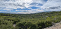
(S/E) Take the track heading south, which runs for nearly 3 km through the Vallon des Brusquières. Continue to the Route des Crêtes (D141).
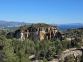
(1) Follow the road to the right with care for 250 metres until you reach the large car park at the Belvédère des Calanques. Cross over to the car park and head to the viewpoint overlooking Cassis and the cliffs: take care with young children as you are right at the edge of the precipice and there are no safety barriers.
(2) Turn left back onto the road, still taking care, and keep to the left-hand side of the carriageway. You’ll come to a very small car park.
(3) Turn left onto the path that runs alongside the road higher up. You’ll reach another car park, larger than the previous one.
(4) Pass through a barrier at the exit of this car park and continue along the path, which rejoins the road further on at a hairpin bend.
(5) Cross the road with great care (poor visibility) and take the DFCI track (Chemin Saint-Loup) opposite, which is closed to vehicles by a barrier.
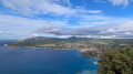
(6) After about 300 metres’ descent, turn left onto a track which, a little further down, offers lovely views of La Ciotat. Walk for just under two kilometres to reach the junction with another track.
(7) Turn right and follow this winding track, which runs almost along the contour lines, to return to the car park (S/E).
 Visorando Member
 Difficult


 Association / Club / Walk leader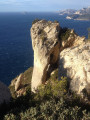
 Very difficult

 Extremely difficult