A circular walk from the Château de la Reine Blanche to the Butte aux Gens d’Armes

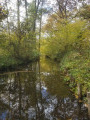
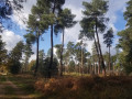
A circular route which, on the outward leg, follows the GR 1 from the Château de la Reine Blanche along the banks of the Étangs de Comelles to the Butte aux Gens d’Armes. Largely situated in the Forêts de Chantilly and Pontarmé, the GR 1 follows the Thève Valley for much of the way. On the return leg, the walk passes by Orry-la-Ville-Coye-la-Forêt station.

Details

15192019
Creation:
Last update:
Last review:
  • Walking
    Activity: Walking
  • ↔
    Distance: 14.85 mi
  • ◔
    Average duration: 7h 05 
  • ▲
    Difficulty: Difficult

  • ⚐
    Back to start: Yes
  • ↗
    Ascent: + 259 ft
  • ↘
    Descent: - 259 ft

  • ▲
    Highest point: 338 ft
  • ▼
    Lowest point: 141 ft

Photos

Description of the walk

Start from the small car park at the Château de la Reine Blanche. For access by train, see the practical information.

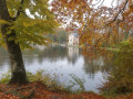
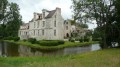
(S/E) TheGR®1, marked in red and white, crosses the car park entrance. Head down to the right towards the Château de la Reine Blanche. Take the steps, walk past the castle entrance and follow the Étang de la Loge. Follow the road which crosses the dyke of the Étang de la Loge and turns right, then take the path along the edge of the pond.

(1) At the crossroads, head straight ahead to walk alongside the second pond, the Étang Neuf. Then carry on straight ahead along the Étang Chaperon. At the crossroads, take the botanical trail straight ahead on the bank of the last pond. Ignore the paths on the left until you reach the junction.

(2) Head straight ahead, then ignore the paths on the left. Take the road on the left, then quickly turn right towards Mongrésin. Continue to the end of Route Manon, ignoring Rue du Moulin and then Impasse de la Thève.

(3) Cross Route de la Forêt (at the pedestrian crossing) and take Chemin des Vignettes straight ahead. At the junction, turn left along a meadow. Go straight on at the next junction, cross Route de Pontarmé, then further on, at another junction, take the path opposite.

(4) Turn right onto the Route du Ministre. At the junction after a building, go straight on. At the Carrefour des Tilleuls, take the third right.

(5) In front of Pontarmé Castle, turn left and ignore the path on the left. Cross the D 1017 at the pedestrian crossing and turn left. Turn right before the cross and follow the wall, then the River Thève, ignoring the paths on the left.

(6) At the junction in front of the bridge over the Thève, follow the path that runs alongside the river. Ignore another bridge and stay on the Chemin Rural de la Red Cross at the edge of the forest. Pass the Rue du Pont Chantrel on your right.

(7) After the water tower, take the Chemin du Plâtre on the left. At the first Fork in the road, turn left and at the second, turn right. At the crossroads, carry straight on.

(8) After the paths on the right leading to the Trou de Sable, turn left at the Fork in the road. Cross the Route de Charlepont and, at the next crossroads, take the third road on the right, the Route Vieille. At the top, head left up the Butte aux Gens d’Armes.

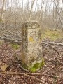
(9) Whilst theGR®1turns right in front of the summit marked by a concrete marker, head down the Route Mesureur to the left. Carry straight on at the junction. At the end, turn right, then quickly turn left twice. Then head down the Route Vieille to the right.

(10) At the Carrefour du Bu, take the second left. At the next junction, turn right.

(11) Then take the Chemin des Grès on the right, with a fence on your right-hand side. At the Carrefour des Charmes, go straight on.

(12) Take the Layon Franclieu on the left. At the Fork in the road, turn right, then at the junction, turn right until you reach the D 1017.

(13) Cross the road carefully and head straight ahead. Go straight on at both junctions.

(14) At the Poteau des Vignettes, follow the third path on the left (counting from the first, which is closed off by a fence), the Layon des Trois Poteaux. Continue straight on until you reach the Poteau Saint-Hubert.

(15) Take the Première Route Ronde straight ahead. At the Carrefour de Mongrésin, cross Rue de Chantilly carefully and take the path on the left. Let a track branch off to the left, then keep to the right at the Fork in the road. Cross a track and then a road in turn, and head down the path opposite.

(2) Cross theGR®1and, after the wooden bridge, turn left. Carry straight on at the junction. Keep left at the Fork in the road. Continue in the same direction until you reach Route Manon.

(16) Cross the road and continue along the path opposite. You’ll cross the Route de la Corne Pineval. Follow the Route de la Croix du Lude to the right.

(17) Turn left along Route Manon.

(18) Carefully cross the D 118 and head towards the Orry signpost. Keep to the right towards the railway line. Follow the fence on your left. Enter the car park.

(19) Walk past the station to reach the D 118 and go under the railway line. Cross the road at the pedestrian crossing, then first turn right then left to walk alongside the railway line on your right-hand side until you reach the tunnel.

(20) Go under the railway line. Walk along the railway line on your left and ignore Route Saint-Ladre. At the Fork in the road, keep right to reach the signpost at Carrefour de Viarmes. At this point, turn right to go downhill past the barrier and take the red-and-white-marked path on the left. The path leads to the car park entrance (S/E) .

Waypoints

  1. S/E : mi 0 - alt. 200 ft - Car park at the - Château de la Reine Blanche
  2. 1 : mi 0.55 - alt. 148 ft - Étang Neuf (Chantilly Forest)
  3. 2 : mi 1.77 - alt. 154 ft - Junction of the two circular loops
  4. 3 : mi 2.48 - alt. 190 ft - Mongrésin
  5. 4 : mi 3.3 - alt. 197 ft - Route du Ministre
  6. 5 : mi 4.18 - alt. 177 ft - Château de Pontarmé
  7. 6 : mi 4.94 - alt. 187 ft - Crossroads - Thève (rivière)
  8. 7 : mi 5.61 - alt. 207 ft - Water tower
  9. 8 : mi 6.03 - alt. 223 ft - Le Trou de Sable
  10. 9 : mi 6.51 - alt. 338 ft - Butte aux Gens d'Armes
  11. 10 : mi 7.59 - alt. 207 ft - Carrefour du Bu (Forêt de Pontarmé)
  12. 11 : mi 7.99 - alt. 197 ft - Junction with Chemin des Grès
  13. 12 : mi 8.57 - alt. 213 ft - Layon
  14. 13 : mi 9.07 - alt. 207 ft - D1017 road - Carrefour de la Croix de Pontarmé
  15. 14 : mi 9.83 - alt. 213 ft - Poteau des Vignettes
  16. 15 : mi 10.53 - alt. 207 ft - Poteau Saint-Hubert (Forêt de Chantilly)
  17. 16 : mi 12.05 - alt. 200 ft - Route Manon
  18. 17 : mi 12.75 - alt. 233 ft - Carrefour à Manon
  19. 18 : mi 13.06 - alt. 266 ft - Poteau d'Orry
  20. 19 : mi 13.54 - alt. 289 ft - Gare d'Orry-la-Ville - Coye-la-Forêt
  21. 20 : mi 14.03 - alt. 269 ft - Tunnel under the railway line
  22. S/E : mi 14.85 - alt. 200 ft - Car park at the Château de la Reine Blanche - Étang de la Loge

Notes

Access to the walk:
- By car: park in the car park at the Château de la Reine Blanche. Please note that this car park has very limited capacity; if it is full, look for a parking space in the adjacent streets.
- By train: Orry-la-Ville Coye-la-Forêt station: RER D line (Paris-Nord station network). For timetables, visit the Transilien website. Start the walk in front of the station at point (19).

N.B. We recommend arriving early in the morning as the Étangs de Comelles are very busy during the day, particularly at weekends.

(S/E) Bar and crêperie.

Worth a visit

Always be cautious and plan ahead when you're outdoors. Visorando and the author of this route cannot be held responsible for any accidents occurring on this route.

The GR® and PR® markings are the intellectual property of the Fédération Française de Randonnée Pédestre.

Reviews and comments

4.6 / 5
Based on 3 reviews

Reliability of the description
4.5 / 5
Ease of following the route
4.7 / 5
Route interest
4.7 / 5
francoise SALLES 81
francoise SALLES 81

A lovely walk – it’s a shame there were no more markers after point 8; it wasn’t easy to find our way again…

Machine-translated

Françoise G9.
Françoise G9.
• Edited:

Overall rating : 4.5 / 5

Date of your route : Apr 16, 2023
Reliability of the description : Not used / Not applicable
Ease of following the route : ★★★★★ Very good
Route interest : ★★★★☆ Good
Very busy route : No

A lovely spring walk, very pleasant, not many people apart from at the start around the lake (but it was a Sunday!), not tiring as there wasn’t much of an elevation gain

Machine-translated

CACOIN
CACOIN

Overall rating : 4.3 / 5

Date of your route : Jun 20, 2022
Reliability of the description : ★★★★☆ Good
Ease of following the route : ★★★★☆ Good
Route interest : ★★★★★ Very good
Very busy route : No

On a lovely spring’s day, this HIKE is easy, with a slight climb before reaching the hill.
The route is very shaded, taking you past PONTARMÉ Castle.
A lovely walk – I’d definitely recommend it.

Machine-translated

kity93
kity93

Overall rating : 5 / 5

Date of your route : Mar 07, 2022
Reliability of the description : ★★★★★ Very good
Ease of following the route : ★★★★★ Very good
Route interest : ★★★★★ Very good
Very busy route : No

A lovely, varied walk that begins by skirting the ponds. It’s a chance to spot the nests of coots and coypu at the ends of branches just above the water. The route takes you through woodland with a few sandy sections as you climb towards the Butte aux Gens d’Armes, but the paths are very easy and accessible to everyone. There was hardly anyone on the trail on this weekday, unlike at the weekends.

Machine-translated

Other walks in the area

For more walks, use our search engine .

The GPS track and description are the property of this route's author. Please do not copy them without permission.