Country:

 City:


Starting point: Chemin d’Arras, near the riding centre. There’s a very wide hard shoulder for parking. The owner of the stud farm is very friendly, but do remember to ask his permission as the site belongs to him.
(S/E) Take the path leading into the fields; it’s on the left as you leave the car park and then veers to the right (be careful, as the start isn’t very clearly visible from the car park – you’ll need to walk a little way forward). Follow this path straight on for about 1.5 km before reaching the D75; turn right onto it, then cross it after about 150 m to reach the ‘voyette’. If you start going uphill along the road, you’ve gone too far.
(1) Turn left into the Voyette (this rather surprising passage through the trees is quite picturesque). At the end of it, turn left, then immediately right, and carry on for about a hundred metres before turning right once more. Be careful: there are two roads on the right; don’t take the first one, but thesecond one leading out of the village. 200 metres further on, you’ll come across a shaded picnic table (lovely in summer) which will tell you you’re on the right track.
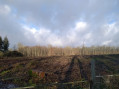
At the top of this climb (it’s a bit of a climb, actually), you’ll emerge facing vast expanses of fields and beautiful woodland on your right (a lovely walk through this woodland is featured here: The high undergrowth of Bouvigny-Boyeffles from the tall mast). Continue along the path to the right, following a landmark you simply can’t miss: the tall 305-metre mast!
(2) Once you can see the tall mast directly in front of you, look to your right and admire the view over the coalfield.
(3) At the foot of the tall mast (305 m high, making itthe third-tallest structure in mainland France), turn right (take care when crossing the road, as it can be quite busy and visibility to the right is limited). After about 100 m, take the tarmac path on the left.
(4) At the crossroads, turn right for a final straight stretch all downhill, leading back to the equestrian centre (S/E).

 Association / Club / Walk leader

 Visorando Member
 Moderate