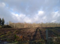
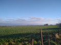
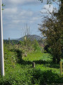
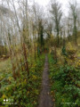
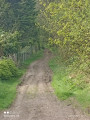
The upper woodlands of Bouvigny-Boyeffles as seen from the tall mast

Why ‘the upper undergrowth’? Because this walk takes place along the ridge of Notre Dame de Lorette (without actually going all the way there). The walk starts at the Bouvigny-Boyeffles TV transmission mast, the third-tallest structure in France at 305 metres. The view of it alone is an attraction in itself, as you’ll be parked about fifteen metres from the base – it’s quite dizzying. Even the first few metres offer a panoramic view of the mining basin.

Details

10278337
Creation:
Last update:
Last review:
  • Walking
    Activity: Walking
  • ↔
    Distance: 4.59 mi
  • ◔
    Average duration: 2h 15 
  • ▲
    Difficulty: Easy

  • ⚐
    Back to start: Yes
  • ↗
    Ascent: + 131 ft
  • ↘
    Descent: - 131 ft

  • ▲
    Highest point: 633 ft
  • ▼
    Lowest point: 486 ft

Photos

Description of the walk

Park in the small car park next to the TDF mast.

(S/E) Set off with your back to the D75 and head east-south-east.

(1) Take in the magnificent view of the mining basin and, turning round, enjoy the view of the mast. Keep heading in the same direction, ignoring any turnings to the right or left. You’ll come to a four-way junction.

(2) Go straight on for about 300 metres.

(3) Turn left into the woodland. Turn right onto the path and continue to the junction with theGR®127and 145.

(4) Do not follow the red and white markings but turn immediately right. Carry on straight ahead at the crossroads.

(5) Take the path on your right and you’ll reach the tomb situated deep in the forest: the Chapel of Auguste Lemaire. Local legend has it that a healer is buried there.

(6) Carry on straight ahead until you reach the road.

(7) Turn right and walk between the houses.

(2) Turn left and retrace your steps in the opposite direction until you reach the large mast:/A:.

Waypoints

  1. S/E : mi 0 - alt. 617 ft - TDF antenna car park
  2. 1 : mi 0.14 - alt. 627 ft - Panoramic view of the mining basin
  3. 2 : mi 1.02 - alt. 610 ft - Junction of the circular loop
  4. 3 : mi 1.22 - alt. 587 ft - Junction
  5. 4 : mi 1.95 - alt. 597 ft - GR°°®°° junction, turn right
  6. 5 : mi 2.33 - alt. 486 ft - Junction, turn right
  7. 6 : mi 2.79 - alt. 505 ft - Auguste Lemaire’s Tomb Chapel
  8. 7 : mi 3.06 - alt. 509 ft - Ferlmes du Bois de Mont
  9. S/E : mi 4.59 - alt. 617 ft - TDF antenna car park

Notes

The paths can sometimes be a bit muddy, so bring a spare pair of shoes for after the walk.
A pair of binoculars for the panoramic view.
You may spot some deer in the woodland.

If you want to shorten the walk, you can head straight to (2), but parking is prohibited there, so I wouldn’t recommend it. What’s more, you’ll miss the view of the mining basin, which is definitely worth a look.

Worth a visit

The Loisinord ski run in Nœux-les-Mines: skiing on an artificial, snow-free slope with a plastic conveyor belt.
Cable-pulled water skiing on Lake Loisinord, also in Nœux-les-Mines.
The windy staircase of the twin slag heaps at Hailicourt (180 m).
Ohlain Park.
Ohlain Castle in Fresnicourt-le-Dolmen.

Always be cautious and plan ahead when you're outdoors. Visorando and the author of this route cannot be held responsible for any accidents occurring on this route.

The GR® and PR® markings are the intellectual property of the Fédération Française de Randonnée Pédestre.

Reviews and comments

4.1 / 5
Based on 3 reviews

Reliability of the description
4 / 5
Ease of following the route
4.3 / 5
Route interest
4 / 5
Salamand59115
Salamand59115

I’ll make a note of that about the mud, thank you very much

Machine-translated

bapfred
bapfred

Thank you for your very kind message. However, please do take care to avoid doing this route after heavy rain, as there may be a lot of mud.

Machine-translated

Salamand59115
Salamand59115

Overall rating : 4.7 / 5

Date of your route : Apr 10, 2022
Reliability of the description : ★★★★★ Very good
Ease of following the route : ★★★★★ Very good
Route interest : ★★★★☆ Good
Very busy route : No

A lovely route, with a few joggers and cyclists out on a Sunday. After a superb view of the mining basin and the slag heaps – which was unfortunately a bit misty this morning – the route continues through the woodland. We enjoyed the silence, apart from the birdsong.
We’ll do it again, perhaps in the opposite direction.

Machine-translated

bapfred
bapfred

But do give it a go – treat yourself. I’d recommend a walk through the Audomarois marshes: 62500 – Clairmarais – exploring the Audomarois marshes.

In my opinion, it’s one of the most beautiful walks in the Hauts-de-France region.

Machine-translated

bapfred
bapfred

It’s true that when you’re out in the countryside, you’re quite at the mercy of the weather, and we have to admit that, as far as rain is concerned, we’ve had more than our fair share towards the end of 2021. There are quite a few sections through the forest on dirt tracks, which get muddy in wet weather. I’d say the best time for this walk would be from late April to late September. Outside these months, you’ll need to wear wellies that come right up to your chin – as with many walks in the countryside.

Machine-translated

Lisbeth
Lisbeth

Overall rating : 3.3 / 5

Date of your route : Jan 03, 2022
Reliability of the description : ★★★☆☆ Average
Ease of following the route : ★★★☆☆ Average
Route interest : ★★★★☆ Good
Very busy route : No

A lovely route, but not recommended in winter – some sections were impassable.
We ran into difficulties at level 4 and got a bit
lost our way

Machine-translated

capauri
capauri

No problem – Rango and I are happy to be official testers.

Machine-translated

bapfred
bapfred

Thank you for your message. It’s always nice to get feedback on a suggested walk. We spend quite a bit of time writing up a description, and not many people think to leave a quick comment.

Machine-translated

capauri
capauri

Overall rating : 4.3 / 5

Date of your route : Jan 02, 2022
Reliability of the description : ★★★★☆ Good
Ease of following the route : ★★★★★ Very good
Route interest : ★★★★☆ Good
Very busy route : No

A lovely walk. A mix of tarmac and forest tracks with some beautiful views. I loved it.

Machine-translated

Other walks in the area

For more walks, use our search engine .

The GPS track and description are the property of this route's author. Please do not copy them without permission.