Country:

 City:
City:


Start at Parc Germinal, Rue Émile Zola.
(S/E) With the building on your left, cross the park and head left onto Rue Édouard Vaillant, which you should follow to the right. Then take a left-hand bend before turning right onto Rue Émile Tirtaine until you reach a roundabout.
(1) Take the road on the right, cross Boulevard de la Fosse 10 and continue straight on until you reach the steps after the motorway.
(2) Climb these steps on the left, then turn right onto Rue des Mésanges and, at the roundabout, take the second street on the left onto Rue des Colibris. Continue to the left, then straight on until you leave the residential area behind and approach the houses in Boyeffles.
(3) Take the footpath on the right, pass under a power line, then at the end turn left and carry on straight ahead to reach Route de la Colline, opposite a cemetery.
(4) Turn right, cross the road and take the footpath on the left opposite number 52. Continue straight on until you reach Rue des Ferronniers.
(5) First turn left then right, and a little further on, turn left then right again to take Chemin des Boisseaux and continue straight on until you reach a Fork in the road.
(6) Turn onto the steeply ascending path on the right. Turn right and carry on straight ahead until you reach Chemin des Loups.
(7) Turn right onto it, carry on straight ahead until you reach the D75 and cross it with care.
(8) Head right for 100 m, leave the road and take the path on the left. Further on, at the junction, turn right and continue straight on until you reach Rue d’Arras.
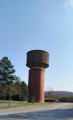
(9) Turn left onto the street; at the junction, take the street on the left and keep left to pass the water tower.
(10) Turn right onto Rue de l’Étang and, at the end, turn left onto Rue d’Arras. Carry straight on until you reach Rue Émile Zola.
(11) Cross the road carefully, turn left, then take the steps on the right and continue to the right until you reach a street.
(12) Cross it, continue straight ahead, turn right at the end and go through the tunnel under the road. Turn right, cross Rue Émile Zola with care and head for Parc Germinal (S/E).
 Association / Club / Walk leader
 Easy
Easy 
 Visorando Member