The upper reaches of Coupigny

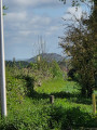
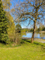
At the start, a short walk around the ponds is a must. The walk then descends towards Hersin, passing the town hall and its green walls. You then need to cross the park before reaching the Coron Béclet. After that, head back up towards the ponds. The route follows paths and a short stretch of tarmac.

Details

92967365
Creation:
Last update:
Last review:
  • Walking
    Activity: Walking
  • ↔
    Distance: 7.96 km
  • ◔
    Average duration: 2h 30 
  • ▲
    Difficulty: Easy

  • ⚐
    Back to start: Yes
  • ↗
    Ascent: + 68 m
  • ↘
    Descent: - 75 m

  • ▲
    Highest point: 137 m
  • ▼
    Lowest point: 68 m

Photos

Description of the walk

Start at the car park next to the Étangs des Claires Fontaines and the water tower at the junction of Boulevard de la Fosse 10 and Rue de l’Étang.

(S/E) With your back to the water tower, enter the car park by the ponds. At the end, take the path on the left and continue straight ahead.

(1) Turn right at the junction and head towards the ponds. Then take the path on the left, go round the ponds, exit via the car park and take Rue de l'Étang on the left. Continue left onto Rue d'Arras.

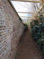
(2) Turn left, cross the road, then take the path on the right. At the top, keep to the right and continue straight on.

(3) At Rue Raoul Briquet, first turn left then right. At the end, first turn left then right again and cross the Coron.

(4) After Rue de Petrograd, take the path on the left. At the end, turn right, cross Rue Victor Hugo and continue straight ahead.

(5) At Rue Daquin, first turn right then left. Cross the street and continue straight ahead. Walk past the town hall, enter the park and cross it.

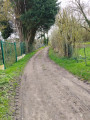
(6) Cross Rue de l'Égalité and continue straight ahead. Stay on the dirt track and follow the Coron Beclet, turning right.

(7) When you reach Rue Émile Basly, first turn left then right; at the Y-junction, keep right and continue straight ahead.

(8) Turn left at the fork. At the end, first turn right then left. At the roundabout, take the first left then turn right.

(9) Turn left and continue straight ahead on Boulevard de la Fosse10.

(10) Turn left onto Rue de Coupigny and continue straight ahead.

(11) Turn right onto the street. At the end, first turn left then right and head for the car park (S/E).


Waypoints

  1. S/E : km 0 - alt. 119 m - Car park and water tower - Étangs de Claires Fontaines
  2. 1 : km 0.27 - alt. 133 m - Crossroads - Étangs de Claires Fontaines
  3. 2 : km 1.55 - alt. 97 m - Rue Émile Zola
  4. 3 : km 2.29 - alt. 88 m - Rue Raoul Briquet
  5. 4 : km 3.04 - alt. 80 m - Fork
  6. 5 : km 4.01 - alt. 69 m - Rue Daquin
  7. 6 : km 4.43 - alt. 81 m - Petit chemin de Sains
  8. 7 : km 5.49 - alt. 74 m - Rue Émile Basly
  9. 8 : km 5.97 - alt. 80 m - Fork
  10. 9 : km 6.48 - alt. 85 m - Boulevard de la Fosse 10
  11. 10 : km 6.94 - alt. 93 m - Rue de Coupigny
  12. 11 : km 7.49 - alt. 109 m - Boulevard de la Fosse 10
  13. S/E : km 7.96 - alt. 119 m - Car park and water tower - Étangs de Claires Fontaines

Notes

No water point

Reviews and comments

5 / 5
Based on 1 review

Reliability of the description
5 / 5
Ease of following the route
5 / 5
Route interest
5 / 5
souchez rando
souchez rando

Thank you for your feedback. I try to offer a variety of walks, but this isn’t always easy depending on the starting points.

Machine-translated

Salamand59115
Salamand59115

Overall rating : 5 / 5

Date of your route : Apr 19, 2026
Reliability of the description : ★★★★★ Very good
Ease of following the route : ★★★★★ Very good
Route interest : ★★★★★ Very good
Very busy route : No

We went on this walk this Sunday morning. We loved it. It combines village and countryside with lovely discoveries and beautiful views.
You never get bored along the way and we’ll happily do it again.
Thanks to the person who designed it.

Machine-translated

Other walks in the area

For more walks, use our search engine .

The GPS track and description are the property of this route's author. Please do not copy them without permission.