


Refine your search for walks in Dournon
Dournon walks


 Circular walk from Dournon to Sainte-Anne and the Pont du Diable
 Visorando Member
 7.83 mi
 +840 ft
 -830 ft
 4h 20
 Moderate
 Departure from Dournon (Jura)
This short, easy circular walk will take you from the hamlet of l’Entrepôt (Dournon) to Sainte-Anne and the famous Pont du Diable, which you can even admire from the bank of the Ruisseau de Château Renaud – the stream it spans – whilst following the small path leading to it. Before that, you’ll have passed through the quaint little village of Sainte-Anne with its street signs written in two languages: French and Arpitan, the local dialect. The return journey takes you through the lovely Chalème Forest with its beautiful forest lanes.
Circular Geraise route via the viewpoints and Grange de Vaux
8.39 mi
+1,132 ft
-1,119 ft
4h 50
Moderate
Departure from Geraise (Jura)
A lovely walk starting from Geraise that will take you through the Vaux valley, from the ridges on the way out and along the valley floor on the way back. The viewpoints along the route offer beautiful views of Nans-sous-Sainte-Anne and the head of the Lison valley.
The Lachaussée, Platières and Saint-Christophe viewpoints
 5.97 mi
+1,220 ft
-1,204 ft
3h 50
Moderate
Departure from Geraise (Jura)
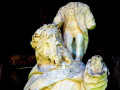
You will walk along a beautiful ridge line to discover, from several viewpoints, Nans-sous-Sainte-Anne nestled in the natural setting of the reculée, topped by Mont Mahoux, the rocks of the Vieux-Château at the foot of which the Lison river rises. Return via the charming leat of Vaux and the16th-century statue of Saint Christopher.
The Devil's Bridge, the Lison spring and waterfall and the Sarrazine Cave
 10.18 mi
+2,254 ft
-2,228 ft
6h 40
 Difficult
Departure from Crouzet-Migette (Doubs)
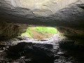
A lovely loop along beautiful paths, discovering the Pont du Diable, the Creux Billard, the Grotte Sarrazine, the Source and the Cascade du Lison. At the start of this beautiful walk, you'll cross the protected natural area of the marl pits and the Bois de Château-Renaud stream. Then head for Crouzet-Migette to reach the Source du Lison site, with a steep descent into the Combe Fagot. Before arriving at the site, you'll passthe Gros Chêne, presumed to be 300 years old, with a circumference of 5.5 m, an imposing sight. On arrival at the site: a return trip to the Creux Billard (unfortunately the Source path is off-limits), then a break at the Cascade du Lison, and a return trip to the Grotte Sarrazine (headlamp required). Then back along the Lison, a nice rest before a steep climb to Crouzet-Migette.
The Belvédère du Vieux-Château and the Pont du Diable
 5.92 mi
+1,050 ft
-1,056 ft
3h 40
Moderate
Departure from Crouzet-Migette (Doubs)
From Crouzet, you will climb up to the remains of one of the largest strongholds of the Chalon family, which are actually quite sparse. Blame Louis XIV, who destroyed a large part of our heritage in revenge! However, your efforts will be rewarded by the splendid view of Nans-sous-Sainte-Anne, nestled in the natural setting of its remote valley, by the pretty Saint-Thiébaud church and by the bold and supernatural bridge spanning the Diable waterfall.
Circular with viewpoints around the Source du Lison
9.87 mi
+2,142 ft
-2,133 ft
6h 25
Moderate
Departure from Nans-sous-Sainte-Anne (Doubs)
Starting from Nans-sous-Sainte-Anne, pass by the Old Castle, Sainte-Anne, the Devil's Bridge and the Montmahoux viewpoint
The source of the Lison and the Belvédère du Vieux Château
 9.13 mi
+1,998 ft
-1,991 ft
5h 55
Moderate
Departure from Nans-sous-Sainte-Anne (Doubs)
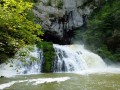
Discover the charm of Nans-sous-Sainte-Anne and its old houses, nestled in the natural setting of the remote valley, its Taillanderie. Then there is the Lison, mystical and wild at the foot of a vertiginous rocky cirque, after a tortuous underground journey, gushing forth in the blue-green plume of its never-ending waterfall, the wild cathedral of the Sarrazine cave, the Creux Billard and finally the belvedere of the Vieux Château.
Fort Belin and the village of Clucy
 5.96 mi
+1,286 ft
-1,263 ft
3h 50
Moderate
Departure from Salins-les-Bains (Jura)
This circular loop climbs up to Fort Belin, where you can enjoy a majestic view of Salins-les-Bains to the north and the green hills of the Jura to the south, before crossing the charming village of Clucy and descending via the Roman road at the foot of Mont Poupet.
The forts of Salins and the Roman Way
 7.96 mi
+2,490 ft
-2,461 ft
5h 50
Moderate
Departure from Salins-les-Bains (Jura)
This circular route allows you to see both forts and the town of Salins from two different angles. The Roman Way is an excuse to get closer to Mont Poupet and increase the elevation. However, the great advantage of this walk is that it is shaded by trees, which is very practical in summer.
Fort Saint-André
 2.72 mi
+823 ft
-846 ft
2h 00
 Easy
Departure from Salins-les-Bains (Jura)
A short walk on the heights of Fort Saint-André to discover the exceptional natural site of Salins-les-Bains, protected by its two old forts.
Salins-les-Bains – Arbois
 12.48 mi
+2,365 ft
-2,457 ft
7h 50
Difficult
Departure from Salins-les-Bains (Jura)
Fourth stage of the Échappée Jurassienne. Right from the start of this stage, things get serious with a demanding route punctuated by steep ascents and descents in the limestone massif of Revermont. Then, through undergrowth, pastures and picturesque viewpoints, the second part of the route reveals itself to be full of charm and tranquillity, offering a perfect transition before reaching Montigny-les-Arsures, a superb wine-growing village where the vineyards come into view. A few more kilometres will take you to Arbois, the capital of Jura wines. Louis Pasteur had his family home here, which is still open to visitors. This colourful town is full of Jura wine tasting cellars and great places to eat for food lovers.
Mont Poupet from Salins-les-Bains
 9.15 mi
+1,991 ft
-1,985 ft
5h 55
Moderate
Departure from Salins-les-Bains (Jura)
Climb to the highest point of the extreme Jura at 851 m, with 360° views of the plains and mountains of the Jura and, on a clear day, even Mont Blanc.
Set off from Salins-les-Bains on the banks of the Furieuse, long known for its salt mining.
A scenic and slightly challenging hike without any major difficulties.
Circular walk in Lemuy: the sources of the Roche and the Montorge stream
9.01 mi
+607 ft
-600 ft
4h 40
Moderate
Departure from Lemuy (Jura)
A lovely forest walk in the Joux State Forest, taking you through part of one of France’s most beautiful spruce forests. From the outskirts of Lemuy, you’ll reach the meadows of Villers-sous-Chalamont, then the source of the Roche at the foot of the viewpoint, followed by the source of the Ruisseau de Montorge and its picturesque setting with a waterfall emerging from an imposing cirque. Beautiful forest tracks and a lovely path will take you back to your car park.
To make the most of the rocky and rugged landscapes around both springs, it’s best to do this walk after a spell of rain so you can admire the waterfalls. In winter, when temperatures drop below freezing, ice will glisten all over the rocks and form magnificent stalactites along the cliff face, making this site even more spectacular.
Mont Mahoux, Le Verneau and the Belvédère des Feuilles
 6.00 mi
+1,703 ft
-1,709 ft
4h 15
Moderate
Departure from Montmahoux (Doubs)
To warm up, the Belvédère de Montmahoux, at an altitude of 828 metres, offers an exceptional view of the Jura Mountains, with the silhouette of Mont Blanc standing out on the horizon. Then, descending through beautiful beech forests towards Nans and its old houses, you will enjoy beautiful views of the wild cathedral of the Grotte Sarrazine. And, after a detour to the Verneau waterfall, return via the Belvédère des Feuilles viewpoint to the meanders and cliffs of the Lison Valley.
Circular route through the Levier Forest via Hyoche and the ‘Épicéas du Roi de Rome’
 9.14 mi
+541 ft
-512 ft
4h 40
Moderate
Departure from Gevresin (Doubs)
An easy circular walk through the Levier State Forest. The route runs almost entirely through woodland on a variety of paths. After taking in the views of Hyoche, you can take a short break at the Brassecouche Spring, sitting at a picnic table by the old railway halt. At the end of the walk, after seeing the gigantic ‘Épicéas du Roi de Rome’ spruce trees, you’ll follow a botanical trail and, on your return to the car park, you can enjoy a relaxing break at one of the many tables and benches situated around the wildlife park at the Maison Forestière du Rondé.
The ancient pass of Chalamont
 3.80 mi
+594 ft
-594 ft
2h 15
Easy
Departure from Villers-sous-Chalamont (Doubs)
This circular route around Chalamont takes you on a journey of discovery to a remarkable historical site: the ancient Chalamont Passage, where the ruts carved into the rock are a reminder of the carts of yesteryear. The route alternates between forest paths, wilder trails and clearings offering beautiful views of Mont Poupet, the valley and the Boujailles plateau.
Chalamont Ancient Trail
 1.17 mi
+171 ft
-161 ft
0h 40
Easy
Departure from Boujailles (Doubs)
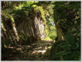
Straddling the municipalities of Boujailles and Villers-sous-Chalamont, this trail will take you to the Chalamont Pass, a former toll station on the ancient road leading from northern Italy to Flanders.
The Botte d’Alaise
8.81 mi
+961 ft
-932 ft
4h 55
Moderate
Departure from Éternoz (Doubs)
A walk along tarmac roads and forest tracks to explore the viewpoints over the River Lison and the Gallic ruins.
Forest path no longer in use (9); see the notice dated 2 September 2023 for an alternative route
The remains of Alésia and the Lison Gorges
 5.24 mi
+840 ft
-843 ft
3h 10
Easy
Departure from Éternoz (Doubs)
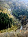
On 10 November 1855, during a meeting of the Société d'Émulation du Doubs, Alphonse Delacroix exclaimed: "There is a place which, until the 19th century, retained its name of Alésia and still reigns amid the remains of the largest battlefield known to man. It is there, in Alaise, that we place the memorable siege that ended the struggle of Vercingetorix." Far from this scholarly debate, discover these ruins and, above all, the magnificent view of the Lison Gorges.
From the Bois de la Chênaie to the Bois de Rozet between By and Myon
5.95 mi
+486 ft
-515 ft
3h 10
Easy
Departure from By (Doubs)
A walk through the forest along dirt tracks and forest paths.
Les Chandeliers
 9.09 mi
+942 ft
-958 ft
5h 00
Moderate
Departure from Éternoz (Doubs)
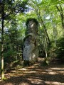
This forest trail will take you to some unusual sites: the Prêtres réfractaires, a small secret wooded area where priests who rebelled against the revolution hid and celebrated mass; and the Chandeliers, large rock columns several metres high, formed by water and frost erosion. You will discover a viewpoint over the lost gorges of the Lison, which you will then follow along a beautiful, cool path, returning via the wild valley of the Vau stream.
Circular path in the Moidons Forest at Valempoulières
8.98 mi
+778 ft
-787 ft
4h 50
Moderate
Departure from Pont-d'Héry (Jura)
This easy walk, which takes place almost entirely in the forest, will take you through magnificent fir forests and beautiful deciduous woodlands. You’ll also enjoy lovely views of the iconic Mont Poupet, and, in the opposite direction, of Mont Rivel and the Haut Jura mountain range.
You’ll also pass through beautiful fields of sharp limestone pavement, typical of the region.
The Feuilles viewpoint, the Verneau waterfalls and the Vau stream
 8.34 mi
+1,073 ft
-1,063 ft
4h 45
Moderate
Departure from Éternoz (Doubs)
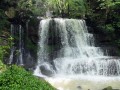
From Éternoz, overlooking the Cirque de Nans-sous-Sainte-Anne, you will head to the beautifully named Belvédère des Feuilles on the meanders and cliffs of the wild Lison valley, notably on the "éperon des aiguilles" (spur of the needles), offering a view of a colourful forest. Then you will descend towards Nans and its old houses and climb boldly to the superb Verneau waterfall before returning along the Lison, through the small, lost and wild valley of the Vau stream.
The Forest of La Joux, from the Maison du Chevreuil to the Belvédère de la Roche
 8.99 mi
+981 ft
-955 ft
5h 00
Moderate
Departure from Supt (Jura)
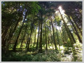
A hike entirely through the forest, alternating between forest roads and footpaths, traversing this vast forest massif. Several designated viewing points offer views of the Jura mountain range or, on the other side of the forest, the Poupet and the entire plateau. A superb site at the start with an arboretum and historical information about the area.
From Myon to the Gour de Conche, going up via the Monniot
9.28 mi
+988 ft
-988 ft
5h 10
Moderate
Departure from Myon (Doubs)
A forest walk combining tracks, forest paths and dirt tracks, taking in the Gour de Conches, its waterfall and its spring.
The Ronchaux Belvedere
 7.19 mi
+784 ft
-778 ft
4h 00
Moderate
Departure from By (Doubs)
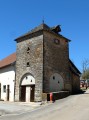
This woodland walk offers three viewpoints over the lower Loue valley, the Jura mountains and Bartherans, nestled in wooded valleys overlooking the Lison valley.
The Lison Gorges
 8.64 mi
+932 ft
-938 ft
4h 45
Moderate
Departure from Éternoz (Doubs)
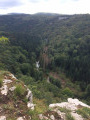
A fairly varied route (geological curiosity, spring, stream and river with numerous small waterfalls), well shaded and wooded enough to encounter various species of trees.
Les Chandeliers and the Lison
 3.64 mi
+482 ft
-482 ft
2h 05
Easy
Departure from Éternoz (Doubs)
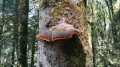
A short, unspoilt circular walk in the heart of the Lison Valley, amongst fir forests, moss-covered sharp limestone pavement and limestone cliffs. The route leads to the impressive ‘Chandeliers’ – large rock columns shaped by erosion – and then offers a lovely view over the Lison Gorges. The walk continues past the Brue fountain and along the riverbank.
From La Chapelle-sur-Furieuse to Villars-St-Georges
 17.02 mi
+1,207 ft
-1,289 ft
8h 55
 Very difficult
Departure from La Chapelle-sur-Furieuse (Jura)
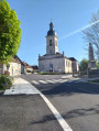
Sixth stage from the Jura to Hauts-de-France via the Francigena: for this long stage, which features less elevation gain, you set off from La Chapelle-sur-Furieuse and, passing through forests, vineyards and meadows, you’ll reach Port-Lesney. From the Vieux-Pont in Port-Lesney, you’ll climb along beautiful forest paths winding through boxwood groves towards the Hermitage of Notre-Dame-de-Lorette, perched on a sheer cliff overlooking the valley, before reaching the village of Arc-et-Senans and its Royal Saltworks, listed as a UNESCO World Heritage Site since 1982. the Royal Saltworks of Arc-et-Senans is a former salt production facility, built on the initiative of King Louis XV between 1775 and 1779. This is followed by a forest trail leading you to Le Signal (467 m), the highest point of this stage. You then descend along beautiful, fairly undulating forest paths, with occasional views across the vast neighbouring state-owned forest, towards the Doubs valley.
From La Chapelle-sur-Furieuse to the ruins of Vaulgrenant Castle (circular trail)
 9.93 mi
+1,345 ft
-1,348 ft
5h 45
Moderate
Departure from La Chapelle-sur-Furieuse (Jura)
From Chapelle-sur-Furieuse, through forests, vineyards and meadows, you will reach the ruins of Vaulgrenant Castle and then return to your starting point along the Furieuse river via a long descent. You will pass through the small village of Onay, then the suburbs of Salins-les-Bains, via the Voie Verte, before reaching Marnoz and heading towards Château de Vaulgrenant.
Enjoy beautiful views of Le Poupet and the forts of Salins-les-Bains.