Two distinct atmospheres between the heights of the Limberg and the banks of the Rhine

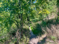
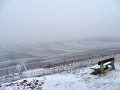
This is a hike offering a wide variety of landscapes, taking in hills, vineyards, woodland and the banks of the Rhine. A hillyfirst section on the Limberg heights gives way to a flat stretch through the Sasbach-Am-Kaiserstuhl Forest.

Details

23832030
Creation:
Last update:
Last review:
  • Walking
    Activity: Walking
  • ↔
    Distance: 4.32 mi
  • ◔
    Average duration: 2h 20 
  • ▲
    Difficulty: Easy

  • ⚐
    Back to start: Yes
  • ↗
    Ascent: + 377 ft
  • ↘
    Descent: - 387 ft

  • ▲
    Highest point: 850 ft
  • ▼
    Lowest point: 577 ft

Photos

Description of the walk

The start of the walk is accessible by car via a car park along the Am Rhein road, in the France → Germany direction.

(S/E) Start by following the path running parallel to the road, with the forest on your left. After a short descent, at the three-way junction, take the cycle path that leads uphill. Shortly afterwards, when the path rejoins the road, you’ll see a small flight of steps on the other side of the road. Cross the Am Rhein (K5144) carefully and head towards the vineyard. Take the path to the left and climb straight ahead. Continue to the ruins of Limburg Castle.

(1) Pass through the stone archway of the castle ruins, follow a short descent, then turn left twice onto the paths that follow. Resume the climb by following the path.
About 600 m further on, at the T-junction, turn left to reach the summit of the Limberg.

(2) Leave the forest by continuing straight ahead along the small road that leads back down. Walk for about 500 m, then turn left and right, staying on the tarmac. A little further on, turn left and then immediately right. 100 m further on, at the junction and as the road begins to curve, keep going straight on, following the path (marked with Yellow Diamonds) which runs between the vineyards. Cross the next road, continuing between the vineyards (the path is slightly offset to the right).
Climb the steps to reach the Lützelberg Chapel.

(3) Leave the chapel grounds via the southern exit and continue straight on. A little further on, after a steep descent, you’ll arrive in Sasbach-Am-Kaiserstuhl. Turn right onto Im Weingarten, then left to pass the children’s playground. Turn right to leave the village and reach the path on the other side of the main road (K5144 – watch out for cars) via the opening opposite, slightly to the right. Follow the path downhill and enter the forest.

(4) After the footbridge, turn right, then take thefirst left, and finally thefirst right. Cross the embankment. At the end of the path, turn left and cross the bridge. Continue straight on until you reach the Rhine.

(5) Turn left and follow the Rhine for about 700 m.

(6) Turn left and head back into the forest. Turn left immediately. At the three-way junction, keep right. Back at the embankment, follow it on the opposite side to where you arrived, then carry on straight ahead until you reach the forest again.

(7) Take thefirst left, then thesecond right, and continue north-east until you leave the forest.

(4) Turn left and walk to the car park (S/E).

Waypoints

  1. S/E : mi 0 - alt. 620 ft - Parking along the Am Rhein road
  2. 1 : mi 0.59 - alt. 722 ft - Burgruine Limburg
  3. 2 : mi 1.17 - alt. 846 ft - Vineyard - Limberg
  4. 3 : mi 1.69 - alt. 719 ft - Chapel - Lützelberg
  5. 4 : mi 2.17 - alt. 591 ft - Entrance to the forest
  6. 5 : mi 2.84 - alt. 584 ft - Edge of the - Rhin (fleuve)
  7. 6 : mi 3.27 - alt. 587 ft - Start of the trail
  8. 7 : mi 3.81 - alt. 594 ft - Junction near the Limburghalle
  9. S/E : mi 4.32 - alt. 620 ft - Parking along the Am Rhein road

Notes

Sun exposure
☀️ 44% (3.1 km)
? 56% (3.9 km)

Breaks and refreshments
(3) Litzelbergkapelle: benches, toilets and drinking water (subject to opening hours)

Alternatives
It is possible to walk only thefirst section (3.6 km, 110 m elevation gain) or thesecond section (3.4 km, flat) of the walk.

Worth a visit

Reviews and comments

4.4 / 5
Based on 3 reviews

Reliability of the description
5 / 5
Ease of following the route
5 / 5
Route interest
3.3 / 5
aude hetier
aude hetier

Overall rating : 4.7 / 5

Date of your route : Mar 23, 2026
Reliability of the description : ★★★★★ Very good
Ease of following the route : ★★★★★ Very good
Route interest : ★★★★☆ Good
Very busy route : No

Please note: we were fined €55 for parking in the recommended spot, despite the ‘parking’ sign. The path was very muddy due to forestry work.

Machine-translated

Nine 68
Nine 68

Overall rating : 4.7 / 5

Date of your route : Mar 31, 2024
Reliability of the description : ★★★★★ Very good
Ease of following the route : ★★★★★ Very good
Route interest : ★★★★☆ Good
Very busy route : Yes

Quite a few hikers on a Sunday, which explains the crowds. Easy, despite the muddy paths. Some views of the Rhine. Perhaps best avoided during mosquito season. .....

Machine-translated

Mickanside
Mickanside

Hello Willems,
Thank you for your review! Personally, I prefer the first part, with its beautiful views and its chapel I'm glad you enjoyed it!
The second part is more monotonous, but the part in the forest is very pleasant in the summer when it's hot. Many people also like to walk along the banks of the Rhine in summer... But it all depends on your taste!
Have a great day!

Machine-translated

Willems Grâce-Hollogne

Overall rating : 3.5 / 5

Date of your route : Jan 07, 2023
Reliability of the description : Not used / Not applicable
Ease of following the route : ★★★★★ Very good
Route interest : ★★☆☆☆ Disappointing
Very busy route : No

Nice little walk, especially the first half. The stretch along the Rhine was much more boring.

Machine-translated

Other walks in the area

For more walks, use our search engine .

The GPS track and description are the property of this route's author. Please do not copy them without permission.