Burkheim, its lakes and Sponeck Castle

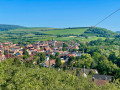
Walk around Burkheim, a pretty village typical of the Kayserstuhl region. The route takes you past the Baggersee gravel pit, Sponeck Castle, through the vineyards and around the village.

Details

26473350
Creation:
Last update:
Last review:
  • Walking
    Activity: Walking
  • ↔
    Distance: 5.24 mi
  • ◔
    Average duration: 2h 40 
  • ▲
    Difficulty: Easy

  • ⚐
    Back to start: Yes
  • ↗
    Ascent: + 253 ft
  • ↘
    Descent: - 253 ft

  • ▲
    Highest point: 827 ft
  • ▼
    Lowest point: 594 ft

Photos

Description of the walk

Park in the motorhome car park on the right at the end of Rheinstrasse in Burkheim.

(S/E) Take the road leading away from the village.

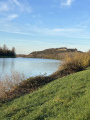
(1) When you reach the forest, leave the road and take the path on the left (Hardtwaldweg), then turn right onto the footpath which runs alongside the Rappennestgiessen stream in places, offering some lovely views. When you reach the road, continue to the left until you come to a beach by a gravel pit.

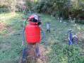
(2) Walk back 150 m and take the path on the left which runs alongside the ponds. Follow the path to the road, which you cross to reach a rather unusual park (the Skulpturenpark) featuring sculptures made from recycled materials.

(3) Turn back 50 m and take the path on the right which runs alongside the road. Continue straight on to reach the banks of the Rhine, opposite the point where the canal feeding the hydroelectric power station meets the Old Rhine.

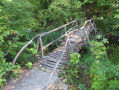
(4) Go back and take the path on the left which runs alongside the sports ground, then turn right onto the path that goes round the edge of the ground. Carry on to the left, pass between two ponds, then turn left to walk alongside some more ponds. Immediately after the playground and the Burkheim Angling Association’s shelter, turn right onto the small wooden bridge to cross a stream, then turn left and continue to a car park.

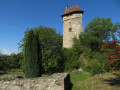
(5) Turn right towards Sponeck Castle. This is private property, but the garden is open to visitors during the summer months. A little further up, at a junction of signposted paths, turn right towards Burkheim (Yellow Diamond markings). After passing through a section of woodland, you’ll reach the vineyards, which offer a lovely view of the Kayserstuhl. Turn right between the woodland and the vineyards, then turn right again into the woodland. You’ll come to a gazebo offering a lovely view of the Rhine Valley.

(6) Continue straight on for about 700 m.

(7) Take the path on the right which leads down towards the village. Walk past a car park towards the church.

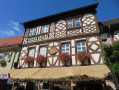
(8) Turn right, then take the steps leading down to the right of the church. Take a moment to admire the engraved stones under the porch at the church entrance. Head down to the left, then turn right onto Am Kirchberg. At the junction, turn right onto the main street (Mittelstadt), with the porch of the old village gate on your left.

After the well on the left, take the narrow lane on the right which passes in front of the Corkscrew Museum. Then turn left towards the entrance porch to Burkheim Castle and walk along the fortifications of the surrounding wall. Return to the main street, turn right and continue to the crossroads. Then turn left and walk for about a hundred metres.

(9) Turn right and walk past the Kräuterhof (herbalist’s shop). At the junction, turn right onto Rheinstrasse and head back to the starting car park (S/E).

Waypoints

  1. S/E : mi 0 - alt. 597 ft - Motorhome car park
  2. 1 : mi 0.13 - alt. 614 ft - Crossroads
  3. 2 : mi 0.74 - alt. 617 ft - Beach
  4. 3 : mi 1.47 - alt. 607 ft - Sculpture Park
  5. 4 : mi 2.01 - alt. 617 ft - Edge of the - Rhin (fleuve)
  6. 5 : mi 3.02 - alt. 604 ft - Car park
  7. 6 : mi 3.88 - alt. 814 ft - Kiosk
  8. 7 : mi 4.09 - alt. 804 ft - Crossroads
  9. 8 : mi 4.64 - alt. 696 ft - Church
  10. 9 : mi 5.04 - alt. 594 ft - Kräuterhof – Herbalist’s shop
  11. S/E : mi 5.24 - alt. 597 ft - Motorhome car park

Reviews and comments

4 / 5
Based on 4 reviews

Reliability of the description
4 / 5
Ease of following the route
4.3 / 5
Route interest
3.8 / 5
PR35
PR35

Overall rating : 4 / 5

Date of your route : Oct 27, 2023
Reliability of the description : ★★★★☆ Good
Ease of following the route : ★★★★☆ Good
Route interest : ★★★★☆ Good
Very busy route : No

Passing over the bridge was not advisable, as there was a ribbon across it. A pleasant walk with lovely views over the vineyards. After the château, the slope is a little steep and greasy in wet weather.

Machine-translated

gulliver
gulliver

Overall rating : 4 / 5

Date of your route : Oct 12, 2023
Reliability of the description : ★★★★☆ Good
Ease of following the route : ★★★★☆ Good
Route interest : ★★★★☆ Good
Very busy route : No

A pleasant and varied trail. The paths are sometimes very discreet, so you need to be careful to find the little wooden bridge. From Sponeck castle, you can continue straight ahead on the main road and avoid the picturesque but steep path for inexperienced walkers (it goes right at the first crossroads, 100 m after the castle). discover Burkheim, a pretty village with pleasant cafés and patisseries.

Machine-translated

Delphinium
Delphinium ★

Overall rating : 4.5 / 5

Date of your route : Mar 06, 2023
Reliability of the description : Not used / Not applicable
Ease of following the route : ★★★★★ Very good
Route interest : ★★★★☆ Good

I ran that route and it was really enjoyable. The variety in scenery was great and peaceful. Some path maintenance is happening at the minute but easy to go around. I really advise going to the heartcafé afterward, a really lovely place as a reward. Thank you for sharing it.

Willems Grâce-Hollogne

Overall rating : 3.7 / 5

Date of your route : Oct 11, 2022
Reliability of the description : ★★★★☆ Good
Ease of following the route : ★★★★☆ Good
Route interest : ★★★☆☆ Average
Very busy route : No

This hike is not easy for older hikers. The slopes after Château Sponeck are very steep and dangerous, despite the safety devices in place.

Machine-translated

Other walks in the area

For more walks, use our search engine .

The GPS track and description are the property of this route's author. Please do not copy them without permission.