Refine your search for walks in Col des Thures (2114m) - Vallon des Thures
Col des Thures (2114m) - Vallon des Thures walks


 GTA, Great Alpine Crossing via the GR®5 and GR®55. From Lake Geneva to Nice.
 Visorando Member
 342.76 mi
 +99,633 ft
 -100,915 ft
 21 days
 Very difficult
 Departure from Saint-Gingolph (Haute-Savoie)
The Grande Traversée des Alpes (GTA) mainly follows the GR®5, with a few possible variations such as the crossing of the Haute Vanoise via the GR®55 and the Via Alpina, which this route takes instead of the GR®5 route via the Col de l’Iseran. It crosses the French Alps from north to south, from Saint-Gingolph to Nice. The guide includes web links to the many accommodation options along the route or nearby: mountain huts, lodges, campsites, cabins and shelters, excluding hotels. Although this guidebook details the GTA as a three-week trek, it can be adapted to suit your own pace, with stages of varying lengths, either completed in one go or in sections over several years. This journey, fuelled by the joy of freedom in unspoilt natural surroundings, will remain a superb and unforgettable experience, offering, moreover, the opportunity to meet many people with whom you can share this same passion for the mountains.
From Les Granges de la Vallée Étroite to Val des Prés
 21.10 mi
+4,957 ft
-6,270 ft
14h 00
Very difficult
Departure from Névache (Hautes-Alpes)
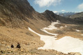
This twelfth stage completes the crossing of the Cerces massifthrough the enchanting Vallée Étroite and the magnificent Vallée de la Clarée. From Les Granges de la Vallée Étroite, the GR®5 climbs south-west, passes the pretty little Lac Chavillon and reaches the Col des Thures. The descent begins gently towards the Cabane des Thures, then becomes steeper in the Combe des Thures, where you can admire the ‘Cheminées de Fée’ (fairy chimneys). It reaches the hamlet of Roubion, crosses the Clarée at the Pont des Armands and passes through the small village of Plampinet before climbing up the gorge of the Torrent des Acles; via the Opon valley, it reaches the Col de Dormillouse, then the Col de la Lauze. From the pass, the path turns towards the Clot des Fonds and descends the Vallon des Baisses, following the Rio Secco torrent, before entering the Durance valley. After Montgenèvre, it leaves the road to follow the Durance and cross a few tributary torrents. At the last one, the route leaves the GR®5 to reach the hamlet of La Vachette.
Walks near Col des Thures (2114m) - Vallon des Thures
Terzo Alpini Mountain Hut – Névache
 8.80 mi
+2,884 ft
-3,455 ft
6h 35
 Difficult
Departure from Névache (Hautes-Alpes)
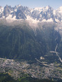
This third stage of the route will take you to the village of Névache via the Col du Vallon, once again following theGRP® “Tour du Thabor”. The climb to the pass is difficult, particularly the section through the scree slope, a former glacier. Due to its exposure, the gully leading up to the pass is prone to snowfields.
The scenery is fabulous. The descent towards Névache is superb, through a lush green valley, alongside a torrent and past a beautiful chapel.
Névache – Refuge des Drayeres
 10.88 mi
+3,451 ft
-1,512 ft
8h 00
Difficult
Departure from Névache (Hautes-Alpes)
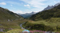
This is the fourth stage of the route, taking you from the village of Névache to the Drayéres mountain hut at the head of the Clarée Valley. The route follows the path known as the Chemin de Ronde, part of theGRP® Tour du Thabor trail. You’ll complete a circular route around Lake Laramon. Alternatively, from this lake you can also reach Lake aux Serpents.
The view over the valley from the top of the Chemin de Ronde is simply stunning.
When you reach the Refuge de la Terrasse, take a moment to admire the mountainous landscape of this valley.
 Buffère Mountain Hut
2.98 mi
+1,627 ft
-98 ft
3 hrs
 Moderate
Departure from Névache (Hautes-Alpes)
You’ll gradually discover the Clarée valley. As you gain altitude, your view will widen. It’ll soon become truly extraordinary!
La Clarée right bank: from Névache to the Laval car park
 6.13 mi
+1,444 ft
-49 ft
4h 05
Moderate
Departure from Névache (Hautes-Alpes)
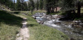
Between forest, mountain pastures and the banks of the Clarée, this walk takes you gently from Névache to the upper Clarée valley. It is also an opportunity to discover the hamlets and isolated chalets scattered throughout the valley. Don't forget to admire the pretty Fontcouverte waterfall on the way!
Please note that if you do this hike outside the shuttle bus operating period (information available from the tourist office), you will have to walk back to the starting point along the same route!
Névache – Refuge de Laval
 5.83 mi
+1,460 ft
-95 ft
6 hrs
Difficult
Departure from Névache (Hautes-Alpes)
Following the famous River Clarée, head to the new Laval refuge in the large cirque of the Champ des Rochilles for a very pleasant evening and night’s stay.
Névache - Briançon
15.15 mi
+4,222 ft
-5,141 ft
10h 40
Difficult
Departure from Névache (Hautes-Alpes)
Étape de la Grande Traversée des Alpes de Névache dans la vallée de la Clarée à Briançon (plus haute ville de France) par la porte de Cristol.
Lac Lavoir - Laval car park via the Pic du Lac Blanc
 8.57 mi
+2,746 ft
-3,556 ft
8 hrs
Very difficult
Departure from Névache (Hautes-Alpes)
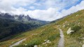
Last day of the circular, returning to the Laval car park via the Col du Vallon and the Pic du Lac Blanc, from where you can see the route of the previous three days.
Pamplinet - Refuge du Chardonnet
8.03 mi
+2,546 ft
-135 ft
5h 55
Difficult
Departure from Névache (Hautes-Alpes)
This section corresponds to the second stage of the crossing of France, following the 45th parallel. This stage is magnificent and can be a hike in its own right. You follow the Clarée valley and discover beautiful waterfalls before climbing up to the Refuge du Chardonnet.
Lac des Méandes - Mont Thabor - Valfréjus
11.02 mi
+2,379 ft
-5,850 ft
7h 10
Difficult
Departure from Névache (Hautes-Alpes)
The hike starts after the bivouac at Lac des Méandes (below Col des Méandes) to reach the summit of Mont Thabor and admire the 360° view of the mountains. Then return via the Refuge du Mont Thabor and descend to Valfréjus.