


Refine your search for walks in Dent de Jaman
Dent de Jaman walks


 Circular walk around the Rochers de Naye starting from Caux
 Visorando Member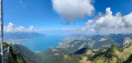
 9.73 mi
 +4,334 ft
 -4,314 ft
 8h 15
8h 15
 Very difficult
 Departure from Montreux (Canton de Vaud) (Vaud)
Les Rochers de Naye (2,042 m): A unique panoramic view of the Swiss and French Alps, from the Eiger to Mont Blanc and Lake Geneva. In particular, you can see the neighbouring peaks of the Dent de Jaman and Cape aux Moines, the French-speaking Jura, much of the Fribourg Pre-Alps and the Vaud Alps, including the Diablerets massif; the Bernese Oberland with the Eiger-Mönch-Jungfrau trio; as well as Mont Dolent and the Aiguille Verte in the Mont Blanc massif.
Walks near Dent de Jaman
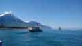
Along the shores of Lake Geneva from Villeneuve to Montreux.
 3.27 mi
+177 ft
-167 ft
1h 40
3.27 mi
+177 ft
-167 ft
1h 40
 Easy
Departure from Villeneuve (Canton de Vaud) (Vaud)
Easy
Departure from Villeneuve (Canton de Vaud) (Vaud)
A pleasant walk along the "Riviera of Lake Geneva", with superb panoramic views of the lake and surrounding peaks, the grand residences of Montreux and the famous Château de Chillon. This walk is proposed as a one-way trip with the option of returning either by boat or on foot.
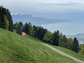
Crossing the Pléiades from Blonay
 6.58 mi
+1,762 ft
-2,480 ft
4h 35
6.58 mi
+1,762 ft
-2,480 ft
4h 35
 Moderate
Departure from Blonay (Vaud)
Moderate
Departure from Blonay (Vaud)
A classic destination in the region offering magnificent views of Lake Geneva and the surrounding mountains. The route is particularly recommended in spring and autumn. In summer, this largely shaded route limits excessive exposure to the sun. The hike is ideal for family activities, including a visit to the AstroPléiades educational site.
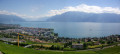
Les Paccots - Vevey
 13.66 mi
+1,657 ft
-4,098 ft
7h 45
13.66 mi
+1,657 ft
-4,098 ft
7h 45
 Difficult
Departure from Châtel-Saint-Denis (Canton of Fribourg)
Difficult
Departure from Châtel-Saint-Denis (Canton of Fribourg)
This last stage will take you to the shores of Lake Geneva in Vevey. From Les Paccots, a forest trail will lead you to the Fégire footbridge, where the Veveyse de Fégire marks the border between the cantons of Fribourg and Vaud. When you arrive at Laly and from the Pléiades trail, you can admire Lake Geneva and the surrounding Alpine peaks. You will pass through a few vineyards before arriving in Vevey.
Les Mosses - Les Diablerets
 6.69 mi
+1,148 ft
-2,096 ft
4h 05
Moderate
Departure from Ormont-Dessous (Vaud)
6.69 mi
+1,148 ft
-2,096 ft
4h 05
Moderate
Departure from Ormont-Dessous (Vaud)
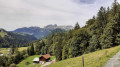
This second stage will take you from the Col des Mosses to the renowned resort of Les Diablerets. The Aï, Mayen and Famelon towers will accompany you for much of the way and you will see them from different angles. The route also offers numerous panoramic views of the Diablerets Massif, the Chablais, the Dents du Midi and the Mont Blanc Massif.
From Leysin to Les Diablerets
 16.15 mi
+4,085 ft
-4,938 ft
2 days
Moderate
Departure from Leysin (Vaud)
16.15 mi
+4,085 ft
-4,938 ft
2 days
Moderate
Departure from Leysin (Vaud)
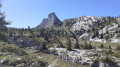
A beautiful hike in the Vaud Alps. The scenery along this route is very varied. You’ll discover the Tours d’Aï, Mayen and Famelon. From the Col de la Pierre du Moëllé, you’ll enjoy a view of Lake Hongrin.Along the route, there are numerous vantage points offering views of the Diablerets Massif, the Chablais, the Dents du Midi and the Mont Blanc Massif.
Leysin - Les Mosses
 9.45 mi
+2,913 ft
-2,838 ft
6h 55
Difficult
Departure from Leysin (Vaud)
9.45 mi
+2,913 ft
-2,838 ft
6h 55
Difficult
Departure from Leysin (Vaud)
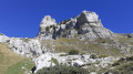
This first stage will take you from Leysin, at the foot of the famous Aï, Mayen and Famelon towers, to the Col des Mosses. From the Col de la Pierre du Moëllé, you can enjoy a view of Lake Hongrin.
Along the route, there are numerous panoramic viewpoints over the Diablerets Massif, the Chablais, the Dents du Midi and the Mont Blanc Massif.
The Terraces of Lavaux, the Three Suns
6.83 mi
+899 ft
-787 ft
3h 55
Moderate
Departure from Vaud
A beautiful walk through the vineyards of Lavaux, discovering the different appellations. Lovely views of the lake and the Alps.
Local wines can be tasted throughout the hike.
N.B. Contrary to what is automatically indicated on the hike information sheet, the Lavaux terraces are located in the canton of Vaud and not in Valais.
Saint Gingolph - La Chapelle d'Abondance
10.74 mi
+6,010 ft
-3,934 ft
10h 10
Difficult
Departure from Saint-Gingolph (Haute-Savoie)
Itinéraire de la traversée des Alpes. Etape des rives du lac Léman au Val d'Abondance. Franchir les montagnes du Chablais par une longue grimpette de 1850m en traversant les alpages pour passer le Col de Bise puis redescendre à la station de ski de la Chapelle d'Abondance. Cet itinéraire offre de très beaux panoramas sur le plus grand lac d'Europe et sur le sommet des Cornettes de Bise.
From Saint-Gingolph to the Chalets de Bise
 7.66 mi
+5,013 ft
-1,348 ft
7h 55
Difficult
Departure from Saint-Gingolph (Haute-Savoie)
7.66 mi
+5,013 ft
-1,348 ft
7h 55
Difficult
Departure from Saint-Gingolph (Haute-Savoie)
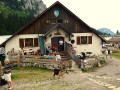
This first stage of the Grande Traversée des Alpes (GTA), from Lake Geneva to the Mediterranean, takes place in the Chablais massif. The path climbs up the Novel valley on the left bank of the Morge, below the hamlet of La Meurtaz, then follows the D30 road, which it overlooks after the hamlet of Jordy. On leaving Novel, the path winds its way above the hairpin bends of the D30 to La Planche. There, it leaves the main valley route to climb due south towards the chalets of Neuteu and on to the Col de Bise, before descending to the Chalets de Bise.
Gruyères - Les Paccots
 12.13 mi
+4,347 ft
-3,284 ft
9h 20
Difficult
Departure from Gruyères (Canton de Fribourg) (Canton of Fribourg)
12.13 mi
+4,347 ft
-3,284 ft
9h 20
Difficult
Departure from Gruyères (Canton de Fribourg) (Canton of Fribourg)
From Gruyères, you will have your eyes fixed on the imposing Moléson. As you make your way towards the summit, the village of Gruyères will remain behind you until you reach Plan Francey. You will temporarily leave trail no. 3, the Alpenpanorama Weg, to climb the Moléson, the highest point of this trek. Back on trail no. 3, at Villard Dessus, you will reach Les Paccots via a descent through the forest.