The Escrière to Colleret route

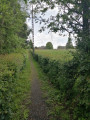
This walk through the fields mainly follows farm tracks. It crosses a large
plain, bare and exposed to the wind.

Details

1559705
Creation:
Last update:
Last review:
  • Walking
    Activity: Walking
  • ↔
    Distance: 5.57 mi
  • ◔
    Average duration: 2h 40 
  • ▲
    Difficulty: Easy

  • ⚐
    Back to start: Yes
  • ↗
    Ascent: + 164 ft
  • ↘
    Descent: - 164 ft

  • ▲
    Highest point: 686 ft
  • ▼
    Lowest point: 528 ft

Photos

Description of the walk

Starting point: Place de l’Europe (church).

(S/E) Leave the square heading towards the church, built around 1500, restored around 1614 and rebuilt in 1846. Turn right onto Rue des Écoles and follow it to the junction. Continue straight ahead along Rue Émile Zola, turn right onto the bridge over the Escrière and immediately turn left onto Route d’Ostergnies for about 150 metres.

(1) Leave the road and head up Rue Léo Lagrange to the right (ignore the street furthest to the right), which soon becomes a grassy path. Let the path wind down to the right and continue along the hedgerow-lined plateau, where a lovely view of the village of Colleret opens up. After 1 km, make the first turn right then left. The grass gives way to tarmac until you reach a junction with a road.

(2) Cross carefully, making a brief first turn left then right.
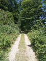
Then take the farm track, Chemin de Jeumont, which winds its way to the bottom of the wooded valley of the Watissart stream. At the first junction, turn right. Cross the Grandes Agacee plain – ‘grandes pies’ – until you reach Chemin du Fache. Turn left towards Château Mariage.

(3) Cross the RD963 with careand take the track opposite for about 300 metres. Then turn right and walk along a stony path that later becomes grassy: the Chemin de Cousolre.
Carry on straight ahead, leaving the path on your right, and at the end, turn right onto the Chemin de Branleux, which you follow for 250 metres.

(4) Turn right onto the small path that leads down to the RD963; cross the road again with care. Opposite, the path continues alongside the Escrière stream and takes you gently back towards Colleret, through a landscape of pastures.

(5) At the crossroads, go straight on. Enter Colleret by turning right onto Rue Jean Jaurès and walk through the village to the church, your starting point (S/E).

Waypoints

  1. S/E : mi 0 - alt. 564 ft - Place de l’Europe (church)
  2. 1 : mi 0.53 - alt. 548 ft - Rue Léo Lagrange in the middle
  3. 2 : mi 1.22 - alt. 620 ft - Route
  4. 3 : mi 2.82 - alt. 659 ft - Cousolre Trail
  5. 4 : mi 3.76 - alt. 659 ft - L'escrière (ruisseau)
  6. 5 : mi 4.81 - alt. 574 ft - Rue Jean Jaurès
  7. S/E : mi 5.57 - alt. 564 ft - Place de l’Europe (church)

Notes

Depending on the season, don’t forget a light jumper… or a sun hat. Sturdy footwear will also come in handy in wet weather. Take care when crossing the RD963 – visibility is reduced.

This route is listed in the PDIPR (Departmental Plan for Walking and Hiking Routes).

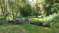
Follow the yellow signposts. (Yellow Cross = wrong direction, arrow pointing right = turn right, arrow pointing left = turn left, horizontal line = go straight on).

Reviews and comments

4.3 / 5
Based on 3 reviews

Reliability of the description
4.7 / 5
Ease of following the route
4.7 / 5
Route interest
3.7 / 5
User 10441405

Overall rating : 4 / 5

Date of your route : Nov 10, 2025
Reliability of the description : ★★★★☆ Good
Ease of following the route : ★★★★☆ Good
Route interest : ★★★★☆ Good
Very busy route : No

Markings to be completed at the start of the route and refreshed throughout the route.

Machine-translated

gerendo
gerendo

Overall rating : 4.7 / 5

Date of your route : May 23, 2022
Reliability of the description : ★★★★★ Very good
Ease of following the route : ★★★★★ Very good
Route interest : ★★★★☆ Good
Very busy route : No

A lovely, peaceful walk along the country lanes

Machine-translated

mamandine
mamandine

Overall rating : 4.3 / 5

Date of your route : May 27, 2019
Reliability of the description : ★★★★★ Very good
Ease of following the route : ★★★★★ Very good
Route interest : ★★★☆☆ Average

A route designed for nature lovers seeking peace and quiet, tucked away amongst the fields on unpaved tracks.
No spectacular scenery, but just what you need to recharge your batteries.

Machine-translated

Other walks in the area

For more walks, use our search engine .

The GPS track and description are the property of this route's author. Please do not copy them without permission.