Country:
 City:
City:


Departure from Viarmes station (section of the Transilien Line H, with Luzarches as the terminus).
(S/E) With your back to the station, follow Avenue Foch to the right, signposted in red and white (access tothe GR®1). At the level crossing, turn left onto Chemin de la Justice. Pass Rue Anna de Noailles on your left.
(1) At the next junction, join theGR®1by taking Chemin de Champlatreux on the right. Ignore the streets on the left and right. After the tunnel, continue straight on and take the path on the left at the crossroads. Turn left again a little further on.
(2) Cross over the railway line. As you come out of the woods, turn right onto Chemin de la Madeleine, which runs alongside an apple orchard on your right.
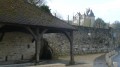
(3) Walk past the wash house on the right, then, once in the village of Seugy, take the first right onto Ruelle du Four. At the end, turn right up Ruelle Eluy to cross the railway line again. Continue straight on until you reach the road.
(4) Opposite the Mont Griffon Golf Club, follow the road to the right. After the entrance to the main car park at Sherwood Parc, when the road bends to the right, carry on straight ahead. Go through the tunnel and continue to the main road.
(5) Cross the road and head left. Turn right after the golf hotel. Stay on the main path, ignoring the turnings towards the golf greens. Go through the tunnel. Then ignore the two paths coming from the left and right. Further on, after the two trees on your left at the side of the path, turn left twice.
(6) After the left-hand bend, carry on straight ahead, ignoring the path branching off to the right. Walk along the edge of the field to the left of the row of trees until you reach a junction in front of another tunnel. Go through the tunnel, then, before the ‘No Public Entry’ sign, take a small path down to the left. The path runs alongside the golf courses once again.
(7) As you enter the Bois du Tremblay, ignore the paths coming from the right and left. When you reach the Éco-pâturage, leave theGR®655on your right and continue straight on until you reach the Route de Rocquemont.
(8) Turn right, then further on, head up the Chemin des Carrières de Saint Côme on the left. When the road bends left to pass between two greens, take the path on the right. Walk past the Croix Saint Côme. At the end of the lane, take Rue Saint Côme (cobbled) on the right.
(9) Leave the red and white markings ofthe GR®1by heading down the Rue Saint Côme on the left, just past number 30. At the bottom of the street, turn left onto Rue Vivien. Continue to the end of this street until you reach the level crossing. Cross the railway tracks on the left. Take the pedestrian crossing across Route des Bruyères. Cross to the opposite side to join Route de Seugy and turn left.
(10) Then take the first road on the right, Allée des Cerisiers (the cherry trees are actually located along Route de Seugy). Pass Allée de la Grenouillère on your right, then take the next path on the right.
(11) Then turn left onto the Chemin du Bois de la Noue, marked in yellow. The path leads out of the woods and turns right through the fields. After a left-hand bend, cross a riding centre.
(12) At the end of the Chemin du Bois de la Noue, turn left onto the Route de Baillon, taking care not to go straight on into the Rue du Pont. After the traffic lights, ignore the Rue de la Ferme on the right, then the two paths coming from the left.
(13) Continue carefully along the Route de Baillon (no pavement). Cross the Ysieux and take the first path on the right. At the entrance to the Bois de Bonnet, carry on, ignoring the paths coming from the right, and continue due north.
(14) At the Blue Cross Poteau, take the third path on the left, the Layon des Moines. Follow it straight on to the end. Turn left, then right into Rue Santiago Soulas. Walk along the wall, leaving Rue du Château and Rue d’Asnières on your left.
(15) Turn left onto Rue des Marais, which runs alongside the Nouvelle Thève. Ignore the bridges crossing the river. At the end of the street, take the path on the left, the Allée de la Reine Hortense. Ignore the path branching off to the right towards the Marais de Baillon and continue on to the road.
(16) The entrance to the Abbey is on the road on the right.
(17) To return to Viarmes, turn back and head straight on. After the bridge over the Ysieux, cross the road at the pedestrian crossing and turn right. Cross the road again at the pedestrian crossing and walk along the Abbey’s boundary wall on the right.
(18) At the end, cross the D 909 road and continue straight ahead (please note: there is no pedestrian crossing). After 600 metres, at the next junction, turn left. Cross the D 922 at the pedestrian crossing and follow the Route de Boran straight ahead. Cross the Rue de Royaumont. Pass the Rue du Grand Clos on your left.
(19) At the stop sign, go straight on along Rue de Boran. 50 metres further on, turn right into Allée Bérard de Favas. At the end, turn left, then follow Ruelle des Quatre Vents to the right. At the junction, turn left. Pass Rue Jean Jaurès on your right, followed by a footpath. Use the pedestrian crossing to join Ruelle du Fréchot. Turn left immediately.
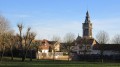
(20) Turn right and stay on Rue de Paris. At the chemist’s, go up the steps to cross the square diagonally and walk past the church entrance.
(21) Walk to the end of Rue du Pape Jean XXIII. Turn right and use the pedestrian crossing to leave Avenue G. Clemenceau and enter Rue de la Gare. Ignore Rue du Montcel on the left. Continue up Rue de la Gare after Chemin de Champlatreux. After the Galliéni underpass on the right, Rue de la Gare comes to an end. Pass Rue Pasteur on your right and go up the ramp on your left, which leads to the front of Viarmes railway station (S/E).

 Visorando Member
 Moderate
 AONB
AONB