Col du Lion, starting from the Grand Échaillon resort

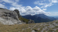
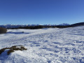
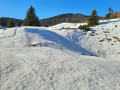
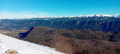
This is a superb snowshoe hike starting from the Grand Échaillon resort, taking in the Col du Lyon and the abandoned hamlet of Gampaloux. At times you’ll be walking along a path that is rarely or never used, which is why it’s important to follow the route closely.

Details

n°30415181
Creation:
Last update:
Last review:
  • Snowshoeing
    Activity: Snowshoeing
  • ↔
    Distance: 5.96 mi
  • ◔
    Duration according to the author: 5 hrs 
  • ▲
    Difficulty: Moderate

  • ⚐
    Back to start: Yes
  • ↗
    Ascent: + 974 ft
  • ↘
    Descent: - 984 ft

  • ▲
    Highest point: 3,930 ft
  • ▼
    Lowest point: 3,369 ft

Photos

Description of the walk

Park in the car park at the Grand Échaillon ski resort.

(S/E) Follow the snowshoe tracks north-eastwards until you reach the Serre du Lion crossroads.

(1) Turn left, then immediately right. Walk underneath the house, keeping as close as possible to the edge of the woodland. Then head for the Col du Lion.

(2) Turn left to reach the edge of the woods.

(3) Follow the edge of the woodland to the right, then turn right into the woodland; it’s helpful to follow the path here. Head towards the Rochers de Caraby.First, cross a wider track before joining asecond one.

(4) Take this track to the right and immediately turn left at a 90° angle. Then follow the power lines on your left as far as Gampaloux.

(5) Then turn left onto the Route Forestière de Gampaloux. Stay on the path at the hairpin bend and rejoin this road. Continue on to reach a path junction.

(6) Turn almost 180° to the right to rejoin this forest road.

(7) Turn left onto it and follow it back to the Col du Lion.

(2) Turn left; you’ll very quickly come back to the junction you passed on the way out.

(1) Follow the route you took on the way there in the opposite direction to return to the car park at the Grand Échaillon ski resort (S/E).

Waypoints

  1. S/E : mi 0 - alt. 3,806 ft - Car park at the Grand Échaillon ski resort
  2. 1 : mi 0.44 - alt. 3,809 ft - Common junction (out and return)
  3. 2 : mi 0.89 - alt. 3,911 ft - Col du Lion (1,191 m)
  4. 3 : mi 1.38 - alt. 3,825 ft - Edge of the woods
  5. 4 : mi 1.79 - alt. 3,606 ft - Trail
  6. 5 : mi 2.3 - alt. 3,458 ft - Gampaloux
  7. 6 : mi 3.66 - alt. 3,924 ft - Hairpin bend
  8. 7 : mi 4.15 - alt. 3,789 ft - Ganpaloux Forest Road
  9. S/E : mi 5.96 - alt. 3,809 ft - Car park at the Grand Échaillon ski resort

Notes

Be sure to follow the GPX track closely, as some sections are off-trail and can only be tackled on snow-covered ground.
Snowshoes are not permitted on the ski runs. Please ensure you bring a mobile phone and the downloaded route to use offline, as there is no mobile signal in certain areas.

Grand Échaillon Cross-Country Ski Centre: 04 75 41 00 15

Worth a visit

(2) The Col du Lion
(5) The hamlet of Gampaloux – please take care not to enter the ruins.
(S/E) The Auberge du Grand Échaillon.

Reviews and comments

5 / 5
Based on 1 review

Reliability of the description
5 / 5
Ease of following the route
5 / 5
Route interest
5 / 5
christineba
christineba

Overall rating : 5 / 5

Date of your route : Aug 11, 2025
Reliability of the description : ★★★★★ Very good
Ease of following the route : ★★★★★ Very good
Route interest : ★★★★★ Very good
Very busy route : No

An easy and pleasant walk in the heat of summer.

Machine-translated

Other walks in the area

For more walks, use our search engine .

The GPS track and description are the property of this route's author. Please do not copy them without permission.