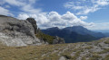
From the Grand Échaillon to the Col de la Bataille

A lovely family outing suitable for all, set in a pleasant, enchanting forest leading to the Col de la Bataille, which is closed to vehicles in winter.

Details

n°43388904
Creation:
Last update:
Last review:
  • Snowshoeing
    Activity: Snowshoeing
  • ↔
    Distance: 4.52 mi
  • ◔
    Duration according to the author: 2.5 hrs 
  • ▲
    Difficulty: Easy

  • ⚐
    Back to start: Yes
  • ↗
    Ascent: + 699 ft
  • ↘
    Descent: - 676 ft

  • ▲
    Highest point: 4,423 ft
  • ▼
    Lowest point: 3,822 ft

Description of the walk

Park in front of the Grand Échaillon establishment.

(S/E) From the car park, continue south along the road until you reach the Route Forestière de Pissenible on your right, the starting point of the route.

(1) Head due south along the forest track, which winds up the valley through a pleasant woodland. At the slightly ascending hairpin bend to the left, you’ll reach the Pas de Chovet junction.

(2) Continue due east. A few metres further on, ignore a track branching off to the left and carry straight on along a path until you reach the road (D199).

(3) Follow it to the right, go through the tunnel – taking care on icy sections – and you’ll reach the Col de la Bataille.

(4) Follow the same route in the opposite direction to return to the Grand Échaillon car park (S/E).

Waypoints

  1. S/E : mi 0 - alt. 3,822 ft - Grand Échaillon car park
  2. 1 : mi 0.54 - alt. 3,924 ft - Start: Pissenible Forest Road
  3. 2 : mi 1.28 - alt. 4,301 ft - Pas de Chovet junction
  4. 3 : mi 1.78 - alt. 4,370 ft - D199 road
  5. 4 : mi 2.26 - alt. 4,304 ft - Col de la Bataille
  6. S/E : mi 4.52 - alt. 3,822 ft - Grand Échaillon car park

Notes

Watch a video of the hike via the following link:
https://youtu.be/V66TXVb-OtI

Route to follow when the Col de la Bataille road is closed.

Warning! Between the tunnel and the Col de la Bataille, there are some icy patches and the wind is stronger in this section.

Worth a visit

The Cistercian Abbey of Léoncel.

The Ambel Plateau, which can be reached from the Col de la Bataille.

The Grand Échaillon Nordic Ski Area.

Reviews and comments

4.7 / 5
Based on 1 review

Reliability of the description
4 / 5
Ease of following the route
5 / 5
Route interest
5 / 5
Du26
Du26

Overall rating : 4.7 / 5

Date of your route : Aug 10, 2024
Reliability of the description : ★★★★☆ Good
Ease of following the route : ★★★★★ Very good
Route interest : ★★★★★ Very good
Very busy route : Yes

All right, let’s say 5 km. The map on display there shows several circular loops ranging from slightly longer to much longer and more challenging.

Machine-translated

Other walks in the area

For more walks, use our search engine .

The GPS track and description are the property of this route's author. Please do not copy them without permission.