Country:

 City:
City:


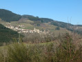
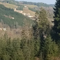
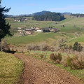
Park at Saint-Vincent-de-Reins station, by the old station building.
(S/E) Follow the D10 southwards for about 100 m. Cross this road carefully, take the path along the old railway line and continue straight on until you reach the junction with the Route du Lacheron.
(1) Cross the Route du Lacheron and continue straight on along the Chemin de la Voie Ferrée. Ignore the Patirot climb on the left, a road on the right, and the Chemin du Munal on the left.
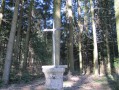
(2) About 3.5 km from the start, before the road junction and just before the buildings, turn left onto the path. Further on, leave the Munal on your left and continue straight on until the next junction (elevation 602), then turn left. At the next junction, follow the track to the right until you reach a beautiful granite cross at a crossroads (elevation 656).
(3) Take the Chemin du Souffle, which descends to the right, and continue to the hamlet of Lurcy.
(4) Turn left between the farm buildings and follow the road down to the junction with the D94E.
(5) Cross it carefully to take the Chemin du Pointu opposite, then cross the pretty stone bridge.
(6) After the bridge, turn left onto the path that climbs and continue to a fork, from where you can see Barbery opposite.
(You’ll probably hear the geese – they’ll surely spot you before you see them yourself!).
(7) Turn right and head uphill until you cross the road to Meaux.
(8) Turn left and follow the fairly steep path uphill, which becomes increasingly difficult (gully-like terrain, stones, roots) for about 1.5 km. Ignore the four successive paths on the left.
(9) At the fork, at an altitude of around 840 m, veer slightly to the left and head uphill until you join theGR® 7.
Continue to the left along this GR®.
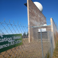
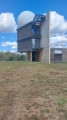
(10) Leave theGR® and head up to the right to the weather radar station to admire the magnificent view of the Alps.
(11) Head back down onto theGR®7.
(10) Turn right to continue along theGR®7straight on as far as the Croix du Sud.
(12) Leave theGR®7and follow the path on the left to Saint-Bonnet-le-Troncy, then cross the village along the main road (D9) for about a hundred metres.
(13) Take the road leading uphill to the right, cross Rue des Écoles to pass over the hamlet of l’Allier and carry on straight ahead until you reach Route du Renard, then turn left onto it for about sixty metres.
(14) Turn right, head uphill and carry on for about 1.5 km until you reach Chemin de la Craze.
(15) Then turn left towards Cambry.
(16) Cross the Route du Pont de la Côte with care, then continue along the small road that passes in front of the cross. Carry on straight ahead for about 3 km along this tarmac road. You will reach a junction you passed on the way there, at the Route du Lacheron.
(1): Turn right and follow the reverse route of the outward journey to the car park (S/E).


 Visorando Member
 Easy
Easy