From Roche Rousse to Prapic via the lakes of Orcières and Les Pisses

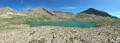
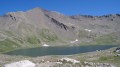
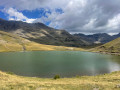
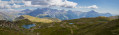
A magnificent hike taking you to discover the lakes of Orcières, Lac des Pisses and the pretty village of Prapic

Details

2322936
Creation:
Last update:
Last review:
  • Walking
    Activity: Walking
  • ↔
    Distance: 7.85 mi
  • ◔
    Average duration: 4h 30 
  • ▲
    Difficulty: Moderate

  • ⚐
    Back to start: No
  • ↗
    Ascent: + 978 ft
  • ↘
    Descent: - 3,373 ft

  • ▲
    Highest point: 8,196 ft
  • ▼
    Lowest point: 5,095 ft

Photos

Description of the walk

The hike starts at the top of the Roche Rousse Telemix. Park in the car park at the lower station. You’ll need to buy a ticket for the ascent at the ticket office (€7.20 + €2 deposit for the card, to be returned after the hike).

(S): Head up the path that branches off to the right of the Estaris chairlift. When you reach the start of the snowpark T-bar lift, ignore the path leading down to the right and follow the winding path up to Lac des Sirènes.

(1) Walk round the lake on the right-hand side. Then take the small path towards Lac Long (north). It’s steep but doesn’t last long.

(2) Walk past Lac Long and head east towards Lac Profond.

(3) Back on a wider path, turn left towards Lac Estaris and the Lacs Jumeaux.

(4) At a junction, turn right towards the Lacs Jumeaux.

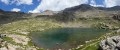
(5) Continue eastwards along the path towards Lac des Pisses. Pass under the Gnourou chairlift line and continue south-east (there is more than one path). The path then turns north-east. Enter the Écrins National Park and arrive shortly afterwards at Lac des Pisses.

(6) Then turn right (south-east) towards Prapic. The path winds downwards and enters the Drac State Forest.

(7) Continue southwards along a wide path. Ignore the side paths and head for the village of Prapic (E).

Return to Orcières:
A shuttle bus leaves from the stop opposite the information point and goes to the Orcières Tourist Office. Tickets must be purchased at the information point in Prapic (€4 per adult).
Check with the Orcières Tourist Office for the shuttle bus timetable.

The shuttle drops you off at the Orcières Merlette Tourist Office.

Waypoints

  1. S : mi 0 - alt. 7,500 ft - Top station of the - Gare arrivée Télémix Roche Rousse
  2. 1 : mi 0.74 - alt. 7,858 ft - Lac des Sirènes - Lac des Sirènes
  3. 2 : mi 1.19 - alt. 8,143 ft - Lac Long Orcières
  4. 3 : mi 1.4 - alt. 8,097 ft - Lac Profond
  5. 4 : mi 1.59 - alt. 8,179 ft - Junction
  6. 5 : mi 1.78 - alt. 8,136 ft - Lacs Jumeaux
  7. 6 : mi 3.89 - alt. 8,196 ft - Lac des Pisses
  8. 7 : mi 7.07 - alt. 5,256 ft - Access to the Poet’s Tomb
  9. E : mi 7.85 - alt. 5,102 ft - Arrêt navette Prapic

Notes

Information on the ski lifts: here

Orcières Tourist Office telephone number: 04 92 55 89 89

This route passes through a protected area, which may be subject to special regulations:

Worth a visit

(7) You can take a detour to visit the Tombeau du Poète (path on the left).

Reviews and comments

5 / 5
Based on 2 reviews

Reliability of the description
5 / 5
Ease of following the route
5 / 5
Route interest
5 / 5
Pdouble
Pdouble

Overall rating : 5 / 5

Date of your route : Jul 27, 2021
Reliability of the description : ★★★★★ Very good
Ease of following the route : ★★★★★ Very good
Route interest : ★★★★★ Very good
Very busy route : No

Hello

Actually, we did the circular route from Prapic, heading up to Lac des Pisses and then taking the balcony path. This avoids the hassle of returning to the start but makes the walk longer. It took us 7 hours 30 minutes, including breaks, at a leisurely pace.
We only visited one of the Orsière lakes at a time, partly because we were in the ski area – so it’s not as scenic – and partly because the weather was looking threatening.
We descended via the valley below Lac des Sirènes, starting from the Gnouroud chairlift and following the stream from Lac du Col. We rejoined the ascent path at point 1817 on the IGN map.

Machine-translated

FPL
FPL

Overall rating : 5 / 5

Date of your route : Aug 15, 2020
Reliability of the description : ★★★★★ Very good
Ease of following the route : ★★★★★ Very good
Route interest : ★★★★★ Very good
Very busy route : No

A magnificent and spectacular route, taking in almost all the lakes in the area. I say ‘almost’ because you’d need to add an hour (according to the sign) each way to visit the Estaris lakes, which must be lovely too.
All these lakes are charming and peaceful, with lovely colours and teeming with life. Unfortunately, there are fishermen about, which really spoils the enjoyment of the moment.
Otherwise, taking the Télémix is a real advantage, as the hike is physically demanding; if you had to add that climb (which isn’t particularly interesting), it would be even tougher. The Télémix is expensive, and don’t forget to go back to the ticket office to collect your luggage afterwards.
The scenery is absolutely sublime and ever-changing – bare high mountains (no trees) – so take care if the sun is really strong, as you don’t always feel it with the pleasant, steady breeze. The section linking the first lakes to Lac des Pisses is quite exceptional; be careful on certain sections where it’s best not to fall…
Reaching Lac des Pisses – and thus the Park – is another highlight; it’s also very beautiful, and, best of all, there are no anglers in this area. The water is cool, and the lake flows continuously downwards, creating magnificent waterfalls.
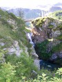
The descent to Prapic is far more challenging, with over 1,000 metres of descent, offering yet more new landscapes and superb waterfalls to discover, but it’s physically demanding – you’ll be eager to reach the pretty little village below.
As for the shuttle bus between Prapic and Merlette, there’s some very bad news: it doesn’t run every day! And yet we’re in the middle of the season. So check in advance, or even book in advance, as seats are limited.
We would have had to add an extra two-hour climb (which would have been tough after everything else), so we had to call a taxi – which was nice but really expensive.
All in all, a lovely hike; you really feel surrounded by nature. It’s a bit busy at the start around the first lakes (with loads of motorised mountain bikes), but all that clears up in the second half. So, there are people about; you might hear the marmots but you don’t see them; the animals we spotted were flocks of sheep heading up to graze at higher altitudes.
Sun, mountains, water – we’d almost have gone for a swim if it hadn’t been for the fishing lines, even though the water was a bit chilly.

Machine-translated

Other walks in the area

For more walks, use our search engine .

The GPS track and description are the property of this route's author. Please do not copy them without permission.