


Refine your search for walks in Gare arrivée Télémix Roche Rousse
Gare arrivée Télémix Roche Rousse walks


 The six lakes of Orcières-Merlette, including Les Estaris
 Visorando Member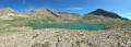
 4.13 mi
 +299 ft
 -1,447 ft
 2h 10
2h 10
 Easy
Easy
 Departure from Orcières (Hautes-Alpes)
This hike has been suitable for all ages since 2020. Using the chairlifts (Drouvet 1 and 2 for the outward journey and Roche Rousse for the return journey) makes it easy. The six large lakes are visited on the way down. A variant towards the Col de Freissinières is possible. The landscapes are magnificent, especially at the starting point at the top of Drouvet. The lakes are all very beautiful and diverse.
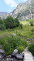
From Roche Rousse to Prapic via the lakes of Orcières and Les Pisses
 7.85 mi
+978 ft
-3,373 ft
4h 30
7.85 mi
+978 ft
-3,373 ft
4h 30
 Moderate
Departure from Orcières (Hautes-Alpes)
Moderate
Departure from Orcières (Hautes-Alpes)
A magnificent hike taking you to discover the lakes of Orcières, Lac des Pisses and the pretty village of Prapic
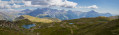
The Lakes of Orcières and Prapic
 13.89 mi
+5,108 ft
-5,102 ft
7 hrs
13.89 mi
+5,108 ft
-5,102 ft
7 hrs
 Very difficult
Departure from Orcières (Hautes-Alpes)
Very difficult
Departure from Orcières (Hautes-Alpes)
A circular walk starting from the Orcières resort to explore Prapic and the high-altitude lakes. There are plenty of options to shorten the walk if necessary.
Lac des Sirènes, starting from Prapic
 6.38 mi
+2,884 ft
-1,864 ft
5h 25
6.38 mi
+2,884 ft
-1,864 ft
5h 25
 Difficult
Departure from Orcières (Hautes-Alpes)
Difficult
Departure from Orcières (Hautes-Alpes)
A walk with almost no descent thanks to the Télémix and the car left beforehand at the Orcières Merlette resort.The Diolon Valley is beautiful and little-known. It takes you from Prapic to Lac des Sirènes. From there, it’s easy to reach Roche Rousse.This hike should only be undertaken when the Merlette resort is open in summer (July and August) so you can return via the Roche Rousse Télémix. (The descent is much shorter as it includes the ride down on the Télémix!)
Walks near Gare arrivée Télémix Roche Rousse
Fressinières Pass (Col)
 13.19 mi
+4,482 ft
-4,911 ft
10h 00
Difficult
Departure from Orcières (Hautes-Alpes)
13.19 mi
+4,482 ft
-4,911 ft
10h 00
Difficult
Departure from Orcières (Hautes-Alpes)
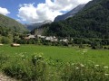
From Prapic to Dormillouse via the Fressinières Pass.
Please note: the height difference is only 1200 m.
Pré de la Chaumette Mountain Hut - Vallonpierre Mountain Hut
 6.50 mi
+3,783 ft
-2,215 ft
6h 15
Difficult
Departure from Champoléon (Hautes-Alpes)
6.50 mi
+3,783 ft
-2,215 ft
6h 15
Difficult
Departure from Champoléon (Hautes-Alpes)
The12th stage of this route features three passes to cross, the last of which is particularly technical and difficult.
The panoramic views remain as exceptional as ever, with vistas of the majestic Chaillol, the Sirac and the Champoléon valley. The refuge is set in lush greenery at the bottom of a cirque at the foot of the Sirac and on the shores of the magnificent Lac de Vallonpierre. A campsite in a beautiful meadow at the foot of the Sirac, with a splendid view of the lake.
Ravin des Serres - Vallonpierre refuge
 10.03 mi
+5,138 ft
-5,220 ft
9h 05
Difficult
Departure from L'Argentière-la-Bessée (Hautes-Alpes)
10.03 mi
+5,138 ft
-5,220 ft
9h 05
Difficult
Departure from L'Argentière-la-Bessée (Hautes-Alpes)
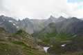
The hike begins with the ascent of the Pas de la Cavale, which rises to an altitude of 2,735 metres. After this climb, you will reach the Pré de la Chaumette refuge. From there, another climb will take you along the imposing Sirac, passing through the Vallette, Gouiran and Vallonpierre passes. The route ends at the Vallonpierre refuge.
The Col des Terres Blanches
11.81 mi
+4,259 ft
-3,822 ft
9h 10
Difficult
Departure from Freissinières (Hautes-Alpes)
From Dormillouse to Prapic via the Col des Terres Blanches.
Vallonpierre Refuge - La Chapelle-en-Valgaudemar
 8.45 mi
+112 ft
-3,999 ft
4h 00
Moderate
Departure from La Chapelle-en-Valgaudemar (Hautes-Alpes)
8.45 mi
+112 ft
-3,999 ft
4h 00
Moderate
Departure from La Chapelle-en-Valgaudemar (Hautes-Alpes)
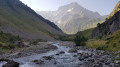
Here we are at the final stage of this 13-day route around the magnificent Écrins National Park. A downhill stage that takes you to La Chapelle-en-Valgaudemar, where this journey began 13 days earlier. A splendid start to the stage, all the way down to the glacial torrents. The panorama is breathtaking, surrounded by the most beautiful peaks of the southern part of the Écrins, already leaving us with a sense of nostalgia for the past 13 days. A route with no technical difficulty.
Vallonpierre refuge - Sebeyras lakes
 14.23 mi
+4,291 ft
-4,255 ft
10h 15
Very difficult
Departure from La Chapelle-en-Valgaudemar (Hautes-Alpes)
14.23 mi
+4,291 ft
-4,255 ft
10h 15
Very difficult
Departure from La Chapelle-en-Valgaudemar (Hautes-Alpes)
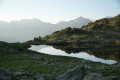
From the Vallonpierre refuge, the hike takes you to the Rif du Sap chapel, then to the charming village of La Chapelle-en-Valgaudémar, where you can stop for refreshments at a local grocery store. The route then crosses the Valgaudémar National Forest before reaching the magnificent lakes of Pétarel and Sebeyras.
Les Prés de Lauplat – Les Naizets
 6.38 mi
+2,762 ft
-3,547 ft
5h 20
Moderate
Departure from La Chapelle-en-Valgaudemar (Hautes-Alpes)
6.38 mi
+2,762 ft
-3,547 ft
5h 20
Moderate
Departure from La Chapelle-en-Valgaudemar (Hautes-Alpes)
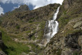
This stage takes you from the Prés de Lauplat to the Naizets bivouac, passing through the village of La Chapelle-en-Valgaudémar. The route follows the Oulles du Diable before climbing via the GR®54, passing the Combefroide Waterfall to reach a grassy plateau.
Refuge du Clot (Xavier Blanc) – Refuge du Pigeonnier
 5.88 mi
+3,963 ft
-610 ft
6h 10
Difficult
Departure from La Chapelle-en-Valgaudemar (Hautes-Alpes)
5.88 mi
+3,963 ft
-610 ft
6h 10
Difficult
Departure from La Chapelle-en-Valgaudemar (Hautes-Alpes)
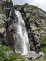
The fourth stage begins gently through the meadows, watched over by marmots, before reaching a major tourist attraction: the stunning Voile de la Mariée waterfall. Once you’ve passed Lac du Lauzon, you’ll find yourself alone again to enjoy the magnificent Lac Bleu. The Pigeonnier mountain refuge, perched on its promontory, is superb with its large bay windows.
From Rif du Sap to Navette via Le Chapeau
 7.39 mi
+4,045 ft
-4,301 ft
6h 55
Very difficult
Departure from La Chapelle-en-Valgaudemar (Hautes-Alpes)
7.39 mi
+4,045 ft
-4,301 ft
6h 55
Very difficult
Departure from La Chapelle-en-Valgaudemar (Hautes-Alpes)
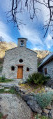
A beautiful and challenging hike in the hills, varied with some unexpected sections. Stunning views. Be careful, there are many tricky and slippery sections. Avoid in wet weather.
From Chaillol 1600 to Chantaussel
 3.05 mi
+121 ft
-1,138 ft
1h 30
Easy
Departure from Saint-Michel-de-Chaillol (Hautes-Alpes)
3.05 mi
+121 ft
-1,138 ft
1h 30
Easy
Departure from Saint-Michel-de-Chaillol (Hautes-Alpes)
A short walk, with very little uphill climb and no difficulty, starting from Chaillol 1600 to the hamlet of Chantaussel (municipality of Saint-Julien-en-Champsaur).
Round-trip walk: you’ll need at least two cars.