


From Morez to Saint-Claude: three days’ walking in the Haut-Jura


Starting from Morez, the return journey from Saint-Claude is by train on the ‘des Hirondelles’ line. The stages have been chosen based on the availability of accommodation (hotels and campsites in summer).
The first stage is fairly short and can be completed in half a day. The second stage, which ends in Lamoura, is the longest. The final stage is of moderate length in terms of both distance and duration.
Details
Creation:
Last update:
Last review:
–
–
-
 Activity: Walking
-
 Distance: 28.42 mi
-
 Average duration: 3 days
-
 Difficulty: Difficult
-
-
 Back to start: No
-
 Ascent: + 5,213 ft
-
 Descent: - 6,161 ft
-
-
 Highest point: 4,905 ft
-
 Lowest point: 1,309 ft
-
 Country:
France
-
 Areas: Jura mountains, Haut-Jura
-
 City:
Morez (39400)
-
 Start: N 46.526099° / E 6.023282°
-
 End: N 46.390043° / E 5.860628°
-


 Hour-by-hour weather


Stages of the route
This route needs several days, find the details below:
This route passes through multiple protected areas, which may be subject to special regulations:
Other walks in the area
From Morez to Les Rousses
 Visorando Member6.85 mi
+2,090 ft
-853 ft
5h 00
 Moderate
Departure from Morez (Jura)
First stage of a three-day hike in the Haut-Jura around the ‘Des Hirondelles’ railway line between Morez and Saint-Claude. This short day’s walk, starting from Morez railway station, leads to the resort of Les Rousses via a fairly steep but short climb.
Tour of the Bienne hills from Morez
 13.30 mi
+2,671 ft
-2,667 ft
8h 25
Difficult
Departure from Morez (Jura)
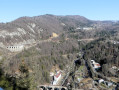
From Morez, I suggest a lovely route overlooking the Bienne Valley, mainly through woodland, with a few scenic viewpoints. The length of the route and a few steep slopes are the main challenges (see the Practical Information section).
Bienne discovery trail
 2.00 mi
+256 ft
-240 ft
1h 10
 Easy
Departure from Morez (Jura)
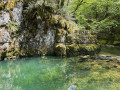
This route, starting from Morez, will take you around the banks of the Bienne and its Trou Bleu, as well as the Saillard Viaduct, crossing two Himalayan-style footbridges. Information boards are placed at various points along the route.
From Morbier to Bellefontaine via Sacré-Cœur
 11.71 mi
+1,854 ft
-1,860 ft
7h 00
Moderate
Departure from Morbier (Jura)
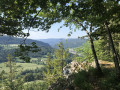
Morbier forms part of the cultural and historical region of Franche-Comté. The village is renowned for its eponymous cheese, its cross-country skiing area and its clock-making industry. Indeed, around 1660, the Mayet brothers crafted their first clocks in this village and, in the 19th century, Morbier, along with Morez, was the capital of Comtois clock-making.
The village of Morbier overlooks the Morez gorge and forms part of the Haut-Jura Regional Nature Park.
Trou Bleu or Doye Gabet
 0.52 mi
+167 ft
-194 ft
0h 25
Easy
Departure from Morbier (Jura)
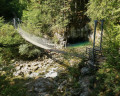
Starting from the ‘Bienne Space-Time Gate’ sculpture, discover the Trou Bleu resurgence – also known as Doye Gabet – and the Himalayan footbridge over the Bienne, set in magnificent surroundings.
Please note: the starting point is not accessible to motor vehicles on Saturdays, Sundays and public holidays.
From La Roche Devant to the Balcon des Crottes via Les Trois Commères
 6.30 mi
+1,076 ft
-1,066 ft
3h 50
Moderate
Departure from Morbier (Jura)
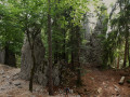
A varied route, alternating between meadows and forests, leading to La Roche Devant with its viewpoint offering a view over the Bienne valley. The route then passes the Trois Commères site – rocks resembling huge menhirs – and on to the Balcon des Crottes, withviews of the viaducts of the Ligne des Hirondelles railway line and the town of Morez.
For more walks, use our search engine .
The GPS track and description are the property of this route's author. Please do not copy them without permission.

