Country:

 City:


Start from Lamoura Church.
(S) Head towards the village centre along the Grande Rue (D25); just before the junction, turn north-east, turning right onto the Chemin du Bruchet. On leaving the village, after 200 m, take the path branching off to the left, which, after 600 m, joins the Route de Lonchaumois just before the hamlet of La Frairie.
(1) From the hamlet, continue right along the D304 for 500 m.
(2) Leave the D304 and turn left; then, after 60 metres, turn right onto Chemin de la Chaux Berthod.
(3) At the hamlet, leave the road and turn left onto the track which climbs due west through the meadows before entering the forest. The gradient levels out and the route is almost flat for the next three kilometres.
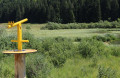
(4) Pass the access path to the Grotte de Célary on your right, or head up there for a quick visit (half an hour there and back). Carry on straight ahead along a forest track for about 2.5 km until you reach a promontory with a bench that’s perfect for a short break whilst enjoying the view.
(5) Just behind the promontory, take the path on the right, which continues to climb through the forest towards La Main Morte. After the short climb, the path winds along the hillside before descending again.
(6) At the hamlet of La Main Morte, follow the road (D304) for a few dozen metres before turning left onto the path heading south-west, which leads to the Crêt Pourri.
(7) The Crêt Pourri path, which branches off to the right, is steep, but the beautiful view from the summit is well worth the effort.
(8) Head back down via the same path you took on the way up.
(7) Continue to the right along the forest road, which descends gradually towards Saint-Claude. It becomes a wider track from Clos Sapey.
(9) From the top of Très Bayard, you can cut across the wide bend by following a path that branches off to the left and rejoins the road just before the entrance to Saint-Claude.
(10) As you enter Saint-Claude from the north-east, you’ll rejoin the tarmac road; from there, the route becomes urban. Follow Rue Christin to Place Voltaire.
(11) Take the stone bridge across the Bienne. At the roundabout, turn left onto Avenue de la Gare and follow it (E).
Head back to Morez via Tain.
 Visorando Member
 Easy