


Refine your search for walks in Morez
Morez walks


 Bienne discovery trail
 Visorando Member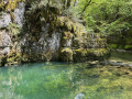
 2.00 mi
 +256 ft
 -240 ft
 1h 10
1h 10
 Easy
Easy
 Departure from Morez (Jura)
This route, starting from Morez, will take you around the banks of the Bienne and its Trou Bleu, as well as the Saillard Viaduct, crossing two Himalayan-style footbridges. Information boards are placed at various points along the route.
Tour of the Bienne hills from Morez
 13.30 mi
+2,671 ft
-2,667 ft
8h 25
13.30 mi
+2,671 ft
-2,667 ft
8h 25
 Difficult
Departure from Morez (Jura)
Difficult
Departure from Morez (Jura)
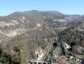
From Morez, I suggest a lovely route overlooking the Bienne Valley, mainly through woodland, with a few scenic viewpoints. The length of the route and a few steep slopes are the main challenges (see the Practical Information section).
From Morbier to Bellefontaine via Sacré-Cœur
 11.71 mi
+1,854 ft
-1,860 ft
7h 00
11.71 mi
+1,854 ft
-1,860 ft
7h 00
 Moderate
Departure from Morbier (Jura)
Moderate
Departure from Morbier (Jura)
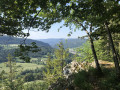
Morbier forms part of the cultural and historical region of Franche-Comté. The village is renowned for its eponymous cheese, its cross-country skiing area and its clock-making industry. Indeed, around 1660, the Mayet brothers crafted their first clocks in this village and, in the 19th century, Morbier, along with Morez, was the capital of Comtois clock-making.
The village of Morbier overlooks the Morez gorge and forms part of the Haut-Jura Regional Nature Park.
Leat of the Chaille Waterfall via the Perroud Bridge
 4.31 mi
+751 ft
-755 ft
2h 40
Easy
Departure from Prémanon (Jura)
4.31 mi
+751 ft
-755 ft
2h 40
Easy
Departure from Prémanon (Jura)
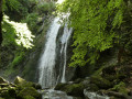
Starting from the Belvédère des Maquisards, the route takes you along a path that runs largely through the undergrowth, allowing you to discover the old Pont Perroud and the magnificent Bief de la Chaille waterfall, nestled at the bottom of the Gorges de la Chaille.
Towards Lac des Rousses
 2.94 mi
+236 ft
-213 ft
1h 35
Easy
Departure from Les Rousses (Jura)
2.94 mi
+236 ft
-213 ft
1h 35
Easy
Departure from Les Rousses (Jura)
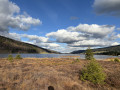
This short route allows you to discover Lac des Rousses, the only lake in Franche-Comté located in the basin that flows towards Switzerland and the Rhine. It is surrounded by peat bogs and you can discover remarkable flora and fauna
. In summer, you can swim in its clear, shallow waters, enjoy the water sports centre or contemplate the beauty of the surrounding landscapes, and in winter, watch the skaters and iceboats when the lake is frozen .
Roche Blanche on the circuit
 7.67 mi
+1,106 ft
-1,109 ft
4h 30
Moderate
Departure from Les Rousses (Jura)
7.67 mi
+1,106 ft
-1,109 ft
4h 30
Moderate
Departure from Les Rousses (Jura)
A family trail starting from Les Rousses, offering views over the peat bog on the edge of Lac des Rousses.
From Les Rousses to the Col du Marchairuz
 17.83 mi
+2,569 ft
-1,476 ft
10h 25
17.83 mi
+2,569 ft
-1,476 ft
10h 25
 Very difficult
Departure from Les Rousses (Jura)
Very difficult
Departure from Les Rousses (Jura)
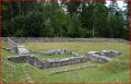
First stage: From Les Rousses to Lake Constance via the Jura ridges. After passing through La Cure, you will enter Switzerland and reach Saint-Cergue. A road will take you through the Jura pastures to the ruins of the Oujon convent. From Les Frasses, a steep forest path leads to a panoramic viewpoint. The climb continues through enchanting scenery, between flower-filled meadows and chalets, towards Crêt de la Neuve, the highest point of the stage. Here you can enjoy breathtaking views of Lake Geneva, the Vaud Alps and Mont Blanc. The hike ends in the Vaud Jura Park, along a pretty forest path leading to the Col de Marchairuz (1,446 m).
From Les Rousses to Lake Constance, following the ridges of the Jura mountains
 251.61 mi
+37,661 ft
-40,128 ft
19 days
Difficult
Departure from Les Rousses (Jura)
251.61 mi
+37,661 ft
-40,128 ft
19 days
Difficult
Departure from Les Rousses (Jura)
This exceptional hike links Les Rousses, in the heart of the French Haut-Jura, to the city of Constance (Konstanz), on the shores of the lake of the same name, following the ridges of the Swiss Jura. A demanding but magnificent 405 km route that crosses the most iconic landscapes of the Jura mountains: high-altitude pastures, deep forests, alpine viewpoints, villages steeped in history and forgotten military ruins.
La Roche Devant
 3.93 mi
+725 ft
-728 ft
2h 25
Easy
Departure from Morbier (Jura)
3.93 mi
+725 ft
-728 ft
2h 25
Easy
Departure from Morbier (Jura)
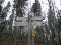
A walk through the Marais forest, taking in a vantage point, the Roche Devant, overlooking the Bellefontaine valley.
Les Rousses Circular Route
 11.36 mi
+1,926 ft
-1,923 ft
6h 55
Moderate
Departure from Les Rousses (Jura)
11.36 mi
+1,926 ft
-1,923 ft
6h 55
Moderate
Departure from Les Rousses (Jura)
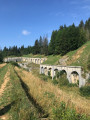
Les Rousses is a commune in the Jura department. Located in the Haut-Jura, on the border with Switzerland, it is the main commune of the Les Rousses ski resort, a major downhill skiing area comprising Les Rousses, Bois-d’Amont, Lamoura and Prémanon. The fort is open to visitors.
A lovely forest walk along pretty paths, with a short stretch along a road and a beautiful waterfall.
The Chaux Mourant woods
6.85 mi
+784 ft
-807 ft
3h 50
Moderate
Departure from Bellefontaine (Jura)
Above Bellefontaine lies the Bois de Chaux Mourant forest. From the Roche Devant viewpoint, you can see the Risoux massif.
Bellefontaine Lake
 6.30 mi
+384 ft
-410 ft
3h 15
Moderate
Departure from Bellefontaine (Jura)
6.30 mi
+384 ft
-410 ft
3h 15
Moderate
Departure from Bellefontaine (Jura)
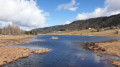
The shores of Lake Bellefontaine with a possible detour to the La Roche Bernard viewpoint (2 km round trip) to continue along the shores of Lake Mortes followed by the stream, village and forest of the same name.
Roche Bernard and Roche Champion from Bellefontaine
 11.59 mi
+2,136 ft
-2,146 ft
7h 10
Moderate
Departure from Bellefontaine (Jura)
11.59 mi
+2,136 ft
-2,146 ft
7h 10
Moderate
Departure from Bellefontaine (Jura)
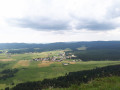
From Bellefontaine, located at an altitude of 1,000 metres in the heart of the Haut-Jura Regional Nature Park, straddling France and Switzerland in the Risoux Massif, you will discover exceptional panoramic views from La Roche Bernard (1,290 metres) and La Roche Champion, over the Val de Mouthe, the lake plateau and the Mont Noir forest. The route climbs 300 metres and requires a good level of fitness.
Bellefontaine – Prémanon
 12.49 mi
+1,982 ft
-1,778 ft
7h 30
Moderate
Departure from Bellefontaine (Jura)
12.49 mi
+1,982 ft
-1,778 ft
7h 30
Moderate
Departure from Bellefontaine (Jura)
Fourteenth stage of the Échappée Jurassienne. For this stage, you will begin your adventure in Bellefontaine, a picturesque village nestled in the heart of the Jura. The hike will take you through the heights of the town of Morez and across the Bienne Valley, where you can admire spectacular views of the surrounding mountains. Along the way, you will reach Les Rousses, a welcoming town with authentic charm. Don't miss a visit to the Fort des Rousses, an impressive historical site that also houses the Comté cheese cellars, where you can discover how this renowned local cheese is made. From there, you will continue your descent to the Bief de la Chaille, a peaceful and enchanting place. The hike ends at the La Grenotte lodge in Prémanon, an ideal place to rest and enjoy the surrounding serenity.
Mont Sâla via Le Noirmont and Creux du Croue
 11.02 mi
+2,192 ft
-2,169 ft
7h 00
Moderate
Departure from Saint-Cergue (Vaud)
11.02 mi
+2,192 ft
-2,169 ft
7h 00
Moderate
Departure from Saint-Cergue (Vaud)
This circular route, entirely within Switzerland, takes you through the beautiful Jura valleys near the resort of Les Rousses. After climbing up to Le Noirmont, you’ll reach Mont Sâla via the Creux du Croue. If the weather is clear, there are magnificent views of Lake Geneva and the Alps.
The route is not particularly difficult, but the climb up to Le Noirmont is quite steep and quite long. This round trip, with the descent via the same route, is in fact a lovely hike in its own right (allow for an elevation gain of around 500 metres).