From Morez to Les Rousses

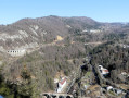
First stage of a three-day hike in the Haut-Jura around the ‘Des Hirondelles’ railway line between Morez and Saint-Claude. This short day’s walk, starting from Morez railway station, leads to the resort of Les Rousses via a fairly steep but short climb.

Details

n°109158791
Creation:
Last update:
Last review:
–
  • Walking
    Activity: Walking
  • ↔
    Distance: 6.85 mi
  • ◔
    Average duration: 5h 00 
  • ▲
    Difficulty: Moderate

  • ⚐
    Back to start: No
  • ↗
    Ascent: + 2,090 ft
  • ↘
    Descent: - 853 ft

  • ▲
    Highest point: 4,236 ft
  • ▼
    Lowest point: 2,303 ft

Description of the walk

Departure from Morez railway station, accessible via the Ligne des Hirondelles, which runs directly from Dole or can be reached from Besançon with a change at Andelot.

(S) To avoid a tedious walk along the N5 and to stock up on supplies if necessary, head down from the station towards the town centre.

(1) Cross the Bienne to pass near the museum, then go round the cemetery.

(2) Cross the river again at the secondary school and head north-east to take the pedestrian underpass beneath the N5.

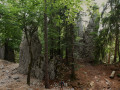
(3) Once you’ve crossed the road, a fairly steep climb begins, leading you beneath the Roche Brûlée.

(4) At the crossroads, turn right, heading due south, and continue the climb towards Fond de Trélarce, where the gradient eases and the wider path becomes a road from Paget Farm onwards.

(5) Before reaching the hamlet of Trélarce, take the second road on the left, which climbs for about 1.5 km.

(6) At the flat stretch, let the road continue to the left and carry on along the path which heads due east and continues, heading south, uphill to the Gros Crétet.

(7) Follow the Route du Gros Crétet for 600 m.

(8) Leave it by taking the first track on the right, towards La Loge à Ponard (south-west). Pass a lodge and carry on south-west until you rejoin the road just before reaching Les Rousses.

(9) Turn left onto this road, which leads to the lower part of Les Rousses, and from there, head towards the town centre: it’s a bit of a climb! You’ll arrive at the church in Les Rousses and reach your accommodation (E).

Waypoints

  1. S : mi 0 - alt. 2,408 ft - Morez railway station - Gare de Morez
  2. 1 : mi 0.4 - alt. 2,303 ft - Crossing the - Bienne (rivière)
  3. 2 : mi 0.83 - alt. 2,316 ft - Crossing the - Bienne (rivière)
  4. 3 : mi 1.02 - alt. 2,448 ft - Passing under the N5 - Bienne (rivière)
  5. 4 : mi 1.32 - alt. 2,818 ft - Beneath the Roche Brûlée - Belvédère de la Roche Brulée
  6. 5 : mi 2.41 - alt. 3,422 ft - Junction before Trélarce
  7. 6 : mi 3.51 - alt. 3,839 ft - Junction at the plateau
  8. 7 : mi 4.41 - alt. 4,232 ft - Gros Crétet
  9. 8 : mi 4.88 - alt. 4,091 ft - Junction on the path
  10. 9 : mi 6.13 - alt. 3,540 ft - Road at the entrance to Les Rousses - Fort des Rousses
  11. E : mi 6.85 - alt. 3,642 ft - Les Rousses Church

Notes

Food shops in Morez.

There are plenty of accommodation options in the resort of Les Rousses.

This route passes through multiple protected areas, which may be subject to special regulations:

Worth a visit

Starting point: the Eyeglass Museum in Morez.

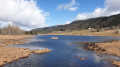
On arrival, a short detour to Lac des Rousses (around 5 km there and back) is well worth it.

A visit to Fort des Rousses can be done the following day at the start of the second stage

Other walks in the area

For more walks, use our search engine .

The GPS track and description are the property of this route's author. Please do not copy them without permission.