


Refine your search for walks in Gare de Champigny-sur-Yonne
Gare de Champigny-sur-Yonne walks


 A family walk along the River Yonne from Cannes-Écluses
 Visorando Member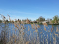
 20.29 mi
 +36 ft
 -39 ft
 4 hrs
4 hrs
 Moderate
 Departure from Cannes-Écluse (Seine-et-Marne)
Circular mountain bike route along the banks of the Yonne, starting from Cannes-Écluses.Ideal for families as it runs alongside the river, is flat and features numerous picnic tables and benches along the route.The route alternates between tarmac roads (a minority), gravel roads and dirt tracks.
Walks near Gare de Champigny-sur-Yonne
 Pont-sur-Yonne – Sens
 Association / Club / Walk leader
 10.16 mi
+1,020 ft
-991 ft
5h 35
Moderate
Departure from Pont-sur-Yonne (Yonne)
10.16 mi
+1,020 ft
-991 ft
5h 35
Moderate
Departure from Pont-sur-Yonne (Yonne)
This is the second section of the Via Burgundia® route, which runs from Montereau-Fault-Yonne to Mâcon.
This walk offers a varied route with beautiful views over the Yonne valley. It invites us to discover Sens, which boasts a remarkable heritage and a rich history that is well worth exploring.
From Montereau to Vernou-sur-Seine via the towpath and the plateau
 8.52 mi
+249 ft
-207 ft
4h 10
Moderate
Departure from Montereau-Fault-Yonne (Seine-et-Marne)
8.52 mi
+249 ft
-207 ft
4h 10
Moderate
Departure from Montereau-Fault-Yonne (Seine-et-Marne)
A three-stage walk from station to station. First, you cross the town of Montereau, the highlight being the Gothic collegiate church and the double bridge at the confluence of the Seine and the Yonne. Next, you follow the towpath, which is mostly shaded. Finally, you climb to a higher elevation before descending to Vernou-sur-Seine station.
(Please note) Just before (9), the underpass beneath the railway line is closed (see the comment posted on 21 July 2026). Until this obstruction is cleared, one option is to turn right to find a level crossing. Once you have crossed the tracks safely, follow the D39 to the left until you reach point (9).
From Montereau-Fault-Yonne to Pont-sur-Yonne
 18.24 mi
+62 ft
-16 ft
10 hrs
18.24 mi
+62 ft
-16 ft
10 hrs
 Very difficult
Departure from Montereau-Fault-Yonne (Seine-et-Marne)
Very difficult
Departure from Montereau-Fault-Yonne (Seine-et-Marne)
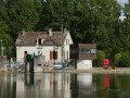
This is the first stage of the Via Burgundia®, which takes you across the whole of Burgundy from Montereau-Fault-Yonne to Mâcon, south of Saône-et-Loire. This major route, covering almost 500 km, is divided into three sections: the Yonne section, the Morvan section and, finally, the Southern Burgundy section.
This first section follows the course of the River Yonne from its confluence with the River Seine to Pont-sur-Yonne. It involves very little elevation gain but remains a fairly long stage if you cover it in a single day. The route winds its way along the River Yonne, past fields of cereals and ponds (or ‘noues’), particularly after Bichain.
Along the River Yonne from Montereau-Fault-Yonne
11.58 mi
+43 ft
-23 ft
5h 20
Moderate
Departure from Montereau-Fault-Yonne (Seine-et-Marne)
A walking route from station to station, starting at Montereau Fault-Yonne station and ending at Villeneuve-la-Guyard along the River Yonne, allowing you to explore the ponds and marshes near the finish. A peaceful, quiet walk along the water’s edge, passing through the village of Misy-sur-Yonne, which is known for its historic site.
From Montereau-Fault-Yonne to Moret-sur-Loing, from one confluence to another.
 15.76 mi
+492 ft
-456 ft
7h 40
15.76 mi
+492 ft
-456 ft
7h 40
 Difficult
Departure from Montereau-Fault-Yonne (Seine-et-Marne)
Difficult
Departure from Montereau-Fault-Yonne (Seine-et-Marne)
This is the twenty-fifth stage of the Grand Tour of Île-de-France via the GR®11, starting from Montereau station, not far from the confluence of the Seine and the Yonne, and ending at Moret-Veneux-les-Sablons station, not far from the confluence of the Seine and the Loing. The stage, entirely on the GR®11, follows a route on the left bank of the Seine, joining the Orvanne valley a little further south, and returns to Moret-sur-Loing and its beautiful historic centre, following the Canal du Loing on its towpath.
From Donnemarie-Dontilly to Montereau-Fault-Yonne in Bassée-Montois
 16.56 mi
+669 ft
-850 ft
8h 10
Difficult
Departure from Donnemarie-Dontilly (Seine-et-Marne)
16.56 mi
+669 ft
-850 ft
8h 10
Difficult
Departure from Donnemarie-Dontilly (Seine-et-Marne)
Twenty-fourth stage of the Grand Tour of Île-de-France via the GR®11, starting from Donnemarie-Dontilly after spending the night there at the end ofthe previous stage. This stage connects the Montois region to the Seine Valley and Montereau-Fault-Yonne, the confluence of the Seine and Yonne rivers. It thus transitions from an agricultural landscape to a marshland landscape in the valley, ending in a more urban environment.