De Maurens à Vaux en deux boucles

A lovely walk in the Lauragais region that will take you to the traditional village of Le Vaux (locals pronounce the ‘X’). This route is described in the walking guides published by the Lauragais Revel et Sorèzois Community of Communes under the name ‘Chemin de l’âne’; signs bearing this name supplement the general yellow markings in places.
Park in the square in front of the town hall.

Details

21372981
Creation:
Last update:
Last review:
  • Walking
    Activity: Walking
  • ↔
    Distance: 9.27 mi
  • ◔
    Average duration: 4h 50 
  • ▲
    Difficulty: Moderate

  • ⚐
    Back to start: Yes
  • ↗
    Ascent: + 620 ft
  • ↘
    Descent: - 630 ft

  • ▲
    Highest point: 958 ft
  • ▼
    Lowest point: 728 ft

Photos

Description of the walk

(S/E) Opposite the town hall, turn right onto Rue de l’École and, at the first junction, turn left onto Chemin des Puits.
(1) At the next junction, turn right onto the tarmac track, which quickly turns into a grassy path.
(2) After passing Le Barbut farm (the second farm on the left along this track), take the track on the right towards En Bonnet. You’ll come to a small tarmac road. Continue along this road. At the first junction, turn left until you reach the junction for the first circular route.

(3) In a left-hand bend in the road, after passing a farm on the left, leave the return path on your right and continue along the tarmac road for about 300 m.

(4) Just before the first right-hand bend in the road, turn left onto the farm track until you reach the D622.
Cross it carefully and continue straight ahead to reach the junction of the second circular route.

(5) Turn right, go downhill, then uphill again, ignoring the path on the left. Continue to a small road (D72). Follow it to the right for about 400 m.

(6) Before the bridge, turn left onto the path that runs alongside the Grasse. When you reach a small road, carry on straight ahead to the junction just past the power lines.

(7) Turn right onto the D18 to follow the stream. Then take the road on the left which climbs towards La Labouriette. At the hairpin bend, carry on straight ahead along the path which climbs and then descends. At the bottom, take the path on the left leading to the Le Vaux pleasure lake.

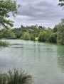
(8) Walk along the right-hand side of the pond. Go round the far end until you come to a path on the opposite bank which climbs to the right onto the road.
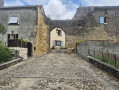
Take the road to the left. At the crossroads, turn right towards the church. When you reach the church, take Rue du Mur de Ronde on the left and walk past the castle. After the castle, turn left onto the road that leads back down towards the D72. Turn right onto the D72 and continue straight on for about 200 m.

(9) At the start of a wide bend, turn onto the dirt track on the right.

(10) At the cross, turn left, pass under the high-voltage power line and return to the junction you passed on the way out.

(5) Turn right, heading in the opposite direction to the outward journey, until you reach the junction of the first circular route.

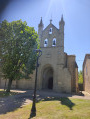
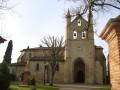
(3) This time, carry on straight ahead along the dirt track. This will take you to the church at Maurens; continue on to the D18A.

(11) Turn right onto the D18A to return to the starting point (S/E).

Waypoints

  1. S/E : mi 0 - alt. 856 ft - Maurens Town Hall
  2. 1 : mi 0.15 - alt. 817 ft - La Bourdette
  3. 2 : mi 0.95 - alt. 883 ft - Towards En-Bonnet
  4. 3 : mi 1.73 - alt. 797 ft - Junction on the first circular loop
  5. 4 : mi 1.86 - alt. 791 ft - Junction for the out-and-back route. Wheel/farm track
  6. 5 : mi 2.92 - alt. 850 ft - Junction for the second circular loop
  7. 6 : mi 3.53 - alt. 732 ft - Bridge - Grasse (rivière) - Affluent du Marès
  8. 7 : mi 4.1 - alt. 758 ft - D18. Power line
  9. 8 : mi 5.18 - alt. 810 ft - Recreational lake - Étang de Vaux
  10. 9 : mi 6.37 - alt. 909 ft - Dirt track
  11. 10 : mi 6.75 - alt. 876 ft - The cross
  12. 11 : mi 9.14 - alt. 794 ft - Maurens Church
  13. S/E : mi 9.27 - alt. 856 ft - Maurens Town Hall

Notes

Ce circuit comporte peu des passages ombragés
Par temps chaud prendre un chapeau et de l'eau en quantité suffisante.

Worth a visit

Take a little time to visit the magnificent village of Le Vaux.
The shores of Le Vaux’s six-hectare recreational lake offer a very pleasant picnic area.
Maurens
Le Vaux

Reviews and comments

4.7 / 5
Based on 13 reviews

Reliability of the description
4.9 / 5
Ease of following the route
4.9 / 5
Route interest
4.3 / 5
Frala
Frala

Overall rating : 4.5 / 5

Date of your route : Oct 29, 2025
Reliability of the description : Not used / Not applicable
Ease of following the route : ★★★★★ Very good
Route interest : ★★★★☆ Good
Very busy route : No

This circular figure-eight loop is a pleasant surprise: beautiful wide grassy paths, pretty rolling hills alternating between grain fields and small deciduous woods, reflecting the importance of the Lauragais region as the breadbasket of Toulouse. The lake and village of Le Vaux are also very charming (don't hesitate to enter the village through the west gate and Rue du Château!).
However, as mentioned in several comments, this hike is not recommended on hot days as there is no shade.
Thank you for the route!

Machine-translated

Garricou
Garricou
• Edited:

Overall rating : 4.7 / 5

Date of your route : May 18, 2025
Reliability of the description : ★★★★★ Very good
Ease of following the route : ★★★★★ Very good
Route interest : ★★★★☆ Good
Very busy route : No

A lovely walk in the countryside without a lot of ascent. The lake is perfect for a picnic!
Not much shade on the way!

Machine-translated

Marc Despierres
Marc Despierres

Overall rating : 4.7 / 5

Date of your route : Nov 30, 2024
Reliability of the description : ★★★★★ Very good
Ease of following the route : ★★★★★ Very good
Route interest : ★★★★☆ Good
Very busy route : No

A pleasant walk, mainly along paths that can get a bit muddy in autumn due to farm machinery passing through. The lakeside, the village of Vaux and the church at Maurens are all well worth a visit.
The walk took 3 hours and 15 minutes at a brisk pace to warm up on a sunny but windy afternoon in late November.

Machine-translated

Nadette183
Nadette183

Overall rating : 4.3 / 5

Date of your route : Jun 24, 2024
Reliability of the description : ★★★★★ Very good
Ease of following the route : ★★★★☆ Good
Route interest : ★★★★☆ Good
Very busy route : No

A very pleasant walk, best avoided after heavy rain. The lovely village of LeVaux 31. A picnic by the lake – a lovely day, much enjoyed by our group of walkers.

Machine-translated

Pat81
Pat81

Overall rating : 4.7 / 5

Date of your route : May 26, 2024
Reliability of the description : ★★★★★ Very good
Ease of following the route : ★★★★★ Very good
Route interest : ★★★★☆ Good
Very busy route : No

There are few tarmac roads; it’s mainly quiet paths lined with tall grass. The old stone buildings of the castle and the village of Vaux are lovely, and the lake below is well worth a visit – an ideal spot for a break and a bite to eat. A lovely walk to do when the weather isn’t too sunny (there’s little or no shade).

Machine-translated

Shrando31410
Shrando31410

Overall rating : 5 / 5

Date of your route : Apr 19, 2024
Reliability of the description : ★★★★★ Very good
Ease of following the route : ★★★★★ Very good
Route interest : ★★★★★ Very good
Very busy route : No

Few tarmac roads, with no motor traffic. The paths are grassy in April, giving the walk a sense of solitude and an off-the-beaten-track feel. Really lovely. Light winds and sunshine make for a pleasant walk. Best avoided during hot weather as there’s little shade. A visit to the high street and the walk past and behind Le Vaux Castle (which is falling into ruin) are a bonus. Easy to follow if you stick closely to the route description. A lovely walk in the Lauragais region, well worth doing.

Machine-translated

iSenior
iSenior

Overall rating : 4.7 / 5

Date of your route : Apr 13, 2024
Reliability of the description : ★★★★★ Very good
Ease of following the route : ★★★★★ Very good
Route interest : ★★★★☆ Good
Very busy route : No

This is a pleasant walk through the rolling countryside of the Lauragais, along farm tracks running alongside fields, interspersed with short stretches of tarmac road. This signposted route (the ‘Chemin de l’Âne’ and ‘Val de Saune’ trail) offers beautiful views of the Ariège Pyrenees to the south.
There is little shade along the route, but there are picnic tables by the lake and next to the church in Vaux.

Machine-translated

Jeaclamer
Jeaclamer

Overall rating : 4.7 / 5

Date of your route : Jan 08, 2024
Reliability of the description : ★★★★★ Very good
Ease of following the route : ★★★★★ Very good
Route interest : ★★★★☆ Good
Very busy route : No

A lovely walk – the little lake at Vaux is the perfect spot for a picnic.

Machine-translated

Viveliane
Viveliane

Overall rating : 4.3 / 5

Date of your route : Jan 08, 2024
Reliability of the description : ★★★★☆ Good
Ease of following the route : ★★★★☆ Good
Route interest : ★★★★★ Very good
Very busy route : No

A lovely walk through the countryside with few roads (and those that are there are very quiet). There are sections with lovely views of the Pyrenees. It’s beautifully undulating… in short, the Lauragais at its most charming

Machine-translated

Jeaclamer
Jeaclamer

Overall rating : 4.7 / 5

Date of your route : Nov 20, 2023
Reliability of the description : ★★★★★ Very good
Ease of following the route : ★★★★★ Very good
Route interest : ★★★★☆ Good
Very busy route : No

A pleasant route, with a lovely spot for a snack by Lake Vaux. The elevation gain is reasonable.

Machine-translated

sequoia1
sequoia1

Overall rating : 5 / 5

Date of your route : Apr 04, 2023
Reliability of the description : ★★★★★ Very good
Ease of following the route : ★★★★★ Very good
Route interest : ★★★★★ Very good
Very busy route : No

A lovely walk. The road you have to cross and the high-voltage pylons remind us that civilisation isn’t far away. The village of Vaux, with its castle and mills, is well worth a look. As is the church in Maurens at the end of the walk. Otherwise, it’s just the countryside, with fields of rapeseed beginning to flower.
You might come across a few people at Lake Vaux. There’s a picnic table and benches in Vaux.

Machine-translated

VincentLafon
VincentLafon
• Edited:

Overall rating : 5 / 5

Date of your route : Mar 20, 2023
Reliability of the description : ★★★★★ Very good
Ease of following the route : ★★★★★ Very good
Route interest : ★★★★★ Very good
Very busy route : No

A really lovely and interesting walk, at least for those who love the countryside, footpaths and solitude (we only came across one car with a single occupant during our 4 hours and 15 minutes’ walk). Facing a steady wind of up to 40 km/h with gusts of 55 km/h, the outward journey was gruelling; the return, with our hoods pulled up like raincoats, was easier. Well done to the route planner and to Aeolus!

Machine-translated

Other walks in the area

For more walks, use our search engine .

The GPS track and description are the property of this route's author. Please do not copy them without permission.