From Goas Lagorn beach to the Lann ar Waremm woods

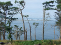
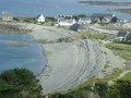
Fine sandy beaches, separated by rocky granite headlands, await you both at the start and end of this walk, which will give you the chance to cross the Lann ar Waremm woods and admire the little chapel of Saint-Dourien.

Details

182687
Creation:
Last update:
Last review:
  • Walking
    Activity: Walking
  • ↔
    Distance: 7.03 mi
  • ◔
    Average duration: 3h 35 
  • ▲
    Difficulty: Moderate

  • ⚐
    Back to start: Yes
  • ↗
    Ascent: + 430 ft
  • ↘
    Descent: - 436 ft

  • ▲
    Highest point: 341 ft
  • ▼
    Lowest point: 26 ft
  • ⚐ Country: France
  • ⚐ City: Lannion (22300)
  • ⚑
    Start/End: N 48.744496° / W 3.548812°
  • ❏
    IGN map(s): Ref. 0615ET, 0714OT
  • Hour-by-hour weather

Description of the walk

Park in the large car park at Goas Lagorn Beach (marked as Gwell-a-Gorn on the IGN map).

(S) At the end of the car park (hairpin bend), take the Customs Officers’ Path due north. Cross a stream and head uphill opposite.

(1) Leave the customs officers’ path by taking a steep path on the right (do not take the Chemin de Porz Mabo signposted on the left). Once you reach Crec’h Meur, the path becomes a track suitable for vehicles, which you should follow.

(2) Take the path on the right towards the Chapel of Saint-Dourien and continue along the same path to the hamlet of Crec’h Rivoalan. At the end of the path, turn left and then left again after 70 metres. You’ll come to a road; take this to the right for about 50 metres.

(3) At the hamlet of Goaquer, turn left onto a track. This track leads to a small road; take this to the right to reach the D65.

(4) Cross the D65 to take the track almost directly off the road (first turn right then left). This is the Chemin de Parc ar Stang, which leads to the hamlet of Poull ar Bélec.

(5) Turn left onto the Chemin de Lann ar Waremm and follow it for 200 metres. Then turn right (east). At the next Fork in the road, take the forest track on the left until you reach the hamlet of Pont an Duc.

(6) Turn left onto another forest track to cross the Bois de Lann ar Waremm and then the hamlet of the same name.

(7) Take the path on the left, which continues as Impasse Gwarenn ar Choat. This leads onto the D65.

(8) Cross the departmental road, following it for 50 metres to the right, then take the first track on the left. Ignore a turn-off on the left and continue to a crossroads.

(9) Take the road on the left.

(10) At the left-hand bend, carry on straight ahead along the track. On the track suitable for vehicles, turn right. Pass through the hamlets of Kernévez and Cabouton.

(11) Take the Chemin du Can by turning left and keep to the left-hand side to join the customs officers’ path. Pass the campsite and the access to Porz Mabo beach on your right and head south-east along the customs officers’ path.

(1) At the junction you passed on the way there, continue south towards the beach and head back up to the car park (E).

Waypoints

  1. S/E : mi 0 - alt. 72 ft - Goas Lagorn beach car park
  2. 1 : mi 0.26 - alt. 95 ft - Take the path on the right
  3. 2 : mi 0.76 - alt. 177 ft - Path on the right towards St Dourien
  4. 3 : mi 1.3 - alt. 256 ft - Goaquer
  5. 4 : mi 1.67 - alt. 325 ft - On the D65, turn right, then take the path on the left
  6. 5 : mi 2.13 - alt. 328 ft - Poull ar Bélec
  7. 6 : mi 2.89 - alt. 335 ft - At “Pont an Duc”, take the path on the left
  8. 7 : mi 3.7 - alt. 328 ft - After “Lann an Waremm”, take the path on the left
  9. 8 : mi 4.33 - alt. 312 ft - On the D65, turn right, then take the path on the left
  10. 9 : mi 4.62 - alt. 299 ft - At the crossroads, turn left
  11. 10 : mi 4.96 - alt. 308 ft - At the left-hand bend, go straight on along the path
  12. 11 : mi 5.39 - alt. 243 ft - After “Cabouton”, turn left onto the “Chemin du Can”
  13. S/E : mi 7.03 - alt. 72 ft - Goas Lagorn beach car park

Worth a visit

After (2) the Chapel of Saint-Dourien.

Reviews and comments

3.5 / 5
Based on 4 reviews

Reliability of the description
3.8 / 5
Ease of following the route
3.5 / 5
Route interest
3.3 / 5
papy29
papy29

Overall rating : 3.7 / 5

Date of your route : Sep 13, 2022
Reliability of the description : ★★★★☆ Good
Ease of following the route : ★★★★☆ Good
Route interest : ★★★☆☆ Average
Very busy route : No

Hello
I use the hiking routes mainly for the GR trails and very rarely for the other paths.

Machine-translated

gwen.cc
gwen.cc

Overall rating : 4 / 5

Date of your route : Aug 08, 2022
Reliability of the description : ★★★★☆ Good
Ease of following the route : ★★★★☆ Good
Route interest : ★★★★☆ Good
Very busy route : No

The start of the route, along the coastal path and then through the sunken lanes (which provide welcome shade in the height of summer), is rather pleasant. Similarly, the final stretch between Pors Mabo and Beg Leguer offers magnificent views.
Perhaps a shorter route, avoiding the section along the road, would be more enjoyable and retain the most interesting aspects of the walk?

Machine-translated

harmonobe
harmonobe
• Edited:

Overall rating : 2 / 5

Date of your route : Jul 09, 2018
Reliability of the description : ★★★☆☆ Average
Ease of following the route : ★☆☆☆☆ Very disappointing
Route interest : ★★☆☆☆ Disappointing

a lot of difficulty finding one’s way, with roads that no longer exist or poorly signposted routes
of little interest apart from the section along the coast, but it ends on the road leading to the next path

Machine-translated

robertsylvie
robertsylvie

Overall rating : 4.3 / 5

Date of your route : Oct 15, 2016
Reliability of the description : ★★★★☆ Good
Ease of following the route : ★★★★★ Very good
Route interest : ★★★★☆ Good

A lovely route, completed within the specified time, with well-placed signposts. A highly recommended walk for a very pleasant stroll.

Machine-translated

Other walks in the area

For more walks, use our search engine .

The GPS track and description are the property of this route's author. Please do not copy them without permission.