Country:
 City:
City:


(S/E) From the Roskoualc'h car park, follow the coastal road towards Notigou Beach. When this road moves away from the coast, turn left at the first dead end (Hent Dall an Aotigou). At the end of the cul-de-sac, a very narrow path leads between the properties. Once past these, it follows the coastline until it reaches the Domaine Départemental du Dourven, then the point of the same name.
(1) Go around the point with your back to the open sea. The Léguer estuary that opens up before your eyes is blocked at the end by the Yaudet promontory (an ancient Gallo-Roman site). Follow the coastal path under the tall trees until you reach Saint-Quiriou Beach. Once past the cove, the path climbs alongside a large property.
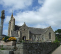
(2) When you reach the entrance gate, leave theGR®® 34 trail on your left and go up the driveway on your right. About a hundred metres further on, leave this road and take a small path on the right which leads to a small street serving a few properties. Follow it slightly to the left, then turn right at the first crossroads. After two hundred metres of a winding downhill street, you will reach the main street of the village of Locquémeau. Turn right again and follow this road along the long curve that leads to the church.
(3) Go around the church and its cemetery, then go straight on along the steeply sloping street that descends to the Keravilin stream. When you reach it, you will see the old mill building that gave its name to the place. Go back up the opposite slope, following Rue Hent Keravilin until you reach the road that descends to Hent Braz Newez harbour.
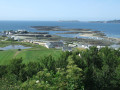
(4) Follow this road for 100 metres, descending to the right, then cross over and turn left onto Route de Kerham. This road quickly begins to climb the hillside, and it is a challenging climb that will take you to the plateau, where you can enjoy views across the whole of Lannion Bay. It is magnificent!
(5) When you reach the first houses in the hamlet of Kerham Izellan, turn right. When you reach the houses right on the edge of the cliff, ignore the path that goes up the slope and turn left. After about a hundred metres, the small road gives way to a narrow path that runs along the top of the steep slope overlooking the foreshore for a good fifty metres. That's the end of the tarmac for a while.
(6) After walking along the top of the cliff for more than six hundred metres, turn right onto the steep path that descends towards the sea. In wet weather, it can be slippery!
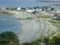
Turn right when you reach the bottom and follow the coastal path until you reach the Étang du Vorlenn. This is nestled between two pebble banks, the western one being particularly impressive.
(7) In front of the lagoon, continue along the track that heads right towards the sailing centre and the access road to Pointe de Séhar. Turn right and follow the road that runs along the sea. If the tide allows, go down to the beach to reach the car park at the other end. Please note that if the Coat Trédrez stream is full, you will need to jump from stone to stone to cross it and reach the car park.
If you are not going via the beach, follow the Route du Port and turn left onto the Route de la Corniche de Notigou when you reach it. The car park is a few hundred metres away (S/E).



 Visorando Member

 Moderate