Country:
 City:
City:


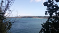
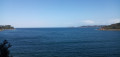
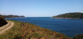
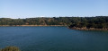
Start from the Dourven car park, north of the village of Locquémeau (follow the signs for ‘Domaine de Dourven’).
Signposts are located at intervals along the route.
Red and white markings
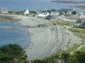
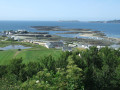
(S/E) Head back towards the car park entrance and, just before reaching it, turn right onto the GR®34 diversion. Follow a zigzagging path down through the ferns (beautiful views of Locquémeau Harbour and Pointe de Séhar).
(1) Come out onto the coastal path and follow it to the left. Cross a footbridge and then pass a chicane. Continue straight on along a track, then onto tarmac, and climb slightly.
No signposting
(2) At the Stop sign, turn left and walk up a street on the left-hand pavement (although it is narrow). Ignore all turn-offs on the right. At the junction, turn left towards Christ and immediately ignore two turn-offs on the left.
(3) Take the next left, Hent Kirio (lovely houses). At the T-junction, turn left, pass a small car park and head slightly downhill. At a Fork in the road, leave a white house on your left and take a shaded path on the right.
(4) At the T-junction, follow a stony track to the right and head uphill. Ignore a turning on the right towards Locquémeau and pass through a housing estate. At the ‘give way’ sign, turn right. After about a hundred metres, take the first left. Pass Hent Park Kreiz on the left, continue straight on and enter the hamlet of Rosmeur.
(5) Take the next left, towards Milin Awel. The tarmac quickly gives way to a track. You’ll come out onto Route de Christ (with a mast opposite) and turn right twice to join another track. Take a series of sharp bends: right, left, right. First turn right then left. About 150 m after the last bend, look out for the entrance to a field on the right, in the middle of which stands the Lianvert Menhir.
(6) If the field is fallow (as of August 2026), you can cross it to reach the foot of this fine menhir. If the field is under cultivation, simply admire it from a distance.
(6) Continue along the path, passing a farmhouse on your right. You’ll come out onto a road you left earlier; follow it to the left and downhill. Cross a stream and head uphill on the other side. Pass through the hamlet of Kerdépot (manor house on the right, fountain on the left).
(7) Then turn left onto the small road and leave the hamlet. Climb slightly and ignore all the side paths. At a T-junction, turn left towards Coat Trédez. Ignore a path on the right, then one on the left, and you’ll soon reach a Fork in the road at the entrance to the grounds of Coat Trédez Castle.
(8) There are two options here:
- For those who wish to do so , and only between 10.00 and 20.00 (see the instructions on the sign), take the path on the left. Walk past the foot of Coat Trédez Castle, then exit the grounds by going through a gate (option not tried by the author). You will then rejoin the main route at the junction that appears immediately afterwards (9).
- Alternatively, as shown on the map, take the path on the right. Walk alongside a wood on your left (a clearing offers a glimpse of the château) and you’ll come to a junction.
(9) Continue along a path heading east (to the left if coming from the castle, straight ahead otherwise) and pass a fine wayside cross on the left (the IGN map places this cross to the right of the path, but it is actually on the left). Descend slightly along a sunken path, cross a stream, then climb gently along a path through a sparse woodland.
(10) At the next junction, continue straight on along a path between two hedges. At the end, pass a chicane formed by two large boulders, continue along a small road and leave the Ploumilliau recycling centre on your right. Ignore a path coming from the right and you’ll reach a crossroads.
(11) Cross the road at right angles and continue straight ahead towards Ploulec’h. At the junction that appears shortly afterwards (witha wayside cross on the right-hand side), go straight on and head gently downhill. At the ‘give way’ sign, turn left towards Place Martin (which may also be spelt Plas Martin). Ignore the turn-off to this hamlet on the left and you’ll immediately reach another junction.
(12) Then turn left. After a house on the left, the tarmac gives way to a track. Further on, ignore a turn-off to the right (not shown on the map) and turn left onto the main track. As you approach Kerven Farm, pass under a piece of string stretched across the track (this is a cattle guide; the land registry indicates that the track is public). Shortly afterwards, pass under a second cattle guide and you’ll immediately come to a small road.
(13) Follow the road to the right and pass by the foot of Keranwern Castle. About 200 metres past the castle and before a riding centre, look out for an inconspicuous path branching off to the left.
(14) Turn left onto this path and walk past the riding centre on your right. Wind your way through a wood and descend gently. Ignore a path branching off to the left and continue down a fairly steep slope. Ignore a path branching off to the left (not shown on IGN maps but present on OSM), turn right then left and walk past a hut on your right. At a junction, carry on straight ahead and downhill. Continue along the tarmac road, passing a small car park on your right, and you’ll reach a junction of small roads at the edge of Pont Roux beach.
Red and white markings
(15) Turn left, head slightly uphill and rejoin the GR®34. Ignore a small road coming from the left.
(16) Shortly afterwards, turn right onto the Chemin des Douaniers (no entry). Walk alongside the Léguer estuary on your right (superb views). After a long stretch of open country, enter a woodland and climb slightly.
(17) At the junction at the top of the hill, carry straight on towards Locquémeau and descend a short, steep stretch. At the bottom, turn left, cross a stream and head uphill again.
(18) When the path turns sharply left, at a place called La Montagne, turn right. Pass a hairpin bend and head down between a fence on the left and a property wall on the right. Further on, walk along Saint-Quiriou beach.
(19) Shortly afterwards, the old route of the GR®34 is blocked: climb a flight of steps on the left, then follow a path through the woodland and on through the ferns. You’ll come out onto a wide gravel track; follow it to the right. Immediately, just before the entrance to the Domaine de Dourven, turn left onto a path that leads straight to the car park where you started (S/E).

 Visorando Member
 Easy
Easy