Country:
 City:


(S/E) Leave the car park by taking the “Ruban vert” (see the section “During the walk or nearby”) heading east.
Pass under the Mothe bridge, over which the road from Melle to Beaussais runs.
Further on, continue straight ahead when you come to the small road leading from La Roche to La Girardière or La Maison Neuve.
(1) Shortly after crossing the Virelebanc stream via a bridge, turn left onto a slightly uphill farm track.
It leads out onto a small road at a place called Pré Nouveau. Turn left onto the road and follow it to the hamlet of Le Quaireux. Walk right through this hamlet and follow the road as it heads north-west, going downhill to cross a small valley before climbing again.
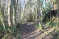
(2) At the crossroads, turn left and then immediately right onto a tree-lined track (not shown on the IGN map).
This track takes you quite quickly to the hamlet known as La Poinière.
(3) As you emerge from the track, turn right onto the small road known as ‘la Poinière’. At the next junction, turn left. Leave the farm track leading to Javarzay on your left.
(4) A little further on, turn left onto a farm track heading south-west and continue straight on until you reach the D737.
(5) Cross it with the utmost caution (this is a busy road between Melle and Beaussais) and carry on along the road opposite. Turn right onto the first farm track, which is grassy.
It leads onto a track suitable for vehicles, which you follow northwards by turning right.
(6) Turn left onto the first farm track. At the next junction, turn left onto a grassy farm track that winds its way towards the hamlet of Eclopegenêt. As you reach the houses, the track gives way to a road.
Carry on to the junction with the road coming from Vitré. Turn left (a sharp bend) and continue along the road. This narrow, quiet road climbs between two embankments: take care on the wide right-hand bend (poor visibility). Continue along the road until you reach a Y-junction.
(7) Take the road on the right and leave it immediately to take a path opposite just as the road bends to the right and heads downhill.
The track passes below some houses, then winds its way up the hillside and emerges at a crossroads.
(8) Cross the junction and continue straight ahead along a road which almost immediately turns into a farm track. This track descends towards the bottom of a valley through which the “Ruban Vert” runs.
When you reach it, cross over and take the path on the left which runs alongside the ‘Ruban Vert’ at the edge of the woods before veering away from it and crossing fields.
Carry on straight ahead, staying on level ground alongside the Ruban Vert. The track eventually leads to a road coming from La Métairie aux Moines, where you’ll find the car park marking the end of this walk (S/E).


 Visorando Member

 Moderate

 Local authority