Country:
 City:


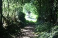
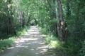
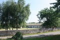
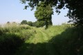
Go straight on along the path at the end of the short cul-de-sac where the entrance to the Melle campsite is located. Cross the small bridge and head up to Rue de la Croix Gasselin, which is spanned by a bridge over which the Ruban Vert (a former single-track railway line) runs. At this point, there is a small car park with three spaces.
(S/E) Cross the road and continue straight ahead along the path opposite, which gradually joins the Ruban Vert.
(1) Just before it joins the Ruban Vert, look out for the start of a path on the other side of the Ruban Vert. Cross over to take this path heading north and follow it.
(2) The path leads out onto a road next to a covered fountain. Turn left and take the road leading uphill towards Saint-Thibault. On reaching the hamlet, follow the road as it slopes gently down to the right; then, a hundred metres further on, turn into the street opposite on the left-hand side. This street is flat before rising slightly and runs between houses. Follow this street to the last house.
(3) At the corner of the last house, you’ll find an uphill path on the left, running between plots of land; take this path. At the top of the climb, the path turns right at the edge of this wooded area. Further on, the path joins a downhill path on the right which leads to the road at Les Renaudries or Pet de Chien, where you turn left.
(4) At a bend, just before the road crosses the Ruban Vert, take the path straight ahead on the left into the Bois du Pault woodland. The path leads onto a forest track that heads towards La Roche and ends at Impasse du Lavoir. Turn right and continue to the end of the cul-de-sac. Turn left into Rue du Pont Giraud. About thirty metres further on, turn right into Rue du Plaqueminier.
(5) At the first junction with a forest track, turn right and follow it until you reach the Ruban Vert. Turn left onto the Ruban Vert and continue for about 1.5 km. Further on, the Ruban Vert passes under the D737 at the Pont de la Mothe.
(6) Three hundred metres further on, you’ll come to a road; turn left onto it towards La Métairie aux Moines. Pass through this hamlet on the road leading towards La Ronze.
(7) At the bend as you leave the hamlet, take the path on the left. This path winds along the edge of the forest before entering the Bois Sureau. Ignore the paths to the right and left and stay on the main track until you reach the edge of the Bois Sureau on the other side.
(8) At the crossroads at the edge of the forest, turn left. The path passes through an area alternating between copses and fields and further on becomes a farm track.
At the first junction, turn left onto the track heading towards the D737. Cross the road and follow the track opposite leading to La Vergne.
(9) At the crossroads, take the road on the right, with your back to the hamlet, and continue towards the D737.
(10) Just before the road joins the D737, turn onto the tree-lined farm track on the left. At the next junction, carry on straight ahead.
(11) The track joins a road at the entrance to La Chauvellerie. Turn right and pass through this hamlet towards Saint-Thibault, leaving the road to Melle and the Route de la Roche on your right. In Saint-Thibault, turn right onto the downhill street which takes you back to the junction you passed on the way there.
(2) Continue along the road, passing under the Ruban Vert, and immediately afterwards turn right onto the path that runs alongside it. Follow the path back to the starting point (S/E) via the same route as on the way there (but in the opposite direction).

 Visorando Member

 Easy