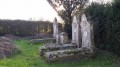
The Métairie aux Moines circular route, starting from Melle

A pleasant walk, with plenty of shade, along varied paths and small tarmac roads.
(9) Possible alternative route to significantly reduce the distance

Details

19895901
Creation:
Last update:
Last review:
  • Walking
    Activity: Walking
  • ↔
    Distance: 6.82 mi
  • ◔
    Average duration: 3h 20 
  • ▲
    Difficulty: Moderate

  • ⚐
    Back to start: Yes
  • ↗
    Ascent: + 243 ft
  • ↘
    Descent: - 240 ft

  • ▲
    Highest point: 548 ft
  • ▼
    Lowest point: 344 ft

Description of the walk

Park in the small car park on Rue de la Croix Casselin by the bridge: three spaces available.

(S/E) Cross the road carefully to take the path opposite, which runs alongside the Ruban Vert or Voie Verte. When you reach the road, turn left and go under the bridge. Follow this small road until you reach the junction.

(1) Turn right onto Route de Pied Pouzin and continue along this small road for about one kilometre, ignoring the road that climbs to the left a little further on. Carry on until you reach the woods.

(2) Turn left onto the footpath that leads into the woods. At the junction, head down to the right and continue for a few metres until you reach the junction with a path; turn left here. Carry on until you reach the junction with Rue du Pont Giraud.

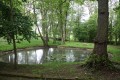
(3) Carry on to the left and, immediately, turn right onto Rue du Plaqueminier. After passing the houses, at the junction with a track, turn right onto it. Shortly after crossing the small stream, you’ll reach a picnic area

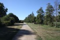
(4) Take the Voie Verte (white track) on the left and continue for about 1.5 km. Pass under the Pont de la Mothe and carry on to the crossroads. Turn left onto the road towards La Métairie aux Moines. Pass through this small hamlet and, at the junction, turn right.

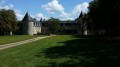
(5) After the last house (a superb farmhouse), take the path on the left at the edge of the woods. Further on, the path enters the woods and crosses through them.

(6) Just as you come out of the woods, head along the path that climbs to the left until you reach a crossroads.

(7) Turn left and join the D737. Cross with great care and continue straight ahead.

(8) When you reach the Poitou-chanvre company, at a sort of crossroads, veer to the right then immediately take the tree-lined path on the left. Carry on straight ahead along this path until you reach the road.

(9) At the small roundabout, cross over and head along the path opposite. Continue along this Route de la Roche until you reach Avenue Roger Aubin; follow it to the left and turn left again at the first junction to reach the start of Petite Avenue de la Gare. (Practical info: see possible alternative route to shorten the distance).

(10) Turn left onto this road. When you reach the junction with a road coming in from the right, cross over and follow the sign for ‘Chemin de la Découverte’ opposite, just past a house. Follow this path. Stay on the path furthest to the right and continue until you reach the car park (S/E).

Waypoints

  1. S/E : mi 0 - alt. 374 ft - Car park by the bridge on Rue de la Croix Casselin. Follow the - Béronne (rivière)
  2. 1 : mi 0.59 - alt. 440 ft - Junction at Saint-Thibault
  3. 2 : mi 1.07 - alt. 449 ft - Path leading into the woods
  4. 3 : mi 1.5 - alt. 499 ft - Rue du Pont Giraud
  5. 4 : mi 2.01 - alt. 453 ft - Greenway
  6. 5 : mi 3.08 - alt. 528 ft - Path on the edge of the woods
  7. 6 : mi 3.58 - alt. 456 ft - Path leading out of the woods
  8. 7 : mi 3.96 - alt. 486 ft - Junction of paths
  9. 8 : mi 4.45 - alt. 486 ft - Poitou Chanvre
  10. 9 : mi 5.25 - alt. 453 ft - Roundabout
  11. 10 : mi 6.16 - alt. 384 ft - Petite Avenue de la Gare
  12. S/E : mi 6.82 - alt. 374 ft - Car park by the bridge on Rue de la Croix Casselin

Notes

Personally, I completed the walk in 2 hours 45 minutes, not 3 hours 20 minutes as calculated by Visorando.
No difficulties except perhaps the distance.

(9) Alternative route. At this roundabout, turn left onto the main road called Rue de la Croix Casselin: follow the signs for the Aqua Melle swimming pool, the forest arboretum and the campsite. After about 500 m, head for the car park just after the bridge.

(9) This walk is slightly less enjoyable starting from point (9) because, once you reach the roundabout, part of the walk (a good kilometre) takes you along a road through residential areas, as you have now entered the town. From point (10), you join the discovery trail and the walk ends on a more pleasant note.

Worth a visit

The ‘voie verte’ or ‘ruban vert’ is a signposted path, made of compacted sand, which was created in 1999 by the Community of Communes of the Canton of Melle and the Cantonal Community of Celles-sur-Belle, on the right-of-way of the former Niort–Ruffec railway line.

Reviews and comments

4.7 / 5
Based on 2 reviews

Reliability of the description
5 / 5
Ease of following the route
5 / 5
Route interest
4 / 5
philouis
philouis

Overall rating : 4.7 / 5

Date of your route : Oct 08, 2022
Reliability of the description : ★★★★★ Very good
Ease of following the route : ★★★★★ Very good
Route interest : ★★★★☆ Good
Very busy route : No

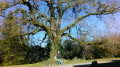
A lovely walk amongst the chestnut trees, which were in full fruit, under the beautiful October sun.

Machine-translated

Cmarsil
Cmarsil

Overall rating : 4.7 / 5

Date of your route : Mar 23, 2022
Reliability of the description : ★★★★★ Very good
Ease of following the route : ★★★★★ Very good
Route interest : ★★★★☆ Good
Very busy route : No

We thought we knew Melle and the surrounding area; we were pleasantly surprised to discover places we hadn’t seen before.
Thank you for this route.

Machine-translated

Other walks in the area

For more walks, use our search engine .

The GPS track and description are the property of this route's author. Please do not copy them without permission.