Country:
 City:


The walk starts at Place de l’Aumônerie, opposite the entrance to the abbey gardens.
(S/E) Facing the abbey, head up Rue des Halles to the right until you reach the small Place des Époux Laurant. Turn left, walk past the church and take the narrow lane on the left. Turn left down a narrow alley, Rue de Pissot, which curves slightly to the left at first. Walk all the way along the abbey’s outer wall (on the left-hand side), pass above La Belle and continue straight on, then start heading uphill along a path with a small wash house on the left-hand side.
(1) The path veers sharply to the right at a right angle. Follow this winding path, first to the right, then to the left, to the right and finally to the left (at a right angle). When you reach the crossroads of paths flanked by dry stone walls, turn right and head into the shade of the trees, passing between the sports facilities and playgrounds. This steep path crosses another that climbs up on the right-hand side. Head along this one and descend until you reach the park, a limestone path which you must cross, followed by a footbridge spanning the stream known as La Belle.
(2) Cross the footbridge over La Belle; on the other side, take a grassy path that curves to the right towards a patch of trees. At this point, turn left, heading uphill towards a flight of steps on the right, which you must climb to reach Avenue de Limoges.
Opposite the town hall in Celles-sur-Belle, turn right and walk uphill for about a hundred metres, then take the street slanting off to the right, Rue Belle Face. After about 150 metres, turn left onto the Passage de la Vallée. After about fifty metres, turn right into Rue de l’Ancienne Mairie, then at the next junction take the street on the left opposite (three-way junction). At the end of this new alleyway, turn left into Rue Émile Verdon; ignore the street on the left and a narrow passage on the right to reach Rue des Jardins on the right; take this street. It curves sharply to the right and reaches a first junction. Continue straight on until the next junction, Route de Vitré.
(3) Turn left onto the road, which meanders to the left and then curves slightly to the right. Continue straight on for one hundred and fifty metres, then turn right onto a narrow path, flanked by dry-stone walls, which descends to a junction.
Turn right onto a new path overlooking the La Belle valley. After just over 150 metres, leave this path and head down the track on the left. At the bottom of the valley, the track crosses the La Belle via a small bridge.
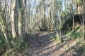
Carry on straight ahead until you come to a path on the right, shaded by trees. It first turns left, then makes a wide curve to the right, and joins another path, which you should take on the right.
Carry on straight ahead along this new woodland path. When you reach the road, head straight on and, at the next junction, take the path on the right and follow it through the housing estate.
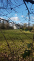
(4) A viewing point offers an exceptional view of the abbey and the historic centre of Celles-sur-Belle. Continue down the road until you reach the junction with Rue Louis Magneron; turn right here and follow it for just over fifty metres, then turn left and follow a tree-lined path for 150 metres. Go through the gate on the right, which opens onto the abbey’s gardens and water features. Walk alongside the abbey until you reach the Place de l’Aumônerie (S/E).

 Visorando Member

 Moderate