The Woods of Celles-sur-Belle

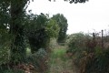
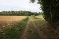
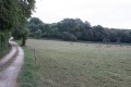
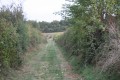
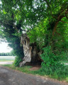
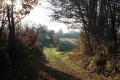
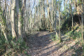
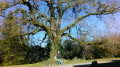
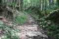
This walk takes you on a route through the Bois de Celles. The route allows you to discover varied landscapes of woodland and farmland, as well as traditional local architecture as you pass through the hamlet of La Garzelle.

Details

384714
Creation:
Last update:
Last review:
  • Walking
    Activity: Walking
  • ↔
    Distance: 6.20 mi
  • ◔
    Average duration: 3h 05 
  • ▲
    Difficulty: Easy

  • ⚐
    Back to start: Yes
  • ↗
    Ascent: + 262 ft
  • ↘
    Descent: - 253 ft

  • ▲
    Highest point: 545 ft
  • ▼
    Lowest point: 374 ft

Photos

Description of the walk

(S/E) Take the forest track leading north-east from the car park to join the Chemin de la Haute Revétizon. Once on the uphill section of the Chemin de la Haute Revétizon, you will soon reach a junction with forest tracks on either side of the path.

(1) Turn left onto the forest track, which is flat at the start. At the first junction of tracks, turn right onto the uphill track. Follow it until it joins a road. Continue to the left, following this road for a few hundred metres as it leads to La Jusselandière, then leave both the farm track on the right and the one on the left behind. Follow the road as it reaches La Jusselandière; the road curves to the right and runs alongside a farmhouse.

(2) At the junction where the road continues as a farm track to the left and there is a path to the right, turn right onto the path. Pass a farm track on the right shortly afterwards. A little further on, the path becomes a farm track and heads towards the Bois de Celles. Cross a road and continue up the farm track into the woods.

(3) At the junction of four paths, take the path straight ahead, leaving the other paths to the right and left. At the next ‘Y’-junction, follow the left-hand branch. Further on, pass a path on the left and continue to the Voie Verte (a former railway line converted into a footpath and mountain bike trail).

When the Voie Verte crosses a road, take it to the right. Pass a farm track on your right. At the next right-hand bend, take the path on the left. This climbs steeply for a few hundred metres. Pass a path on your left.

(4) Near the hamlet of La Talle, take the path on the left just before the farm track leading to La Talle farm. At the Y-junction immediately afterwards, continue along the left-hand branch: the path enters the Bois de la Sibaudière. At the next junction, carry on straight ahead towards the hamlet of Le Pommerat. The path reaches a T-junction. Turn right onto the path that runs alongside the Voie Verte. Where it joins the road, take the road on the right, which climbs uphill and leads to the dairy farm of La Métairie aux Moines.

(5) At this crossroads, turn right, walk past the farm and, at the next bend, turn left onto the path that runs along the edge of the Bois Sureau. At the first junction, turn right onto the path leading into the Bois Sureau; at the next junction, turn left; then, about 300 metres further on, continue to the right for a few dozen metres.

(6) Ignore a path on the left and continue along the main path which crosses the Bois Sureau. On leaving the woods, the path becomes a farm track. This leads to a road, which you cross to take the road opposite leading to the Ronze water tower.

(7) At the junction of roads next to the water tower, carry on straight ahead. Pass the streets on your left and take the first path on the right. You’ll come to a T-junction; turn left onto the street, which quickly turns into a farm track. This track leads to a road; take this road, continuing straight ahead to move away from the Ronze. Further on, pass a road on your right.

(8) At the next junction, turn left onto the track. Ignore a turn-off on the left which leads nowhere.

(9) At the junction of farm tracks, turn left to make a round trip to the hamlet of La Garzelle, most of whose houses are built in the traditional style. The track makes a circular loop around the hamlet of La Garzelle and returns to the track you left.

(9) Continue to the left. Further on, the path joins a road. Turn left.

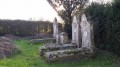
(10) Immediately afterwards, turn right to enter La Revétizon. In this hamlet there are numerous Protestant graves scattered across the various properties. Follow the road and, at the next four-way junction, veer to the right.

Ignore the road branching off to the right which serves the few houses in the hamlet. The road curves to the left and, at the next right-hand bend, take the farm track on the left. This track, which slopes gently downwards, leads fairly quickly back to the first crossroads at the start of the walk.

(1) Once you reach the road, turn left and return to the car park via the same route as at the start of the route (in reverse). You’ll soon reach the car park where you started (S/E).


Waypoints

  1. S/E : mi 0 - alt. 374 ft - DDE depot car park
  2. 1 : mi 0.15 - alt. 394 ft - Junction of road and forest tracks
  3. 2 : mi 0.71 - alt. 463 ft - Road-path junction near La Jusselandière
  4. 3 : mi 1.39 - alt. 466 ft - Crossroads where four paths meet. Towards the - Belle (rivière) - Affluent de la Boutonne
  5. 4 : mi 2.19 - alt. 489 ft - Path junction near La Talle
  6. 5 : mi 2.88 - alt. 525 ft - Road junction – La Dairy Farm aux Moines
  7. 6 : mi 3.32 - alt. 482 ft - Path junctions
  8. 7 : mi 4.09 - alt. 463 ft - Road junction – La Ronze water tower
  9. 8 : mi 4.69 - alt. 509 ft - Junction between the road and forest tracks
  10. 9 : mi 4.95 - alt. 489 ft - Crossroads near La Garzelle
  11. 10 : mi 5.65 - alt. 443 ft - Crossroads near La Revétizon
  12. S/E : mi 6.2 - alt. 374 ft - DDE depot car park

Notes

This route can be adapted in many ways, depending on the numerous paths in the area.

This walk requires sturdy footwear, given the long stretches through the forest, although the paths are in good condition.

Parking near a DDE depot and recycling bins: please ensure you do not obstruct access to these facilities.

The forest sections can be considerably cooler than the rest of the route; please bear this in mind when choosing your personal kit.

Worth a visit

Celles-sur-Belle
The charming little town of Celles-sur-Belle, nestled in the heart of Poitou on the Way of St James, is renowned for its royal abbey. Originally a priory, it was elevated to the status of an abbey by the Bishop of Poitiers in 1137. The Abbey of Celles-sur-Belle was rebuilt in the 15th century on the orders of King Louis XI, then reconstructed in the 17th century by the architect François le Duc, known as ‘Toscane’.
Featuring an imposing bell tower and a light-filled nave, the abbey church of Notre-Dame preserves in its narthex a splendid remnant of the original building: a remarkable Romanesque portal, with Eastern influences, featuring six polylobed arches!
Overlooking both the Belle Valley and beautiful French-style gardens, the majestic 17th-century convent buildings, in the Louis XIV style, house a museum where visitors can explore the abbot’s chamber, a reconstructed monastic cell, as well as collections of liturgical objects and ecclesiastical vestments.

The Royal Abbey of Celles-sur-Belle
Originally a ‘celle’ (meaning ‘small priory’), it was a dependency of Lesterps Abbey (in the Diocese of Limoges), whose sanctuary, dedicated to the Virgin Mary, saw numerous miracles ‘flourish’ from as early as 1095. It became a popular place of pilgrimage, situated close to a route to Santiago de Compostela.

Between 1137 and 1140, it became an independent abbey of the Order of Saint Augustine, as well as an ecclesiastical seigneury whose estates grew thanks to offerings and donations.

Now a must-visit cultural destination, the Royal Abbey welcomes family tourists, business travellers and professionals from the arts world alike.

Reviews and comments

4.7 / 5
Based on 3 reviews

Reliability of the description
4.3 / 5
Ease of following the route
4.7 / 5
Route interest
5 / 5
randonneurs.DS
randonneurs.DS

Overall rating : 4 / 5

Date of your route : Jan 03, 2025
Reliability of the description : ★★★☆☆ Average
Ease of following the route : ★★★★☆ Good
Route interest : ★★★★★ Very good
Very busy route : No

We really needed the sat-nav and the map to get back on track, as the route description wasn’t always very clear to us and we strayed off course twice (luckily only slightly). That didn’t spoil the walk, which was very enjoyable.

Machine-translated

isamerceron
isamerceron

Overall rating : 5 / 5

Date of your route : Feb 17, 2020
Reliability of the description : ★★★★★ Very good
Ease of following the route : ★★★★★ Very good
Route interest : ★★★★★ Very good

A really lovely, very well-designed course

Machine-translated

jeanjean79
jeanjean79

Overall rating : 5 / 5

Date of your route : Nov 18, 2018
Reliability of the description : ★★★★★ Very good
Ease of following the route : ★★★★★ Very good
Route interest : ★★★★★ Very good

A lovely, crisp but sunny autumn day. A brilliant, peaceful and varied walk.
A big thank you.
JL

Machine-translated

Other walks in the area

For more walks, use our search engine .

The GPS track and description are the property of this route's author. Please do not copy them without permission.