From La Tuilerie to the Bois de Celles

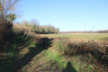
A pleasant walk through a little-known part of the Mellois plateau between Les Bois de Celles-sur-Belle and Vitré. This route allows you to discover a wealth of architectural and natural heritage, such as the Fontaine de la Belle, a menhir, two wash-house fountains, examples of traditional buildings and rolling countryside. Part of the route follows the old single-track railway line, which has been converted into a ‘Ruban Vert’ (Greenway).

Details

n°1790508
Creation:
Last update:
Last review:
  • Walking
    Activity: Walking
  • ↔
    Distance: 5.69 mi
  • ◔
    Average duration: 2h 50 
  • ▲
    Difficulty: Easy

  • ⚐
    Back to start: Yes
  • ↗
    Ascent: + 253 ft
  • ↘
    Descent: - 249 ft

  • ▲
    Highest point: 505 ft
  • ▼
    Lowest point: 351 ft

Photos

Description of the walk

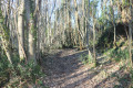
(S/E) Follow the road southwards with care. After about 150 metres, turn onto a path on the right. Head uphill through the woodland. Just before the houses at La Jusselandière, turn right. At the T-junction, turn left at the edge of the woodland.

(1) At the next junction, turn right. At the T-junction, turn right again. Head towards the edge of the woods on your left before turning off to the left. A little further on, at a Fork in the road (not shown on the map), take the path on the right which descends through the woods. Once you reach the area below the Ruban Vert, veer left and almost immediately take a path on the right which leads back to the Ruban Vert.

(2) Follow this path to the left (west). At the end, take a small road on the right and, after 50 metres, you’ll come out onto the D103. Follow this road to the right and immediately turn onto a path on the left.

(3) At a factory on the left-hand side, just before a bridge, head down to the right along a steep path; this leads onto another path, which you should follow to the right. Cross the Route des Patureaux (D108) and continue along the track opposite. Further on, you’ll see Fontiville Castle on your right; you’ll come out onto a road and follow it to the right. Pass the hamlet known as l’Infirmerie.

(4) At the crossroads, turn right onto a small road towards La Bertamerie. Pass a triangular-shaped open space on your left and stay on the Chemin de Saint-Jacques. Walk past a remarkable porch on the left and reach the D103. Then turn left (be careful: a narrowing of the road reduces visibility). At the fork in the road, turn right onto Rue du Lavoir. Go down a stone staircase and back up on the other side of the washhouse (which is well worth a visit). Continue along the street.

(5) When you reach the temple, turn right (east) onto Chemin de Joubert and walk past the Maison Familiale de Vitré (a private school). When the road bends to the left, leave it and take a path on the right. Go straight on (south-east) and, after about 400 metres, head steeply downhill.

(6) Cross a stream, a tributary of La Belle, then head uphill on a gentler slope. Once you reach a sort of plateau, continue south-east and ignore a turn-off on the right (marker 133).

(7) At a triangular junction, turn right, go about ten metres past the junction and turn left onto a path. Walk along the edge of the Bois d’Enfiré. Just before a road, turn right onto a grassy path leading downhill. This quickly turns left and joins the road leading downhill towards the hamlet of La Carte.

(8) Follow the road to the left (with care). Ignore a road coming from the left and turn right. At the next bend, which is to the left, you’ll see the Fontaine de la Belle (a stone-built spring) on your left. Continue along the road and, at the next junction, turn left. Pass under a bridge over the old railway line.

(9) Immediately climb the wooden staircase on the right, between the road and a path, which leads to the Ruban Vert (old railway line, see the ‘During the walk’ section). Follow this to the left. Note the lovely views to the right towards the Métairie de la Carte, a pond and the Belle valley. Further on, the Ruban Vert curves slightly to the left and passes through a cutting in the hillside.

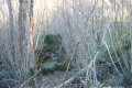
(10) Roughly halfway up the hill, climb the steps on the right which lead to the top of the hill: there is a menhir on the right-hand side. Resume your walk along the Ruban Vert heading west. After about 250 metres, leave the Ruban Vert and take a path on the left. Note the Fontardiou fountain and washhouse on the left, then return to the car park (S/E).


Waypoints

  1. S/E : mi 0 - alt. 371 ft - Parking near the Fontardiou wash house
  2. 1 : mi 0.49 - alt. 446 ft - La Jusselandière
  3. 2 : mi 1.03 - alt. 367 ft - Green ribbon - Belle (rivière) - Affluent de la Boutonne
  4. 3 : mi 1.39 - alt. 371 ft - Junction
  5. 4 : mi 2.24 - alt. 423 ft - Crossroads
  6. 5 : mi 2.77 - alt. 410 ft - Vitré Temple
  7. 6 : mi 3.27 - alt. 381 ft - Stream
  8. 7 : mi 3.85 - alt. 482 ft - Triangular junction
  9. 8 : mi 4.4 - alt. 505 ft - The Map
  10. 9 : mi 4.87 - alt. 417 ft - Staircase leading to the ‘green ribbon’
  11. 10 : mi 5.41 - alt. 404 ft - Menhir
  12. S/E : mi 5.69 - alt. 371 ft - Parking near the Fontardiou wash house

Notes

The car park is located in the Bois de Celles-sur-Belle, below the Ruban Vert on the road between Haute Revétizon and La Carte, near the Fontardiou fountain and washhouse.

Another option is to park in the car park at the former Vitré town hall and adjust the route accordingly.

This walk across varied terrain requires suitable footwear.

Alternative route
A slightly shorter route is possible by staying on the Ruban Vert path from point (5) to point (8). The walk is then 8.38 km instead of 9.16 km.

This walk is only very partially signposted, as it crosses small sections of other routes marked in yellow. Please note that these signs, which do not correspond to this route, may lead to confusion. Consequently, it is advisable to follow the directions in the description and on the map, whilst also paying close attention to the landscape. The waypoints (with their GPS coordinates and the distance from the starting point) serve as aids for walkers exploring the route for the first time.

Hike completed by the author on 15 February 2019

Worth a visit

The Ruban Vert

From Melle to Celles-sur-Belle (Deux-Sèvres)
Length: 9 km
Date created: 2009
Total investment cost: 137,576 euros (including VAT)
Investment cost per km: 15,286 euros (including VAT) per km
Surface: stabilised sub-base.
Few structural works.
The ‘Le Ruban Vert’ Greenway was developed in 1999 by the Community of Communes of the Canton of Melle and the Cantonal Community of Celles-sur-Belle, on the right-of-way of the former Niort–Ruffec railway line.
Source: Celles-sur-Belle Cantonal Community, 2000 document.
Description of the Greenway: AF3V website page (click).
Source: Cycle Routes and Greenways – South

Celles-sur-Belle

The commune of Celles-sur-Belle lies between Niort and Melle in the Deux-Sèvres department, within the Pays Mellois region. Celles-sur-Belle is situated on the former Route Nationale 148, which linked Sainte-Hermine to Étagnac via Niort and Melle. This road is now known as the Départementale 948. The Belle flows through the town; it is a 25-kilometre-long stream and a tributary of the Boutonne. It rises near Celles-sur-Belle and flows into the Boutonne after passing through Secondigné-sur-Belle.

The Royal Abbey of Celles-sur-Belle

Its imposing façade consists of a tall bell-tower porch and, lower down, a striking Romanesque portal with six polylobed arches, remnants of the original building. Further evidence of the original structure can be seen in the carved capitals on the north façade, decorated with plant, animal and human motifs.
Inside, a monumental staircase leads up to the nave. The apparent imbalance of the façade, with its off-centre staircase, stems from the fact that the north wing was never completed. The interior of the building is bathed in light, thanks to the height of the pillars, the vaults and the side aisles lined with chapels.
Situated below the church, the abbey and the monastic buildings were also rebuilt to plans by François le Duc. The building, in the Louis XIV style, commands a superb view over the Belle Valley and the magnificent French gardens.
In many places, the remains of former monastic buildings—which were regularly visited by Louis XI—bear witness to the grandeur of the first abbey, which was established on this site as early as the late 11th century and was completely destroyed during the Wars of Religion in the 16th century.
In the south wing, a large refectory comprising six bays leads to the former kitchen. On entering the rear courtyard, a magnificent ambulatory provides access to the Salle du Pilier, as well as to the crypt of the first parish church of Celles-sur-Belle, the Church of Saint-Hilaire, the only Romanesque feature still visible on the site.
There is a museum on the first floor of the convent buildings: notably, the abbot’s chamber – where several illustrious figures once stayed – has been reconstructed, as has a monastic cell.

Fontiville Castle

History
The Fontiville residence was probably built between 1845 and 1848 for Pierre-François-Alcide Taillefer, justice of the peace for the canton of Celles, and his wife Pauline-Virginie Belleroche, on a plot of land belonging to the Infirmerie dairy farm, which was owned by his family. They named their house ‘Fontiville’, a name first recorded in 1856. In 1890, Jacques-Louis-Alfred Guille-Desbuttes and his wife, née Anne-Fanny Taillefer, had the orangery built. In the first half of the 20th century, the main house was let to various private individuals, after which a restaurant moved in. It was during this period that the winter garden, attached to the south elevation, was renovated by replacing the glazed panels with double-glazed windows on the same base. Since 1996, it has once again been a privately owned residential property.
Description
The main building, which is square in plan and double-depth, has five bays on the north, east and south elevations, and three bays on the west elevation. On the north elevation, two false bays appear to have been bricked up from the outset. The coping is made of cut stone. The levels of the raised ground floor and the first floor are emphasised by string courses. The square second floor serves as an attic storey. The corner piers are rusticated up to the level of the second floor. The glass panes in the front door are protected by ornate cast-iron panels. The balustrades on the upper storey are also made of ornate cast iron. The entrance hall is paved with ceramic tiles. The rooms in the basement, accessible via a spiral stone staircase, have semi-circular vaults. The former conservatory, built on a foundation of rubble masonry and cut stone, is attached to the three central bays of the south façade. The main building is roofed with long gables and hipped roofs with a very gentle pitch, whilst the winter garden has a metal roof. All the outbuildings are roofed with hollow tiles. A ram pump, used to draw water, had been installed in a meadow below, near a spring.
Source:

La Talle à Teurtous

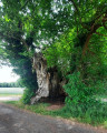
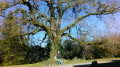
La Talle à Teurtous (the chestnut tree for everyone), a remarkable tree. A ‘talle’ is a grafted chestnut tree grown for fruit production. This particular tree gave its name to the spot where it stands in the hamlet of La Revêtizon. The main trunk, which has a circumference of over 7 metres at a height of 1.80 m, has been dead for several years; however, two suckers growing around it have given it a new lease of life. The entire tree has a circumference of 11.65 m at a height of 1 m.
Source: Wikipedia and various websites

Fontardiou Washhouse

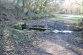
The washhouse is situated on the edge of a country lane leading off local road No. 13, south of the River Belle and the old railway line, in a picturesque setting. The uncovered basin is fed by a masonry spring covered with a single monolithic stone. Grooved stones indicate that the washhouse could be filled or emptied via a drain.

The village washhouse in Vitré

Source: Dracis79_The Washhouses of Deux-Sèvres

The Temple of Vitré

Completed on 13 February 1869 to plans by Mr Vallet of Niort and repaired in 1896–1897. The façade of the Vitré temple is the one the architect had originally envisaged for the temple at Verrines/Celles;
Source:

Reviews and comments

4 / 5
Based on 2 reviews

Reliability of the description
4 / 5
Ease of following the route
4 / 5
Route interest
4 / 5
philouis
philouis

Overall rating : 4 / 5

Date of your route : Jul 27, 2021
Reliability of the description : ★★★★☆ Good
Ease of following the route : ★★★★☆ Good
Route interest : ★★★★☆ Good
Very busy route : No

Despite two mistakes on our part, the route was interesting, especially as we came across three roe deer.
The start of the walk was through brambles and stinging nettles. I should point out that we set off from the temple in Vitré.
As for the steps, no problem at all.

Machine-translated

pgetrochon
pgetrochon

Thank you for your comment.
The link between the route and the Ruban Vert is via a flight of steps with a handrail; whilst it is admittedly very steep, it is still manageable. Having tried it both ways myself, I’d say it’s harder to go down than up.
Enjoy your walks

Machine-translated

RASSELET
RASSELET

Overall rating : 4 / 5

Date of your route : Mar 12, 2019
Reliability of the description : ★★★★☆ Good
Ease of following the route : Not used / Not applicable
Route interest : ★★★★☆ Good

A lovely walk to go on (or go on again), for which you’ll need sturdy footwear. Take care at the junction between the route and the green trail – it’s a bit tricky, especially after rain.

Machine-translated

Other walks in the area

For more walks, use our search engine .

The GPS track and description are the property of this route's author. Please do not copy them without permission.