La Jasse du Play and the Pas de Berrièves

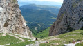
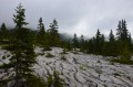
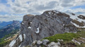
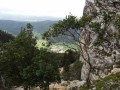
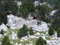
The hike to the Pas de Berrièves (1,887 m) offers an immersive experience of the wild heart of the Hauts Plateaux du Vercors Nature Reserve. You’ll pass through forests of mountain pine, high-altitude meadows and suspended scree slopes. At the summit, the view opens out, on one side, onto the vast, deserted expanse of the plateau, and, on the other, onto a barrier of cliffs, facing Mont Blanc and the Écrins . The area is ideal for spotting ibex, marmots and griffon vultures.

Details

100350833
Creation:
Last update:
Last review:
  • Walking
    Activity: Walking
  • ↔
    Distance: 7.43 mi
  • ◔
    Average duration: 4h 55 
  • ▲
    Difficulty: Moderate

  • ⚐
    Back to start: Yes
  • ↗
    Ascent: + 1,719 ft
  • ↘
    Descent: - 1,745 ft

  • ▲
    Highest point: 6,207 ft
  • ▼
    Lowest point: 4,462 ft

Photos

Description of the walk

The start is at a small, clearly marked car park on the Route Forestière des Baschassons. This is a round-trip walk.

(S/E) Take the path opposite the car park, heading east at the start. The path then turns north.

(1) Carry on straight ahead at the junction, heading east.

(2) At the fork in the road, keep right, heading due east.

(3) Ignore a path on the left further on.

(4) Junction with the GR®91; follow it straight on towards the east at the start, then due south.

(5) Jasse du Play mountain hut (alt. 1624 m). Continue along the GR®.

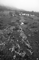
(6) After the monument, leave the GR®91 and take a path on the left, following the stone cairns. There are no further signposts, but the path is clearly marked, except on the few areas of sharp limestone pavement.

(7) Pas de Berrièves (alt. 1,887 m) and its Lorraine Cross. Return to the car park via the same route as on the way there (S/E).

Waypoints

  1. S/E : mi 0 - alt. 4,488 ft - Car park on the Route Forestière des Baschassons
  2. 1 : mi 0.31 - alt. 4,508 ft - Path junction
  3. 2 : mi 0.92 - alt. 4,724 ft - Path junction
  4. 3 : mi 1.12 - alt. 4,797 ft - Path junction
  5. 4 : mi 2.04 - alt. 5,220 ft - GR91 junction
  6. 5 : mi 2.47 - alt. 5,279 ft - Cabane Jasse du Play
  7. 6 : mi 2.63 - alt. 5,325 ft - Path junction after the monument
  8. 7 : mi 3.58 - alt. 6,198 ft - Pas de Berrièves
  9. S/E : mi 7.43 - alt. 4,488 ft - Car park on the Route Forestière des Baschassons

This route passes through a protected area, which may be subject to special regulations:

Always be cautious and plan ahead when you're outdoors. Visorando and the author of this route cannot be held responsible for any accidents occurring on this route.

The GR® and PR® markings are the intellectual property of the Fédération Française de Randonnée Pédestre.

Other walks in the area

For more walks, use our search engine .

The GPS track and description are the property of this route's author. Please do not copy them without permission.