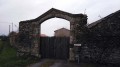
From La Droille to L’Armazie

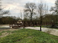
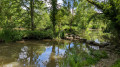
Set off on a walk along the paths of La Salle-et-Chapelle-Aubry, following the Droille and Armazie streams.
Visit the gold mine at Saint-Pierre Montlimart and its cosmopolitan town from the early 1900s.

Details

n°4879472
Creation:
Last update:
Last review:
  • Walking
    Activity: Walking
  • ↔
    Distance: 7.32 mi
  • ◔
    Average duration: 3h 40 
  • ▲
    Difficulty: Moderate

  • ⚐
    Back to start: Yes
  • ↗
    Ascent: + 312 ft
  • ↘
    Descent: - 335 ft

  • ▲
    Highest point: 354 ft
  • ▼
    Lowest point: 135 ft

Photos

Description of the walk

Park in the car park at Place Saint-Hilaire, at the foot of the church in La Salle-et-Chapelle-Aubry.

Follow the blue signposts.

(S/E) In front of the church façade, head east and walk past the church on your left. Take thesecond left, the Chemin de la Mercerie (north-east).

(1) As you approach a left-hand bend in the road, take a path on the left. Turn right immediately onto this path and pass under a power line. At the end of the path, head right towards La Mercerie.

(2) Pass the farm on your left, cross the tarmac road and take the path opposite. When you reach the building, head left (north). Continue until you reach a road with a wayside cross.

(3) Turn left at the wayside cross, cross over the Ruisseau de la Droille and then take the next path on your left before the Roussière. Walk on to La Bertinière.

(4) Turn right twice and carry on until you reach Le Frêne. Turn right at the T-junction onto the D201, which you’ll follow for about 300 metres.

(5) Then take the path on your left and continue for 2 km through fields and woodland. You’ll pass near the old gold mine at Cancale.

(6) Carry on to the D17 and turn round to rejoin the D134; continue for 50 metres and enter the woods on the right to follow the Ruisseau de la Bellière. Head towards the Chemin d’Armazy, walk a few metres, then continue to the right through the hedgerows until you reach the pond.

(7) Turn left and carry on for 500 metres until you reach the junction. Head diagonally left onto the road, ignore the first path on the right and turn left at the second junction.

(8) Walk round the field; after about 400 metres, turn right, then right again until you reach the Mourandière, which you cross.

(9) Follow the road to the next junction by the pylon, turn left onto the path and cross the Ruisseau de la Bellière to reach La Paillerie.

(10) Continue for 500 m, then pass the school on your right and turn right into Rue des Peupliers. Take thefirst left and you’ll immediately reach the church car park (S/E).

Waypoints

  1. S/E : mi 0 - alt. 308 ft - Car park - Église Saint Hilaire (La Salle-et-Chapelle-Aubry)
  2. 1 : mi 0.55 - alt. 335 ft - Junction
  3. 2 : mi 0.83 - alt. 351 ft - La Mercerie
  4. 3 : mi 1.52 - alt. 295 ft - Calvary
  5. 4 : mi 2.31 - alt. 315 ft - La Bertinière
  6. 5 : mi 3.02 - alt. 295 ft - Path on the left
  7. 6 : mi 4.31 - alt. 184 ft - Les Coteaux
  8. 7 : mi 4.93 - alt. 194 ft - Sources of the Sangsuerie
  9. 8 : mi 5.37 - alt. 246 ft - Junction on the path
  10. 9 : mi 5.88 - alt. 246 ft - T-junction
  11. 10 : mi 6.84 - alt. 289 ft - La Paillerie
  12. S/E : mi 7.32 - alt. 308 ft - Car park - Église Saint Hilaire (La Salle-et-Chapelle-Aubry)

Notes

Make the most of the picnic area by the pond at the start of the route.
This trail can also be combined with the walk from Grenet to Saint-Quentin-en-Mauges.

Worth a visit

La Cité Cancale: The Saint-Pierre-Montlimart gold mine near (6) resumed operations in 1905, after centuries of inactivity, and even became the second-largest in France in terms of production (around 10 tonnes!). A cosmopolitan community then sprang up in the town of Cancale. It was home, in precarious conditions, to around thirty miners’ families. The mine closed in 1952 but remained a source of industrial development for the region.

La Paillerie: The horse has always reigned supreme at La Paillerie. Charles Marsault won the Prix d’Amérique in the 1950s on ‘Cancannière’ and, buoyed by this victory, he bought more horses – around 35 in 1964. A 630-metre round-pen was built in the 1970s. It allows horses born and bred in this mecca of local horsemanship to train early in the morning. From the 1970s onwards, their successes established the Marsault family as leading figures in national, regional and local racing...

La Nocturiale: This traditional night-time walk, featuring a variety of entertainment, takes place in early September. Every year, it attracts nearly 2,000 people who gather at nightfall to walk through the countryside around La Salle-et-Chapelle-Aubry in a festive atmosphere.

Geocaching: Have fun whilst hiking on the route from La Droille to L’Armazie. Set off in search of 40 traditional caches and 2 letterboxes.

How do you go geocaching?

- Visit www.geocaching.com to find the GPS coordinates of the caches along the route. (There are loads of them...)
- Make sure you have a GPS device or a smartphone with a geocaching app.
- Set off on an adventure, day or night, for a real treasure hunt.
- Once you’ve found the geocache, leave a comment about your discovery, sign the logbook and return the box to its original location.
- If you take anything from the box, replace it with an item of at least equal value.

Sourcewww.geocaching.com

Reviews and comments

4.7 / 5
Based on 1 review

Reliability of the description
5 / 5
Ease of following the route
4 / 5
Route interest
5 / 5
manuuher
manuuher

Overall rating : 4.7 / 5

Date of your route : May 16, 2026
Reliability of the description : ★★★★★ Very good
Ease of following the route : ★★★★☆ Good
Route interest : ★★★★★ Very good
Very busy route : No

A lovely walk, with very little road, plenty of nature and sections alongside streams. It’s really enjoyable.
Three bodies of water, and occasionally a sewage treatment plant, though it isn’t particularly smelly.
We finish at a lovely horse farm where you might spot a working riding arena.
The blue markings are clearly visible and were almost identical to the arrows on another “Scala” walk organised the following day.
The full description of the walk can also be found at the start of the route, at the foot of the church.

Machine-translated

Other walks in the area

For more walks, use our search engine .

The GPS track and description are the property of this route's author. Please do not copy them without permission.