Country:
 City:
City:


From Beaupréau-en-Mauges, take the D80 to reach Fief-Sauvin. Park your car in the car park on Rue de l’Èvre, next to the Church of Notre-Dame.
White signposts
(S/E) Take Allée de l’Avenir on the right, then turn left immediately, walking alongside the primary school until you reach the car park on Allée des Chênes.
(1) Turn right onto this road, then turn right again. At the T-junction, head left onto Allée des Érables, then right to follow Allée des Hêtres to its end at La Gabardière.
(2) First turn right then left, then keep left until you reach the Grotte de Lourdes at La Gabardière, in the parish of Notre-Dame-d’Èvre. Continue to the end of the path.
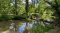
(3) Carry on, following the River Èvre, which is circular, to reach the next crossroads.
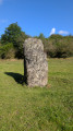
(4) Carry on straight ahead towards the Bréau Menhir.
(5) After admiring the menhir, turn round and head back to the previous crossroads.
(4) Turn right, then left, and carry on until you rejoin the road. At the next junction, turn right and follow the road uphill, passing through the hamlet of Chevrie. Go up a hill and you’ll come to a crossroads.
(6) Turn right onto Route la Tournerie, then turn left onto the tree-lined path. Walk alongside the field on your left.
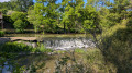
(7) Cross the Abriard and rejoin the banks of the Èvre.
(8) Turn sharply left and continue along the path, passing through the hamlet of Le Pointreau before leaving the village.
(9) Then turn right and continue to the end of the track at La Roussière.
(10) Turn left to re-enter the village. Leave the village on the right, then take the first left to join the D146, Route du Fief-Sauvin.
(11) First turn right then left onto Chemin de la Bretêche, then turn right onto a tree-lined path.
(12) Continue along the track, then turn left towards Les Coteaux (marker 76).
(13) Continue along the track towards Carrefour Saint-Dard (marker 100). Turn right at the junction.
(14) At Carrefour Saint-Dard, take a quick first turn left then right. Carry on until you reach the road and the forest.
(15) Carry on straight ahead, crossing the road with care. Enter the forest and continue to the junction.
(16) Turn left and carry on straight ahead for 2 km through the Forêt de Leppo. (Ignore the roads branching off to the left or right.) Leave the forest at a road and a crossroads.
(17) Carefully cross the D80 to reach the opposite side, then take the first left towards Le Cornier.
(18) Carry on towards La Guèrivière. Continue along the road until you reach the junction.
(19) Turn left, walk past the lake and, ignoring an access path on the left, carry on to the next junction.
(20) First turn right then left, and carry on to the first track on the left.
(21) Turn left, then left again.
(22) Leave the return path on your right. Carry on straight ahead until you reach the road. Pass to the left of the buildings and follow the road as it climbs. Go round the hamlet of Saint-Vincent until you reach the next junction.
(23) Turn right. On leaving the village, take the bend to the right and follow this road down to where it ends at Les Landes.
(24) Turn right and follow this road to its end.
(22) Back on the road you took on the way there, go straight on towards Sainte-Catherine.
(25) After passing through this village, carry on until you reach the ‘Give Way’ sign.
(26) Turn right towards Chêne Garreau, then, just before reaching it, turn left and follow the Ruisseau de la Planche to the first junction.
(27) Turn left, then turn right onto Chemin de la Trouère. Follow this road to its end.
(28) Make a quick first turn right then left and carry on to the D146. Cross the road carefully and take the path opposite towards Les Granges, then follow the D146. You’ll rejoin the D146 further on.
(29) Back on the D146, go round the bend to the left then slightly to the right, and take the path on the left to reach the junction between the two roads.
(30) From there, turn carefully right onto the D146 and head down to the first footpath.
(31) Turn left to catch a glimpse of the protohistoric and Gallo-Roman oppidum (Caesar’s Camp, archaeological site).
(32) Turn round and head back to the junction of the two paths.
(30) Head straight ahead along a path, then, at La Croix, turn right onto the La Petrodière road and continue to the junction. Turn right, then left towards Le Grand Nombault.
(33) On leaving the hamlet of Le Grand Nombault, carry on through the vineyards, with the lake on your right, until you rejoin the D146.
(34) Carefully follow the D146 back up towards the centre of Le Fief-Sauvin, then cross a stream and arrive at a cross.
(35) Take the first right, turning onto a path once more. Continue along this path, taking the left-hand track that runs alongside the River Èvre as far as the Moulinard farm.
(36) Follow Rue du Moulinard into the town centre, as far as the town hall.
(37) First turn right then left, cross the car park to reach Rue de l’Èvre and return to the car park (S/E).



 Visorando Member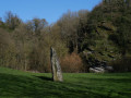
 Moderate
 Easy
Easy  Tourist office