Country:
 City:
City:


(S) Cross the Bohardy bridge, walk up the street and take the first right. Cross the D17 road (caution: heavy traffic) to take the path opposite, which leads further on to a new road in Grigné.
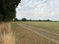
(1) Turn right here, then right again at the wayside cross, before continuing along the path opposite. Then keep going straight ahead.
(2) When you reach the houses, carry on along the path to the right and head towards La Gréfumière. Then turn left.
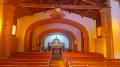
(3) At the junction, turn right onto the road to reach a T-junction and the Chapelle Saint-Avoye.
(4) Then head left. Shortly afterwards, turn left onto a path. Further on (marker 81), take a path on the right. Continue straight on to reach the Frêne.
(5) Head straight on to reach La Bourassière via the footpath, then take the road on the left, before reaching La Boissière-sur-Èvre by continuing along the next footpath and the road that follows on from it.
(6) Take the Allée des Coteaux on the right, then follow the Rue des Vignes Rouges, keeping to the right. As the road curves, continue straight ahead along the path.
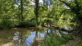
(7) At the junction near a pond, turn right twice to walk along the Ruisseau de Beugnon to the bottom of the valley, before climbing back up (panoramic view) and reaching La Maltière.
(8) Follow the road to the left and continue to the right onto the D152 departmental road (caution: busy road) as far as the wayside cross.
(9) Turn right towards La Clergerie, then take the path on the left as you leave the hamlet.
(10) At the end of the track, take the D201 road on the right, cross the River Èvre and turn left onto the road at the junction. Pass La Roche, turn left and take the first footpath on the left until you reach Courossé.
(11) Cross the footbridge and then the small stone bridge. Head uphill until you reach a junction with the road.
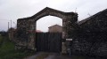
(12) Take the path opposite, walking alongside the wall of the Château de la Baronnière (private property). When you leave the path, take the road on the left. At the next wayside cross, take the path on the right and continue along it; this leads back onto the D201 road.
(13) Follow it to the right and head towards La Chapelle-Saint-Florent.
(14) Leave the main road, head towards Saint-Florent-le-Vieil on the right, and pass the cemetery and its car park before coming to a path on the left a little further on. Take this path and it will lead onto a road lined with houses; follow it to the right.
(15) Shortly after a pedestrian crossing, the road veers slightly to the right: leave it via a short path on the left between two houses. Continue along the road opposite until you reach the T-junction, then turn left.
(16) Pass through Bourg Pailloux and turn right shortly afterwards to reach the Croix de Navarre.
(17) Turn right and keep left at the junction. A few metres before reaching the main road, turn right onto a path and head towards Les Brosses.
(18) Turn right, then immediately left onto a track. Return to the River Èvre via a new track running alongside it, passing the Èvre Loisirs canoeing and kayaking centre and the Drain’guette (a pop-up open-air café in high season), before reaching the bridge and the D751. Cross the River Èvre and head towards the Sanctuary of Notre-Dame du Marillais.
(19) Cross the car park on the left and take the road on the right for 250 metres before turning left onto the Promenade Julien Gracq. Follow this path alongside the Loire and, after passing the temporary installations, take a path on the right that climbs up the cliff. Walk past the column of the Duchess of Angoulême and go round the back of the Abbey Church of Saint-Florent-le-Vieil, skirting it on the left.
(20) Walk down the square to the left and, at the far end, make your way through the narrow pedestrian streets, turning left, then right, and left again to rejoin the promenade along the Loire. Head towards the quays on the right (E)
 Visorando Member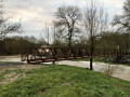
 Moderate
 Easy
Easy 
 Tourist office
 Difficult