Historic Blaiseron circular loop

A walk through a hilly, partly shaded area, passing through historic sites and ending, for the final two kilometres, by following the banks of the Blaiseron (a tributary of the Blaise). The three villages you pass through are steeped in history, and for a while you follow in the footsteps of Joan of Arc.

Details

100957211
Creation:
Last update:
Last review:
  • Walking
    Activity: Walking
  • ↔
    Distance: 9.83 mi
  • ◔
    Average duration: 5h 00 
  • ▲
    Difficulty: Moderate

  • ⚐
    Back to start: Yes
  • ↗
    Ascent: + 597 ft
  • ↘
    Descent: - 594 ft

  • ▲
    Highest point: 1,280 ft
  • ▼
    Lowest point: 791 ft

Description of the walk

Park at Place du Général de Gaulle (car park) in Flammerécourt.

(S/E) Follow the Grande Rue D117 eastwards. After 100 m, turn right into Rue de l’Église (Saint-Rémy). Follow this street until you reach the edge of the village.

(1) Take the first path leading uphill to the left. Follow this path to a three-way junction that runs on either side of a pylon. Take the right-hand fork and join a farm track.

(2) Continue left along this track for about 3 km until you reach Blécourt, arriving at Rue des Marronniers (D117).

(3) Turn right onto this street and take the second right towards Notre-Dame Church. Continue south on this street and, at the next junction, turn right onto Rue des Lavandières, then immediately left onto Chemin des Combes, and carry on until you reach a T-junction.

(4) Follow the path heading south to the right, the GR®703, marked in red and white, and continue to follow these markings at junctions, passing under a high-voltage power line until you reach the D13.

(5) Cross the road and continue southwards, staying on the GR®, ignoring the paths on either side; pass at the foot of a pylon, then past some wind turbines.

(6) Turn right onto the first path after the wind turbines, staying on the GR®, and pass close to the Oratory of Saint Anthony. At the entrance to the village of Leschères-sur-le-Blaiseron, leave the GR® and continue straight on to the Church of Our Lady of the Nativity, crossing the ford.

(7) When you reach the church, turn right into Rue du Moulin. After 500 m, the road becomes a footpath running along the western bank of the Blaiseron. Follow this path for about 1,500 m.

(8) Cross the Blaiseron and join the D117.

(9) Follow it northwards (i.e. to the left), passing under a high-voltage power line, then past a wayside cross. At the entrance to Flammerécourt, turn right and head for Place du Général de Gaulle (S/E).

Waypoints

  1. S/E : mi 0 - alt. 794 ft - Place du Général de Gaulle
  2. 1 : mi 0.26 - alt. 843 ft - First path on the left after the church
  3. 2 : mi 0.89 - alt. 1,014 ft - Path
  4. 3 : mi 2.61 - alt. 1,040 ft - Rue des Marronniers
  5. 4 : mi 3.07 - alt. 1,047 ft - GR703
  6. 5 : mi 4.85 - alt. 1,253 ft - Crossing the D13
  7. 6 : mi 5.92 - alt. 1,201 ft - The path begins after the wind turbines
  8. 7 : mi 7.79 - alt. 830 ft - Église de la Vierge en sa Nativité (Leschères-sur-le-Blaiseron)
  9. 8 : mi 9.16 - alt. 801 ft - Fording the - Blaiseron (cours d'eau) - Affluent de la Blaise
  10. 9 : mi 9.38 - alt. 797 ft - D117 road
  11. S/E : mi 9.83 - alt. 797 ft - Place du Général de Gaulle

Notes

Shortly before (7), the Blaiseron is crossed by fording. It is therefore advisable to undertake this walk in summer.

Worth a visit

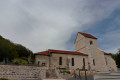
  • The Church of Saint-Rémy, notable for its turret.
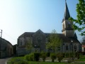
  • The Gothic church at Blécourt.
  • Blécourt, a village frequented since the Middle Ages by historical figures such as: St Leo IX in the 11th century, Jean de Joinville in the 13th century and Joan of Arc in the 15th century.
  • The GR®703 takes us in the footsteps of Joan of Arc, who followed this route in 1429 during the second stage of her journey from Vaucouleurs to Chinon.
  • The village of “Les Leschères sur le Blaiseron”, a former seigneury of the Ségur family. The Church of Our Lady of the Nativity.

Always be cautious and plan ahead when you're outdoors. Visorando and the author of this route cannot be held responsible for any accidents occurring on this route.

The GR® and PR® markings are the intellectual property of the Fédération Française de Randonnée Pédestre.

Other walks in the area

For more walks, use our search engine .

The GPS track and description are the property of this route's author. Please do not copy them without permission.