From Hochgrat to the Falkenhütte via the ridge, then back to the Hochgratbahn valley station

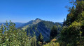
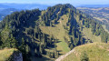
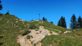
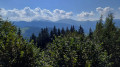
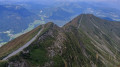
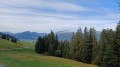
A lovely hike along a ridge path offering numerous views of the Allgäu peaks.

Details

39688128
Creation:
Last update:
Last review:
  • Walking
    Activity: Walking
  • ↔
    Distance: 6.55 mi
  • ◔
    Average duration: 3h 55 
  • ▲
    Difficulty: Difficult

  • ⚐
    Back to start: No
  • ↗
    Ascent: + 1,020 ft
  • ↘
    Descent: - 3,740 ft

  • ▲
    Highest point: 5,955 ft
  • ▼
    Lowest point: 2,844 ft

Photos

Description of the walk

From Oberstaufen, head to the Hochgratbahn (car park).
Take the Hochgrat cable car to the start of the hike.

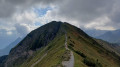
(S) Hochgrat mountain station: on leaving the upper station, head east and take the path that follows the ridge.

(1) Walk along the ridge to the summit of the Hochgrat.

(2) Enjoy the panoramic view before heading back down to the station via the south-facing path.

(S) Continue westwards to the first junction.

(3) Continue along the ridge to the Seelekopf.

(4) Stay on this path, passing via the Hohenfluhalpkopf. Continue to the next junction.

(5) A sign points to the Falken Hütte; stay on the path heading west. Carry on to the next fork.

(6) Turn right and begin the descent to the clearly visible Falken Hütte.

(7) Enjoy a refreshment break at this pleasant hut. Go round the building and take the path heading north, which descends quite steeply until it reaches a crossroads.

(8) Follow the sign for ‘Hochgrat Talstation’. Continue north-east until you reach a track.

(9) Turn right onto this small road until you reach a junction just after a bridge over a stream.

(10) Turn left onto this small road to return to the Hochgratbahn car park (E).

Waypoints

  1. S : mi 0 - alt. 5,574 ft - Hochgratbahn Upper Station
  2. 1 : mi 0.04 - alt. 5,581 ft - Start of the ridge path to the summit
  3. 2 : mi 0.41 - alt. 5,935 ft - Hochgrat summit
  4. 3 : mi 1.04 - alt. 5,361 ft - Towards Falken
  5. 4 : mi 1.52 - alt. 5,361 ft - Seelekopf
  6. 5 : mi 2.48 - alt. 5,203 ft - Signposted to the Falkenhütte – 30 mins
  7. 6 : mi 3.22 - alt. 5,003 ft - Falkenhütte 1/4 stunde
  8. 7 : mi 3.56 - alt. 4,711 ft - Falkenhütte
  9. 8 : mi 4.01 - alt. 4,170 ft - Hochgrat Talstation sign
  10. 9 : mi 4.73 - alt. 3,871 ft - On the right
  11. 10 : mi 5.48 - alt. 3,550 ft - Towards the Hochgrat valley station
  12. E : mi 6.55 - alt. 2,851 ft - Horgratbahn valley station

Notes

Hike undertaken by the author on 6 September 2023

  • Mountain kit, including good walking boots, warm clothing and sun protection.
  • Hochgrat:

- Free single journey if you have the Oberstaufen Card, provided free of charge by accommodation providers in Oberstaufen.
- otherwise, a single journey costs €19.70 (summer 2023).

  • Hochgratbahn car park: €5 for the day.
  • Food and drink available at the Falkenhütte

Worth a visit

  • Hochgrat
  • Seelekopf
  • Falkenhütte

Reviews and comments

5 / 5
Based on 1 review

Reliability of the description
5 / 5
Ease of following the route
5 / 5
Route interest
5 / 5
User 27097238

Overall rating : 5 / 5

Date of your route : Aug 11, 2025
Reliability of the description : ★★★★★ Very good
Ease of following the route : ★★★★★ Very good
Route interest : ★★★★★ Very good
Very busy route : No

Magnificent landscapes, technical passages

Machine-translated

Other walks in the area

For more walks, use our search engine .

The GPS track and description are the property of this route's author. Please do not copy them without permission.