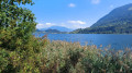
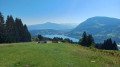
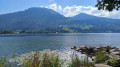
Above and on the shores of the Goßer Alpsee

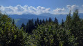
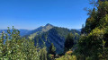
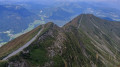
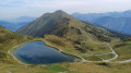
A route that climbs to offer views of the Goßer Alpsee. The return journey follows the Jakobsweg (Way of St James), staying as close as possible to the northern shore.

Details

39734085
Creation:
Last update:
Last review:
  • Walking
    Activity: Walking
  • ↔
    Distance: 9.42 mi
  • ◔
    Average duration: 5h 25 
  • ▲
    Difficulty: Moderate

  • ⚐
    Back to start: Yes
  • ↗
    Ascent: + 1,240 ft
  • ↘
    Descent: - 1,253 ft

  • ▲
    Highest point: 3,514 ft
  • ▼
    Lowest point: 2,365 ft

Photos

Description of the walk

From Oberstaufen, head to Ratholz on the road to Immenstadt.
The start and finish of this walk are at the Jägerhaus car park in Ratholz.

(S/E) Leave the car park on the west side and head to the first junction.

(1) Turn right onto the small road, heading north. Cross the Konstanzer Ach stream, then the railway line. You’ll reach a fork in the road at Reuterhof.

(2) Turn left and follow the road as it climbs towards the ridge. After several hairpin bends, you’ll reach a footpath; follow it to a signpost indicating ‘Alpensee Blick’.

(3) Head towards this viewpoint overlooking the Goßer Alpsee.

(4) Enjoy the panoramic view before retracing your steps, then head north to rejoin the Oberallgäuer Rundwanderweg.

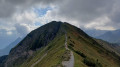
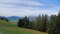
(5) Turn right to follow this beautiful balcony path, which often runs through woodland. Pass the Siedelalpe farm and continue to the hamlet of Zaumberg.

(6) Turn right and head south along a small road. As you approach a farm, look out for the start of a path on the left. Please note: the road continuing to the right leads only to the farm.

(7) Take the path on the left which descends to the lake. You’ll arrive at the Fior del Lago inn.

(8) Pass under the railway line and turn right, walking along the lake to its western end, following the Jakobsweg (Way of St James). You’ll come to a sign for Jägerhaus.

(9) Turn left, then follow the Konstanzer Ach to a small bridge.

(10) Cross the stream and you’ll easily find the Jägerhaus car park (S/E).

Waypoints

  1. S/E : mi 0 - alt. 2,411 ft - Jägerhaus car park
  2. 1 : mi 0.05 - alt. 2,398 ft - Turn right
  3. 2 : mi 0.74 - alt. 2,625 ft - Reuter Road
  4. 3 : mi 2.42 - alt. 3,458 ft - Alpensee Blick sign
  5. 4 : mi 2.67 - alt. 3,455 ft - Alpensee Blick
  6. 5 : mi 2.92 - alt. 3,422 ft - Oberallgäu Circular Walk.
  7. 6 : mi 5.68 - alt. 2,822 ft - Zaumberg
  8. 7 : mi 5.86 - alt. 2,746 ft - To the left
  9. 8 : mi 6.28 - alt. 2,385 ft - Fior del Lago inn
  10. 9 : mi 8.8 - alt. 2,395 ft - Signposted to the Jägerhaus
  11. 10 : mi 9.04 - alt. 2,382 ft - Bridge
  12. S/E : mi 9.42 - alt. 2,415 ft - Jägerhaus car park

Notes

Hike completed by the author on 7 September 2023

  • Good walking boots.
  • Food and drink available at the Fior del Lago inn.

Worth a visit

  • Goßer Alpsee
  • Oberstaufen
  • Immenstadt

Reviews and comments

4.7 / 5
Based on 2 reviews

Reliability of the description
5 / 5
Ease of following the route
5 / 5
Route interest
4 / 5
Positiver68
Positiver68

Overall rating : 4.7 / 5

Date of your route : Apr 05, 2024
Reliability of the description : ★★★★★ Very good
Ease of following the route : ★★★★★ Very good
Route interest : ★★★★☆ Good
Very busy route : No

Nice walk in bad weather

Machine-translated

Positiver68
Positiver68

Overall rating : 4.7 / 5

Date of your route : Apr 05, 2024
Reliability of the description : ★★★★★ Very good
Ease of following the route : ★★★★★ Very good
Route interest : ★★★★☆ Good
Very busy route : No

Please note that the small car park designated as the starting point is now reserved for people visiting the cemetery.

Machine-translated

Other walks in the area

For more walks, use our search engine .

The GPS track and description are the property of this route's author. Please do not copy them without permission.