Staufner Berg

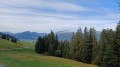
A short circular walk taking in this small peak overlooking Oberstaufen. Despite its modest altitude, the Staufner Berg offers panoramic views of the village and the surrounding area.

Details

39830988
Creation:
Last update:
Last review:
  • Walking
    Activity: Walking
  • ↔
    Distance: 3.09 mi
  • ◔
    Average duration: 2h 10 
  • ▲
    Difficulty: Easy

  • ⚐
    Back to start: Yes
  • ↗
    Ascent: + 889 ft
  • ↘
    Descent: - 869 ft

  • ▲
    Highest point: 3,419 ft
  • ▼
    Lowest point: 2,579 ft

Photos

Description of the walk

The starting point for this walk is at the entrance to Oberstaufen, at the Norma car park.

(S/E) From the car park, head towards the village centre along Lindauer Straße until you reach the church square.

(1) Follow Bahnhofstraße, cross the level crossing and continue along Immenstädter Straße until the first junction on the right.

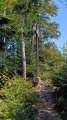
(2) Turn right towards Staufen. Take the cul-de-sac, which then becomes a good path crossing pastures. You’ll come to a crossroads.

(3) Turn left and follow the path to the summit, marked by a cross and a mobile phone mast.

(4) Enjoy the view over Oberstaufen and the surrounding area. Facing south-west, head down the wide, fairly steep path to a crossroads.

(5) Take the path on the left and keep an eye out for the start of a small track on the right.

(6) Turn right and you’ll soon reach a stony track. At a junction, take the track on the left which descends towards the railway line.

(7) Heading west, walk down towards Oberstaufen, passing under the railway line, and continue to the station car park.

(8) Take Rainwaldstraße back to Kirchplatz.

(1) From the church square, return to the car park (S/E) by following the route you took on the way there in reverse.

Waypoints

  1. S/E : mi 0 - alt. 2,582 ft - Norma car park
  2. 1 : mi 0.3 - alt. 2,598 ft - Kirchplatz
  3. 2 : mi 0.51 - alt. 2,602 ft - Sign for Staufen
  4. 3 : mi 1.1 - alt. 3,166 ft - On the left
  5. 4 : mi 1.54 - alt. 3,412 ft - Staufen summit
  6. 5 : mi 1.78 - alt. 3,153 ft - On the left
  7. 6 : mi 1.85 - alt. 3,159 ft - On the right
  8. 7 : mi 2.19 - alt. 2,867 ft - On the right
  9. 8 : mi 2.67 - alt. 2,595 ft - Car park at the station
  10. S/E : mi 3.09 - alt. 2,585 ft - Norma car park

Notes

  • Good walking shoes.

Worth a visit

  • Staufen
  • Oberstaufen

Reviews and comments

4.7 / 5
Based on 2 reviews

Reliability of the description
5 / 5
Ease of following the route
4.5 / 5
Route interest
4.5 / 5
leoS
leoS

Overall rating : 4.3 / 5

Date of your route : Aug 19, 2025
Reliability of the description : ★★★★★ Very good
Ease of following the route : ★★★★☆ Good
Route interest : ★★★★☆ Good
Very busy route : No

A pleasant walk with beautiful views, but there is an area where the path is not really maintained (at least when we were there), although you can still see where the path is. You'll be waist-high in ferns and brambles, so wear trousers and clothes that don't catch on anything!

Machine-translated

Jacques R
Jacques R

Overall rating : 5 / 5

Date of your route : Jul 15, 2025
Reliability of the description : ★★★★★ Very good
Ease of following the route : ★★★★★ Very good
Route interest : ★★★★★ Very good
Very busy route : No

A pleasant hike with superb views, alternating between sunny and shaded sections. The benches along the route are always a bonus

Machine-translated

Other walks in the area

For more walks, use our search engine .

The GPS track and description are the property of this route's author. Please do not copy them without permission.